Gun Point Cove from Devil’s Back Area trails, Harpswell, ME
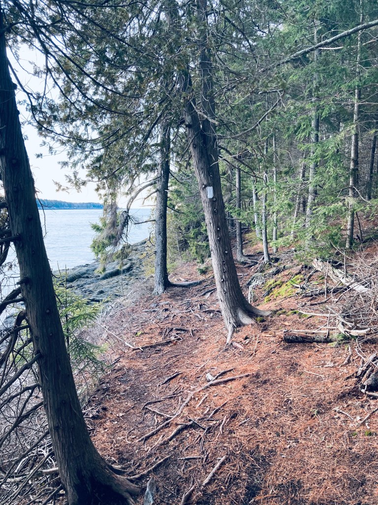
The Devil’s Back Trail area in Harpswell, Maine, is another jewel managed by the Town of Harpswell. This rugged but narrow area straddles Route 24 on the way to Orr’s Island, with the east side overlooking Gun Point Cove, and the west on Long Cove. The Town of Harpswell has descriptions and a trail map here, and there is an excellent treatment of this hike in Maine Hikes off the Beaten Path.
(Check the website of the Prouts Neck Association for updates, as the Cliff Walk is currently closed. January 2024 storm damage resulting in pending repairs of up to $4 million, which won’t be complete until possibly 2025, according to a May 2024 Portland Press Herald article.)
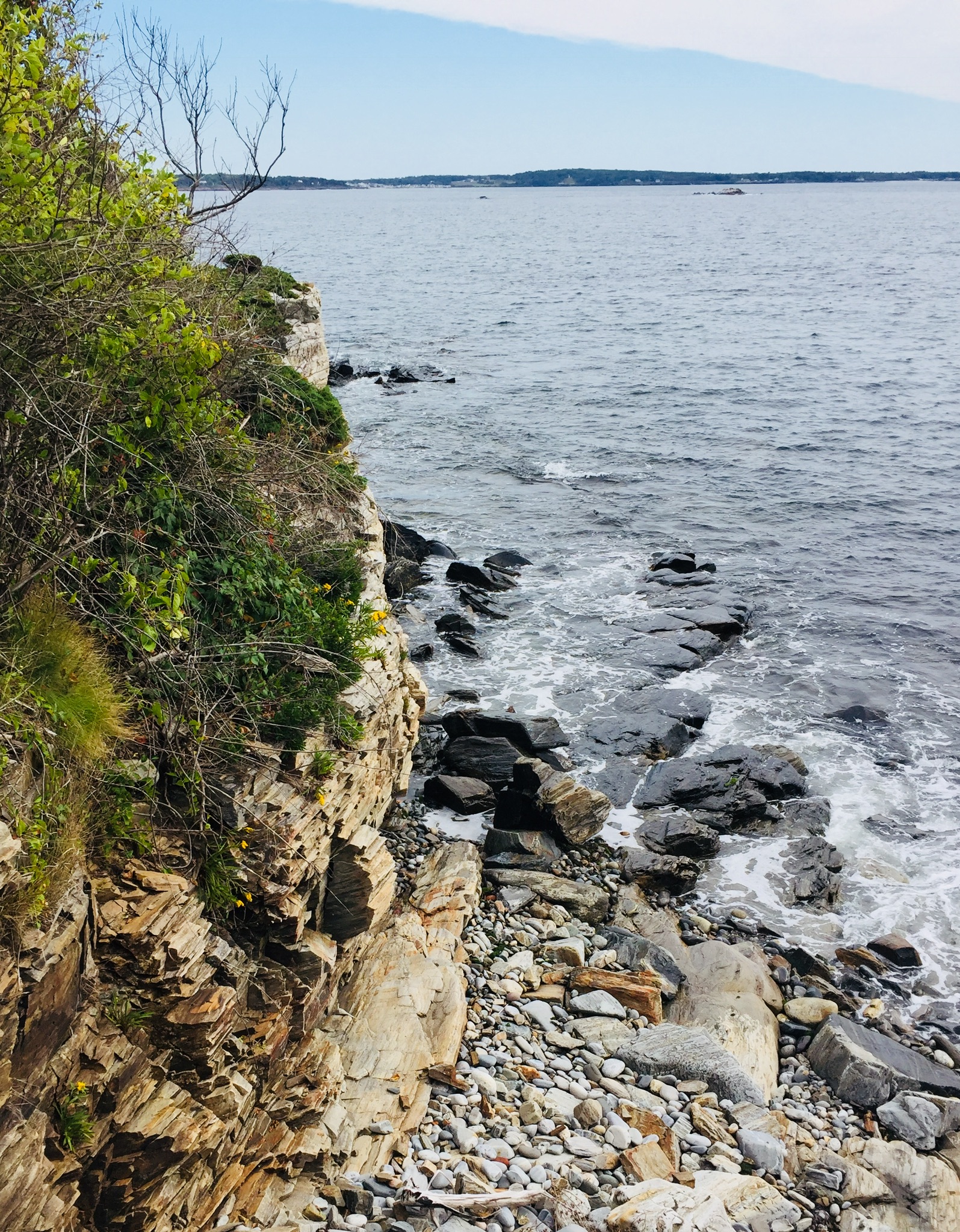
If you like dramatic cliffs, ocean views, rocky beaches and stunning homes, this may be your walk! The residents at Prouts Neck in Scarborough, Maine harbor a secret gem in their gated community – but fret not – while the entrances are hidden and parking is complicated, it is still possible (and legal) to walk variations of the same 1-mile route that Winslow Homer did, even if you are not an “insider.”
This is definitely categorized as a Sunday stroll-type of walk, a walk with a good friend that you haven’t seen in a while or a lone walk with a camera or sketch book. The uneven terrain and sometimes narrow path demand a leisurely pace. The smell of rugosa roses, the salty ocean breeze and the lobster boats are center stage and require frequent pauses. The views are unbeatable. The only problem is logistics. Below we will describe how to safely and lawfully enjoy a hike in summer, or even winter, from the Black Point Inn (45 minutes to an hour) or a longer “lollipop” loop from Ferry Beach (3.7 miles, about an hour and a half).
Western Cove from Black Point Road, Prouts Neck, Scarborough, MaineContinue reading →
Halfway Rock and Great Diamond Island from Mackworth Island, Falmouth, ME
Mackworth Island, connected to the Falmouth mainland by a causeway off Andrews Avenue, is a State Park donated to the State of Maine in 1946 by Governor Percival Baxter for state public purposes and “as a sanctuary for wild beasts and birds.” The island, which also contains the Baxter School for the Deaf, is open daily 9 am to sunset. Parking is limited, so have a backup plan (the nearby Gilsland Farm Audobon is nice), or be prepared to wait. The visitor fee is currently $3 for Maine residents, $4 for non-Maine residents, and $1 for non-resident seniors and children 5-11 (Maine residents over 65 and children under 5 are free). An outhouse is available by the parking lot.
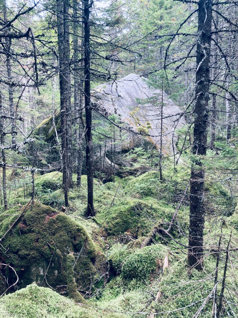
Icicles on the Nature Trail section of Mt. Will Trail, Bethel, ME
Mount Will (1,726 ft), which spans across the town lines of Newry and Bethel, Maine is a lesser-traveled peak, accessed through a loop trail, with a small parking area across the road from the Town of Bethel transfer station. This trail, marked with bright blue blazes, was developed by the Bethel Conservation Commission, and is maintained by the Town of Bethel. Detailed description can be found in Maine Hikes Off The Beaten Path or the AMC Maine Mountain Guide.
Androscoggin River Valley from North Ledges, Mt. Will TrailContinue reading →
Eleanor’s Trail, Pleasant Hill Preserve, Scarborough, ME
Tucked between the Pleasant Hill neighborhood and the Rachel Carson National Wildlife Refuge, Scarborough’s Pleasant Hill Preserve is 135 acres of land, with over 1.5 miles of trails, held and maintained by the Scarborough Land Trust (SLT). No hunting or bicycles are allowed on the trails, dogs must be leashed, and the .25 mile Eleanor’s Trail is ADA accessible. The trailhead, at 270 Pleasant Hill Road in Scarborough, has year-round parking and a map kiosk.
Swallow Barn, and intersection with Monty’s Trail, Pleasant Hill Preserve, Scarborough, MEContinue reading →
Access road to the summit of Black Cat Mountain, Poland, Maine.
This easy mountain hike, actually more of a road walk to a hilltop where is a cell tower, made for a simple First Day 2021 winter stroll. Black Cat Mountain (820 ft) in Poland, Maine (not to be confused with the larger Black Cat Mountain in Baxter State Park), is accessible from North Raymond Road, where a small gated road marked with yellow cell tower signs and the number 72 has limited parking (with overflow on the road’s shoulder).
Afternoon light through the trees, road to Black Cat Mountain, Poland, ME.Continue reading →
Access Trail, Libby River Farm Preserve, Scarborough Land Trust
Close to Prouts Neck and Scarborough Beach, the 75-acre Libby River Farm Preserve, tucked between Camp Ketcha and the Libby River, has about a mile of trails to explore. While well-attended, it is not as crowded as Ferry Beach and Scarborough Beach, and can be a good option if these places are busy.
Libby River Farm Preserve, owned and maintained by the Scarborough Land Trust, with a small parking area at 320 Black Point Road provided by Camp Ketcha, is open year-round for hiking, snowshoeing, and cross-country skiing. Dogs must be leashed, and bow-hunting (with Scarborough Land Trust permission) is allowed, so blaze orange is always a good fall idea.
Shrubland, Libby River Farm Preserve, Scarborough Land TrustContinue reading →
View west on North Traveler Trail, Baxter State Park
The last couple years, dad and daughter have picked a late-summer weekend to climb Mount Katahdin together at Baxter State Park (BSP). On last year’s trip, we diverted to explore some easier trails from Katahdin Stream Campground, and this year, due to daughter’s same lingering knee injury from last year and her recovery from late August knee surgery, it was a solo trip for dad. Not wanting to climb Katahdin without my hiking buddy, I set my sights on the Traveler Loop. South Branch Pond Campground was full, so I canceled our mid-September Roaring Brook parking reservation, and found a tent site instead at Trout Brook Farm Campground.
Having completed two strenuous hiking days in the northern part of Baxter State Park, I wanted to explore an easier path on my long, scenic way out through the Togue Pond Gate. Celia and Jackson Ponds, reached in that order, are accessed from the Kidney Pond campground day-use trailhead via a 3.2 mile (1.5 to 2 hours) out-and-back hike using the Sentinel Connector Trail, and Celia and Jackson Ponds Trail. I found this hike using Falcon Guides’ Hiking Maine’s Baxter State Park.
The pleasant smell of woodsmoke from the campground quickly gave way to that of pine, and the path has a definite enchanted woods feel, with soft, greenish light cast on the moss surrounding the trail. Shortly after the trail’s beginning, a large boulder on the left is whimsically marked “Kidney Stone – do not remove.” Kidney Pond can be seen through the trees, and then a small side trail to the shore provides excellent views of Katahdin to the west.
Giant boulder, Celia and Jackson Ponds Trail, Baxter State ParkContinue reading →
Sun rising over Black Cat and South Branch Mountains from Traveler Loop
The Traveler is a strenuous 10.1 mile loop hike over the rhyolite peaks of Traveler Mountain, the highest volcanic mountain in New England, with over 4,000 feet of total elevation gain. This full-day (6-10 hour) hike begins at Baxter State Park’s (BSP) South Branch Campground, and based upon advice from the AMC Maine Mountain Guide and Falcon Guides’ Hiking Maine’s Baxter State Park and BSP rangers, is best attempted counterclockwise via the Pogy Notch, Center Ridge, Traveler Mountain, and North Traveler trails. This is to avoid descending the steep, loose rock on the Center Ridge Trail.
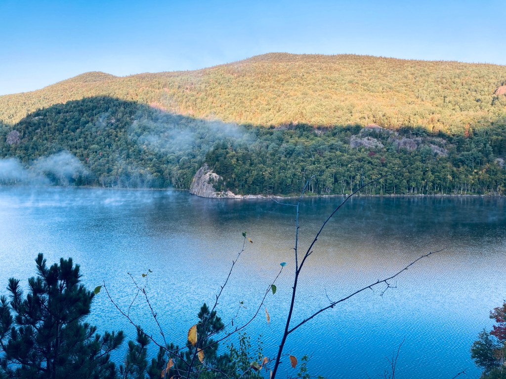
Lower South Branch Pond at dawn
This route over Traveler’s bulk, which the AMC Maine Mountain Guide accurately describes as “starfish-shaped,” crosses Peak of the Ridges (3,254 ft), Traveler summit (3,550 ft), and North Traveler summit (3,152 ft). As it says on BSP’s website, “Preparation for a Traveler Loop hike is the same as a Katahdin hike,” due to the exposed nature of the hike, elevation gain, lack of available water, and distance. This is true, and in inclement weather, hikers should explore other options. To navigate, I used Map Adventures’ Katahdin Baxter State Park Waterproof Trail Map, but BSP’s official website also has free downloadable/printable trail maps, and the South Branch Pond map covers this area.