Mt. Katahdin: Knife Edge Trail

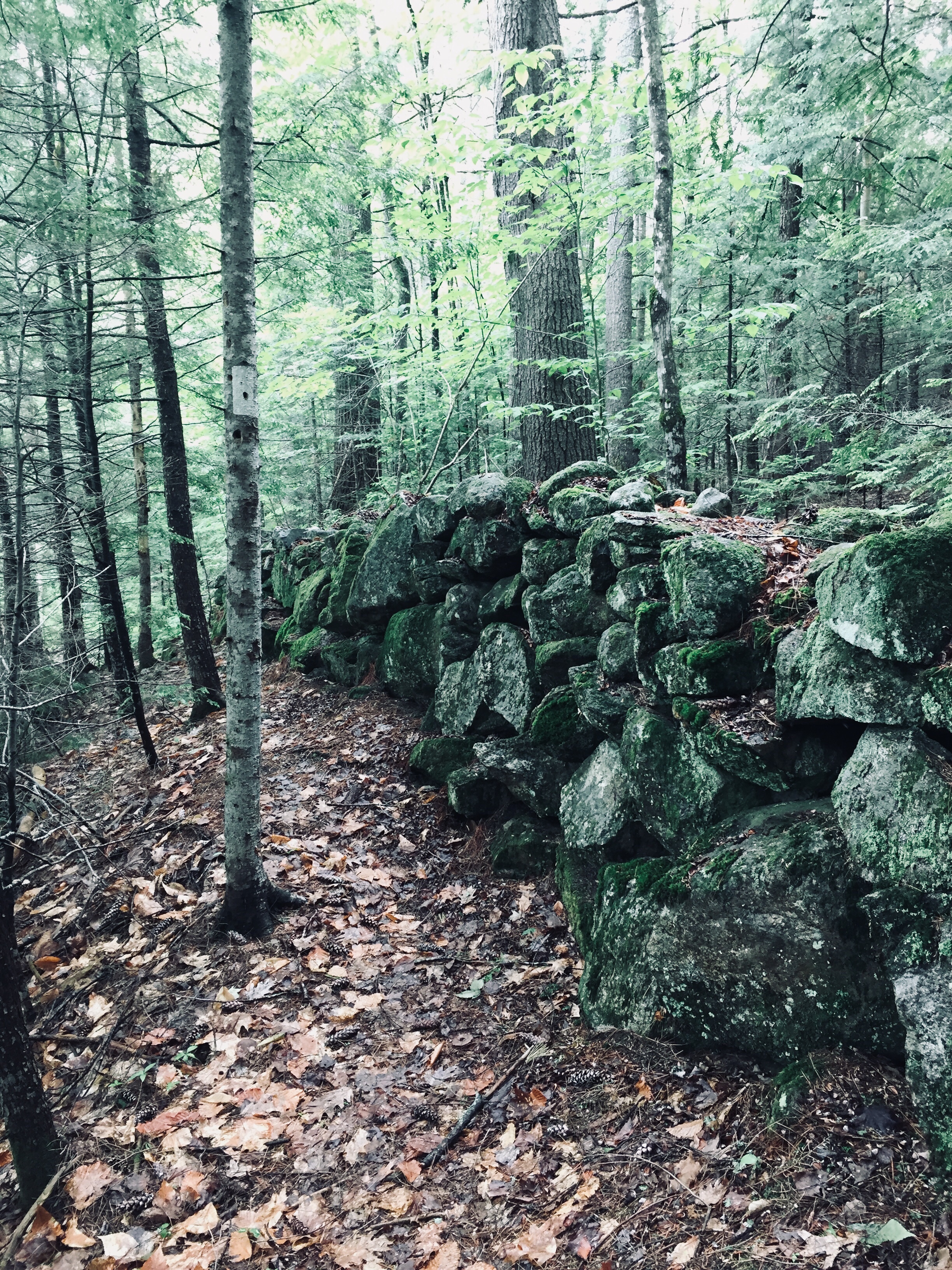
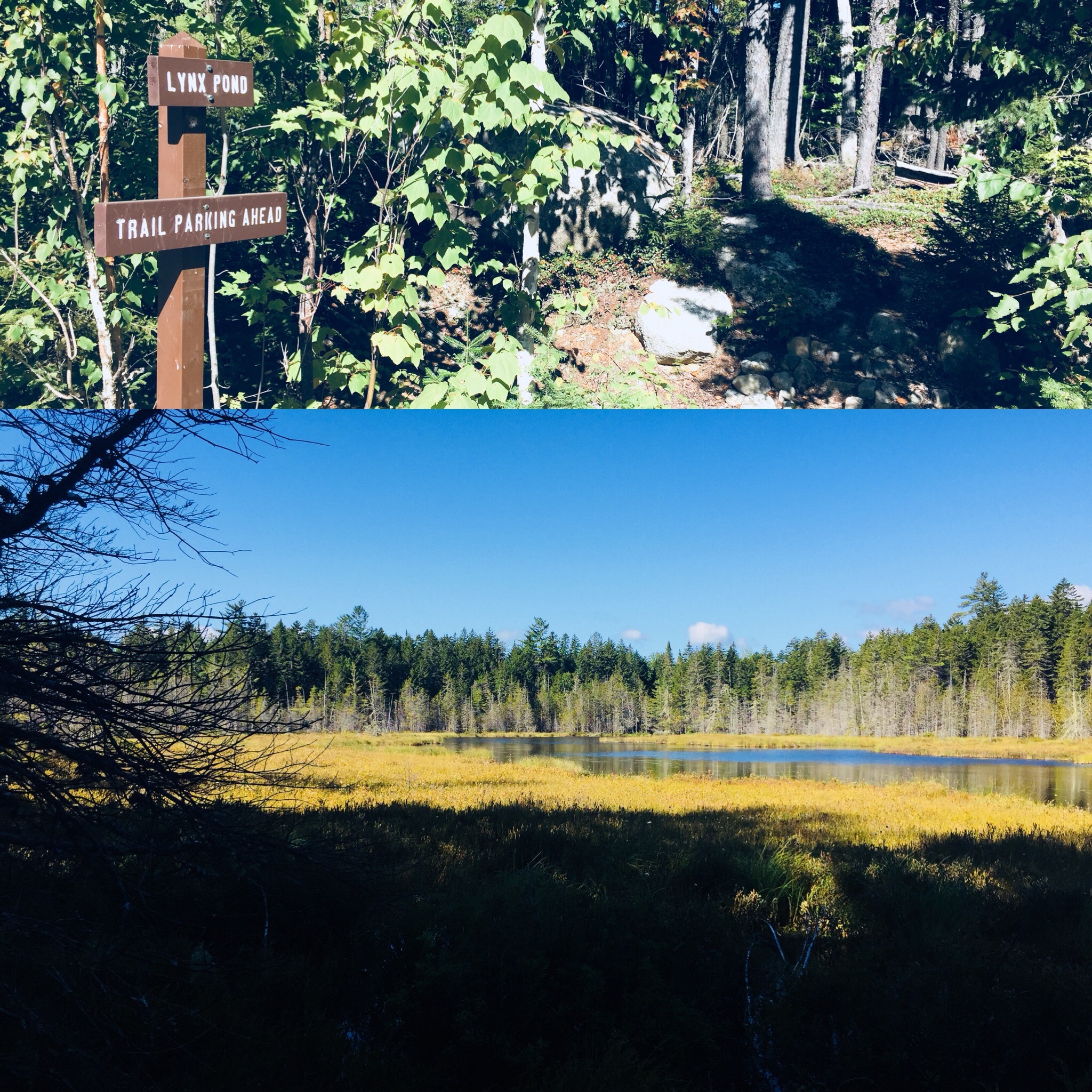
We had hiked Katahdin, but daughter had never taken the legendary Knife Edge Trail, the narrow 1.1 mile stretch (and Maine rite of passage) from Pamola Peak to Baxter Peak. At age 12, it was time. On September 9, 2018, we hiked together to Baxter Peak on Mt. Katahdin via the Helon Taylor Trail to cross the Knife Edge. On the way down, dad and daughter took the Saddle and Chimney Pond Trails (total R/T appx 10.2 mi). (For maps, other routes, and links to Baxter State Park’s great resources, see our September 2017 Mt. Katahdin post.)

0172d54659cdd143a2e535ad691a9ff82820cc2ff5

On the way in to Millinocket the night before, we stopped at Hannaford to stock up on supplies before staying at the Parks Edge Inn. In preparation, we went with a chocolate and peanut butter theme, and for our lunches, wrapped Nutella, peanut butter, and bananas in lavash bread like some Willy Wonka burritos, and grabbed peanut butter chocolate chip Larabars and peanut butter M&M’s to snack on.

To get into line at the Baxter State Park gate the next morning, we woke up around 5 am, and signed in to start hiking at Roaring Brook at 6:47 am. The $5 Day Use parking pass for Maine residents has to be the most value Mainers can get for $5. This easy online step is essential to guarantee a spot in the park, which is kept wild in many ways, including the limitation on daily access to the park.

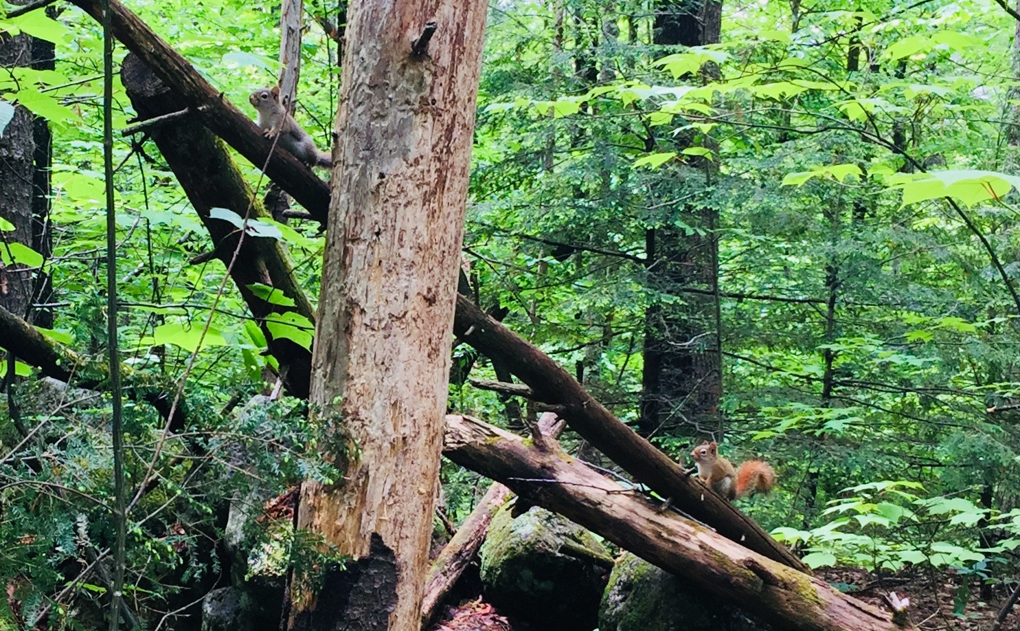
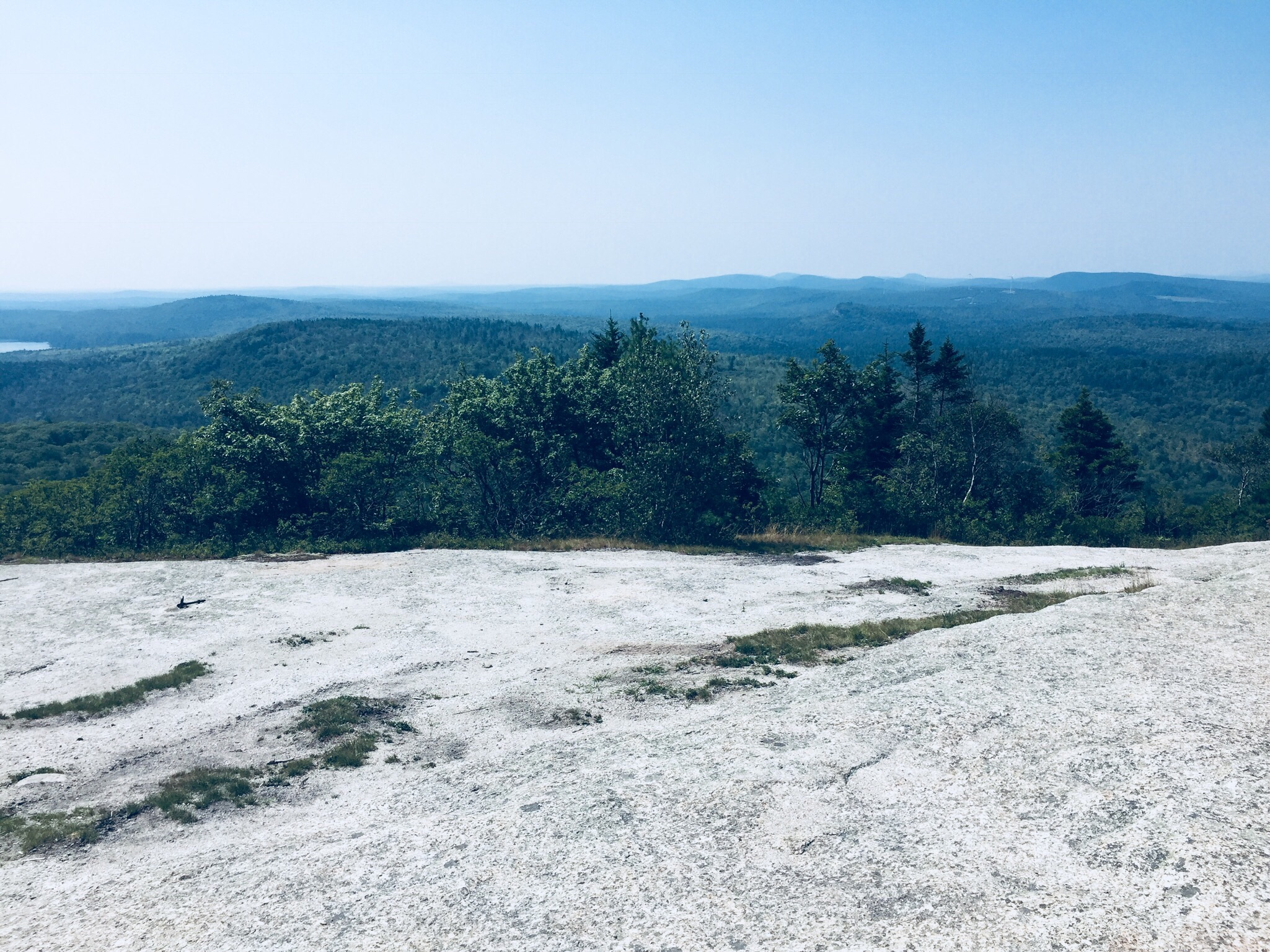
The climb up Helon Taylor Trail was steady and tough, but we took our time, and enjoyed the changing vegetation and ubiquitous chattering of red squirrels, often looking back to enjoy the views behind us to the east, as we slowly emerged from the forest, patches of scrub pine, and finally above the tree line, reaching Pamola Peak around 10 am.

Getting ready to descend into the beginning of the Knife Edge.

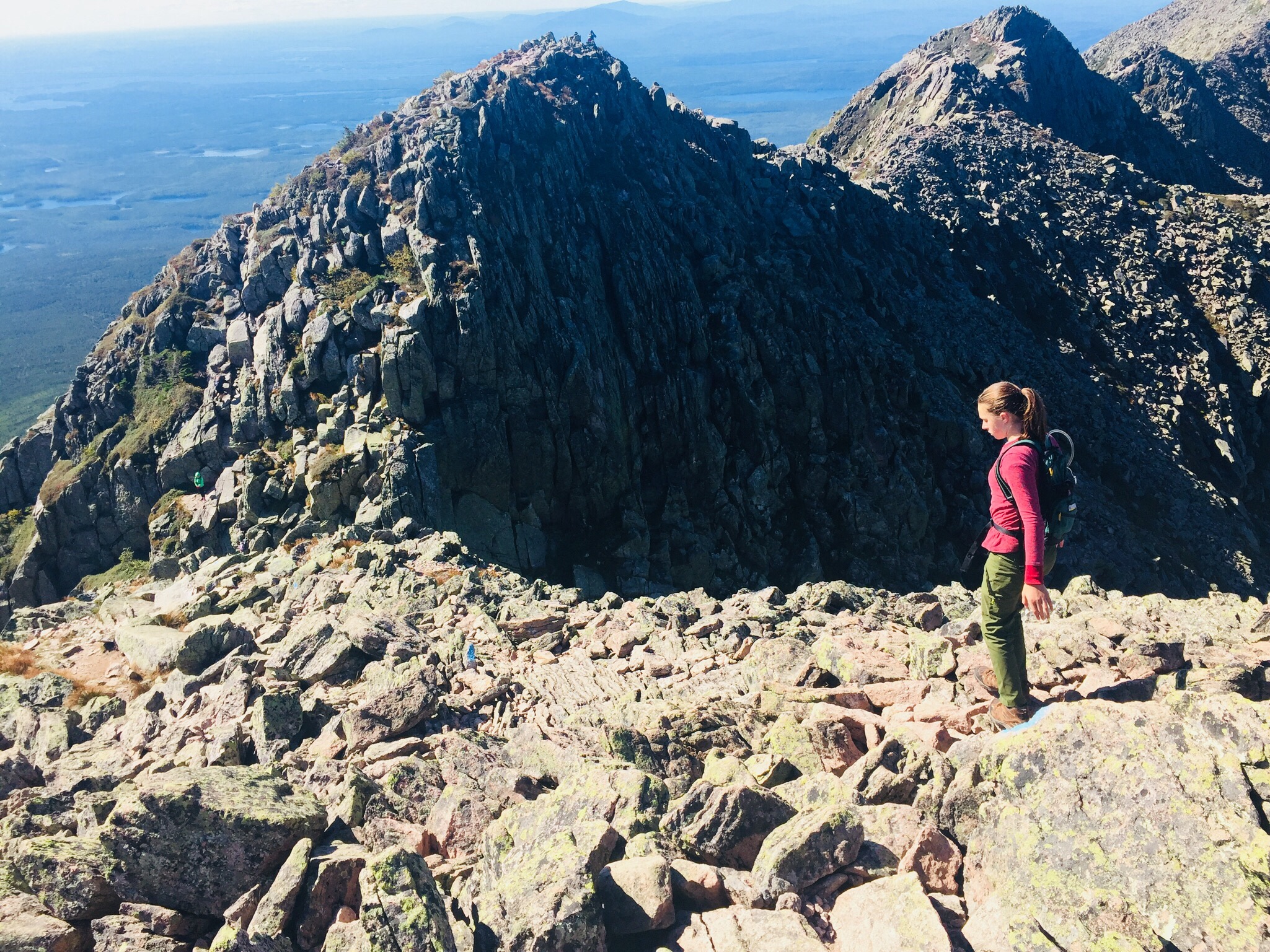
The first step of the Knife Edge was the descent into the chimney adjoining Pamola, then a quick climb back up, setting the tone for a fun traverse. We saw several other groups of people crossing the Knife Edge, including some coming from the direction of Baxter Peak, one of which contained the only other child we saw, a nimble little boy, younger than daughter, leaping from rock to rock.

01c81e48ed71e597962fa6f05767a9ee388f7ca107
The Knife Edge Trail is a dizzying series of up and down climbs.

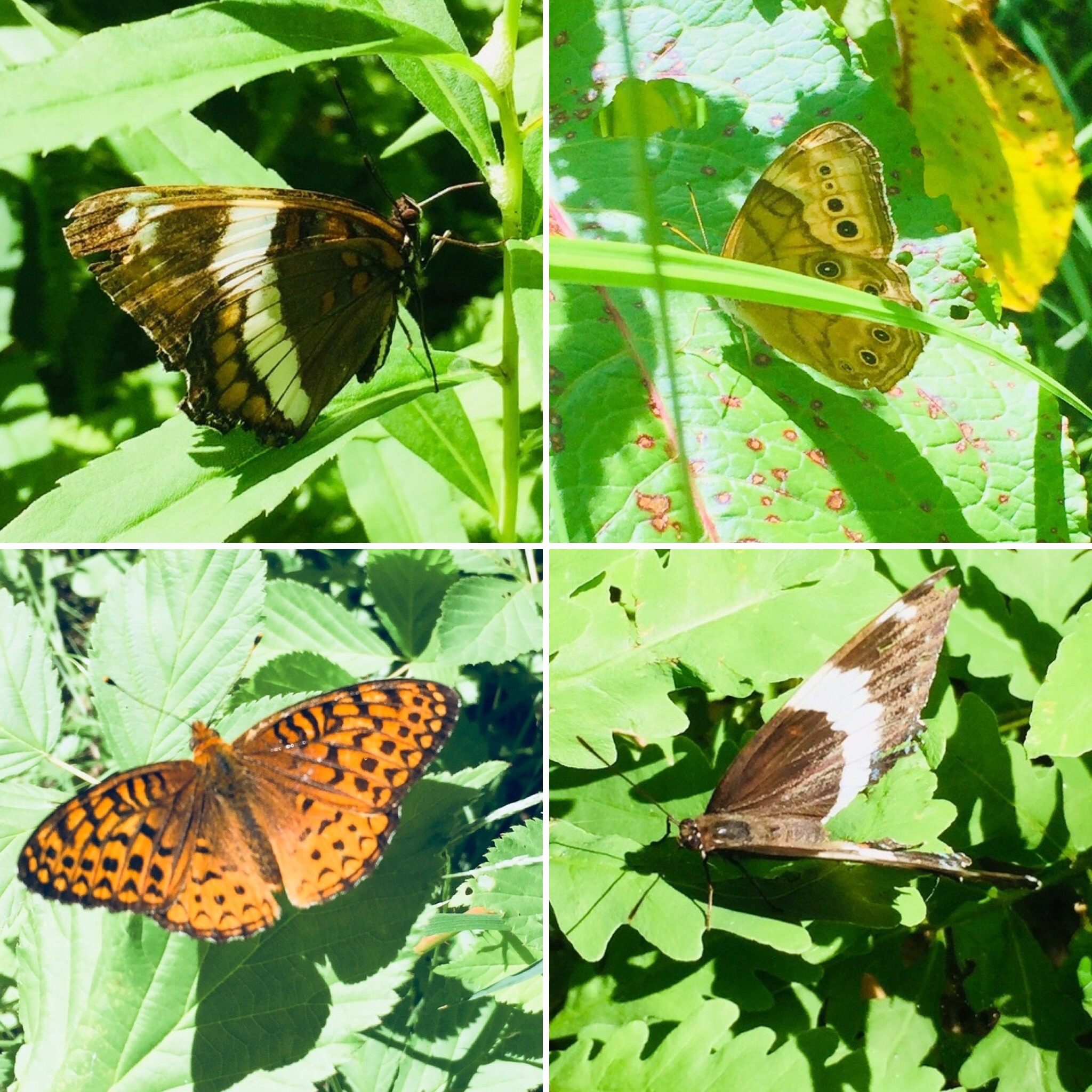
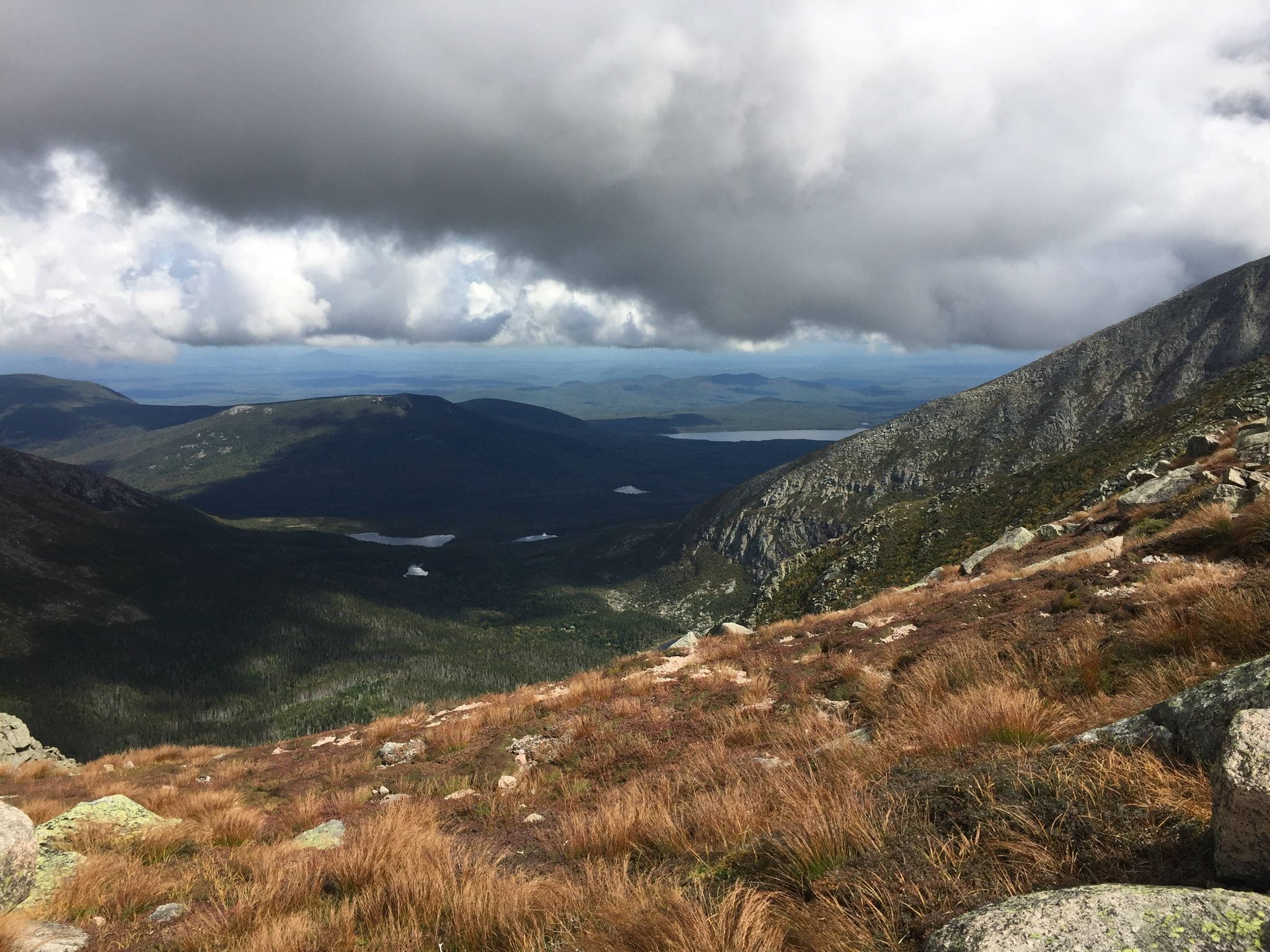
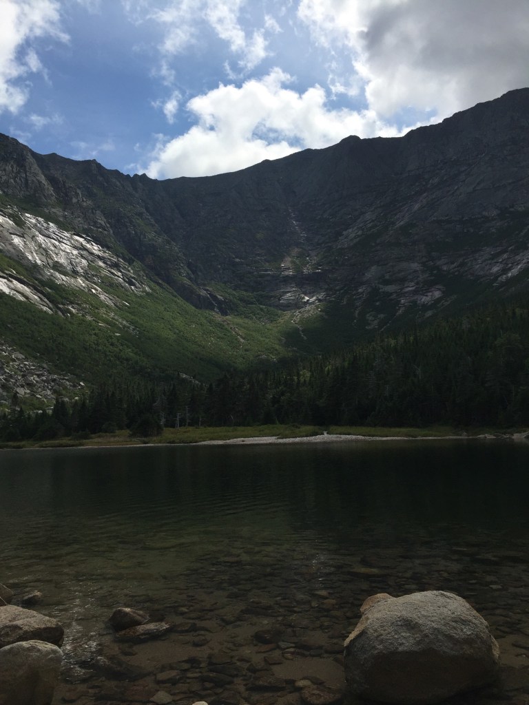
After the climb up Helon Taylor, exposed to the wind, and steeply ascending until our legs ached, we agreed that the Knife Edge was more mentally than physically challenging, and stopped frequently to gaze down into the bowl created by the steep cliffs of Katahdin, look at rock slides down the cliffs to the south, and watch ravens wheel and glide on the air currents below us.

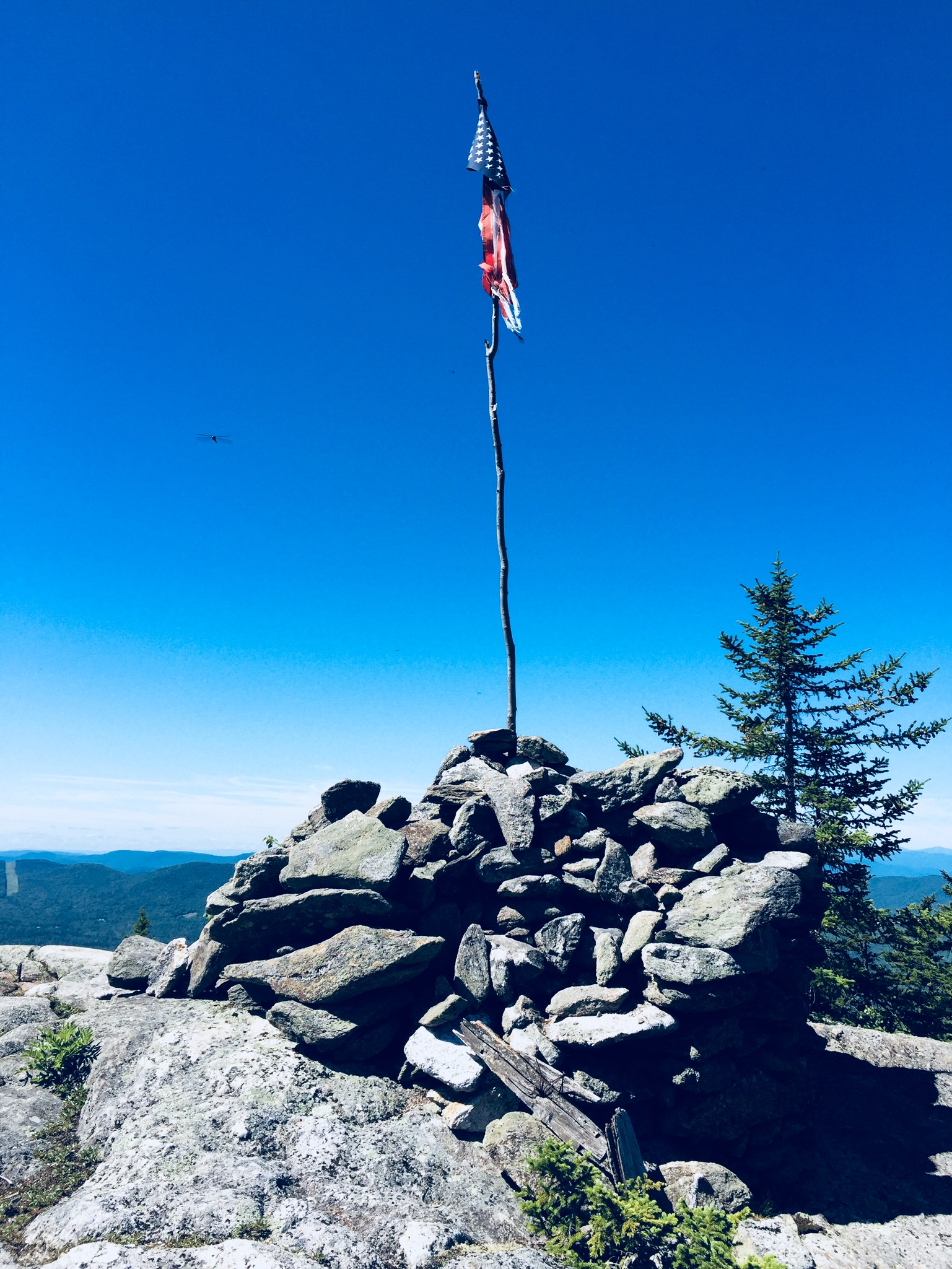
We did not spend long on the summit of Baxter Peak, which was crowded with thru-hikers and large groups, with a long line to take pictures at the summit sign. Millennial-types used the cell service available due to the summit’s elevation to FaceTime with friends (“You’ll never guess where I am right now”) and send Instagram pictures ad nauseam. Daughter waited for a quick break in the action and snapped a ghost summit photo.

01a2f643bc980244847feea3a6a726ad630f126553
A weather-worn sign cautions hikers on the Saddle to take care with alpine plants.

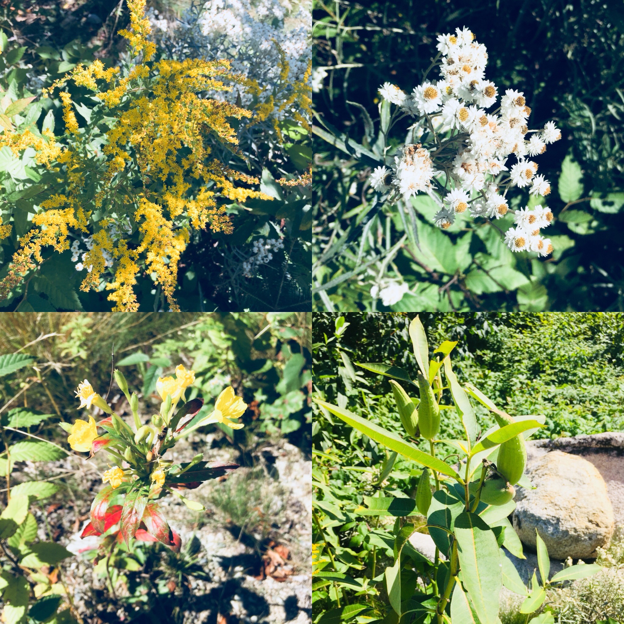
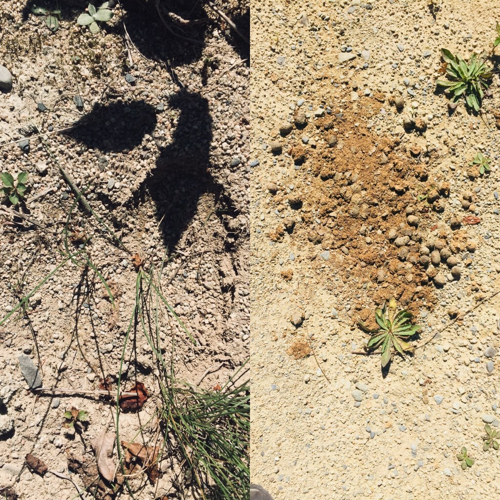
Much more interesting was our meeting on the way down to the Saddle Trail with a Baxter State Park ranger, who educated us about the fragility of alpine plants. She told us that even a small patch can take up to one hundred years to grow back, and can be killed by as few as seven footsteps on it. We asked a number of questions we had gathered during our hike, including why some slides looked different- she explained that the slides where the trees were laying downhill were caused by avalanches in the winter, but that when the mountainside was denuded of vegetation, it meant that a rockslide had occurred. This ranger, from Asheville, North Carolina, works at Baxter from May to October educating hikers, conducting rescues, and sometimes climbs Katahdin every day.

01822412dddc6a9f1b996a90b8da39f3bcbab40686
Relaxing on the descent by Chimney Pond.

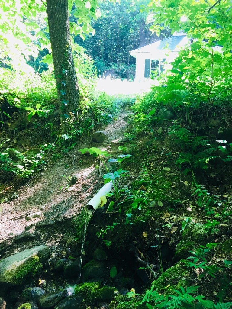
Our descent of the Saddle Trail was slowed by the onerous process of passing what looked like a large school group, and we got to Chimney Pond around 1:40 PM, where we took a long break to enjoy the sunshine, air out our feet, and birdwatch.

From there, it was a downhill walk over rocks and roots to Roaring Brook and our car, getting back around 3:30, for a total of almost nine hours of hiking. During this last stretch, one of dad’s hiking poles snapped, but our hike was otherwise uneventful.

So what worked? Obviously, chocolate and peanut butter. But daughter felt good about her hiking and running in the weeks leading up to the Knife Edge, and it got her into shape for the climb.

Mentally, we had talked about the challenges, and even used technology to our advantage, watching YouTube videos of the Knife Edge (the volume was quickly muted) to dispel fears. We started hiking with the agreement that we would not stupidly try to push through bad weather, and even reserved another parking spot for the following day, just in case.

We had a ton of water, using our 3 Liter Osprey hydration systems (Dad still ran out with a mile or two left to go). Dad carried a light pack with extra clothing layers and food. Daughter stayed with a Camelbak pack that allowed her to carry water and a few energy bars, but didn’t hinder her while climbing.

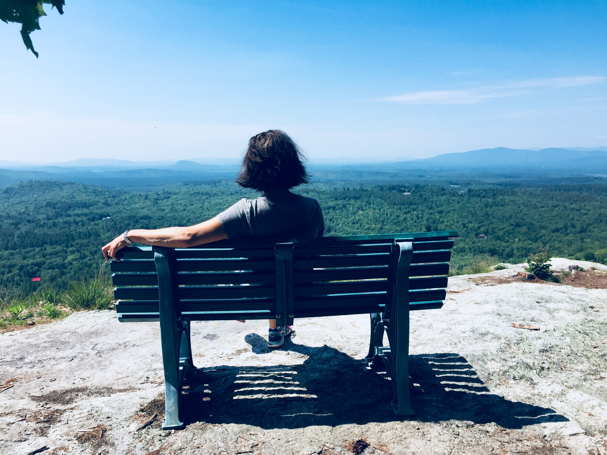
We shared a great hike, and daughter enjoyed being the tallest thing in Maine, even for a few seconds. With the right attitude, preparation, and training, the Knife Edge can be an incredible, unforgettable experience for kids, as part of an exploration of Maine’s tallest mountain and the limits within themselves. Even an unsuccessful attempt, safely and properly handled, can create a goal for future conquest, and build decision-making and risk management skills.

Mount Katahdin

01b0d2e588aa8bf383a096ae560a27117ae4e90ca1
Keeping an eye on the weather on our descent down the Saddle Trail.

Katahdin is the grandfather of Maine mountains, and the northern terminus of the Appalachian Trail.  It’s hard to describe the way Katahdin’s bulk dominates the landscape without actually seeing it for yourself.  Dad and daughter climbed Katahdin’s Baxter Peak (5,268 ft) via the Chimney Pond, Cathedral, and Saddle Trails (total R/T appx 10.5 mi) on September 9, 2017 to cap off our spring and summer of hiking.  Dad had previously hiked Katahdin via the Hunt Trail (11 mi R/T), and via the Helon Taylor, Knife Edge, Saddle, and Chimney Pond Trails (total R/T appx 10.2 mi), but this was daughter’s first ascent.

(Note: for a deeper dive on the Knife Edge Trail, check out this update in September 2018.)

Here is the Katahdin trail map from the Baxter State Park website, which wisely suggests allowing 8 to 12 hours for a Katahdin hike, and has all the info you will need for a successful hike:

Climbing Katahdin requires some prior planning, due to the remoteness of Baxter State Park.  We stayed in Millinocket the night before our climb, as well as the night after, as not much was available for campsites within the park.  We booked late, and due to a good deal, stayed both nights at a large suite in the Parks Edge Inn, which was more space than we needed, but it would be a perfect arrangement for a larger group of hikers, as it was cozy, friendly, there was a kitchen, and there were plenty of places to sleep.

IMG_3943
View of Katahdin from the Chimney Pond Trail.

Our day started early, with the drive out to wait in line by the park’s gate.  Luckily, dad had secured a parking pass for the Roaring Brook campground beforehand, and we weren’t turned away, as some in line were.  Definitely plan ahead, and allow yourself the time to get to Baxter State Park’s gate, as well as the time for the slow drive on the Park’s dirt roads to wherever your trailhead is, as this will always take longer than you think.

011f15615c9cf5c5efacfc20d1a9de2f3f1214c210
The Knife Edge from Chimney Pond.

We parked at Roaring Brook, took a look at the scale model of the mountain at the ranger station there, signed the log, and began our trek beside Roaring Brook on the Chimney Pond trail.

Chimney Pond is beautiful, and a great jumping-off point for multiple hikes, as well as family-friendly ranger-led programs in the summertime.  With ominous clouds moving in, we signed the trail log, got advice from the ranger at Chimney Pond to avoid descending the Cathedral Trail, and decided to make our push up Cathedral, and to return via the Saddle Trail.  We decided we would forgo the Knife Edge, and take it the next time the weather allowed us to.

01ba305c0ff3b141ded98c07aae886762fcab315c9
The Knife Edge on a previous ascent – not for the faint of heart.

Dad and daughter started the steep climb, and mom, who had accompanied us on this trip and hiked with us as far as the Chimney Pond Campground, then turned back to wait at the Roaring Brook lot for us as we climbed to the top.  We felt strong, and our packs were intentionally light, focused on water, food, and light rain gear (in that order).

Dad/daughter each carried a 3 Liter Osprey water bladder (dad is one of those humans who just flat-out uses a lot of water), and we left daughter’s less full to reduce weight.  Water on Katahdin is crucial, as straining leg muscles can easily dehydrate and cramp up, making for a difficult trip.  In addition to water, eating bananas, and/or taking small amounts of salt and magnesium with food can help counter this cramping.

0133b937ff6ea2d22f2e9a7f67efb133903d14da03
Daughter pushing up the Cathedral Trail.

We encountered several other pairs of hikers, who we spoke to briefly as we leap-frogged our way past and then behind them again during rest breaks.  Cathedral was a serious climb, with a few hand-over-hand scrambles to follow the blue blazes.

We didn’t linger long at the summit of Baxter Peak, or stay for our planned lunch break.  There was a large crowd that had come up the Hunt Trail, and the clouds did not look friendly.  When dad did this hike the first time, it had been an icy affair, with stinging hail and ice, combined with a steady rain, and sure enough, we heard distant thunder, and started to feel a few drops.

015c13ee891adaead0134de30bcdcbe2f81a02f1ef
Looking back at Pamola Peak and the Knife Edge from the Saddle Trail.

We scrambled down the Saddle Trail as the rain began to pick up, and about halfway down, dad’s feet went out from under him on a wet rock, and he took the weight on his wrist.  The pain was dazzling, and we looked at the joint and the hand, but besides the discomfort, it appeared to be fine, so dad pulled it into his stomach to minimize the jostling as we descended, and we kept going.

The rain really began coming down, and we stopped in the treeline to put covers on our packs, and for daughter to don her rain jacket.  The rain began to lighten while we stopped to enjoy some PB+J in a covered shelter at the Chimney Pond Campground.  From there, we covered the ground quickly down the Chimney Pond Trail to the Roaring Brook lot, and our truck.

Getting back in the truck, dad realized that he couldn’t shift, steer, or turn the keys in the ignition with his right hand, and used his left to reach over the wheel for these tasks.  As we wrote in our brief post on this hike to start this blog back in September 2017, it turned out, after X-rays a couple weeks later, that the wrist was broken.  Bummer.  Again, a great argument for the utility of hiking poles on a slippery descent, which would likely have mitigated this injury.

Daughter and dad agreed that Katahdin was the most challenging mountain of the summer, far surpassing Washington. We were happy with our route, and would suggest it to those tackling Katahdin when the Knife Edge is not a good idea due to weather.  Cathedral offered us incredible views, and we used our rest breaks to turn and survey our progress and the landscape.  We are looking forward to hiking Katahdin again, as well as exploring more of the newly established Katahdin Woods and Waters National Monument.

A Post Script….

We did enjoy a great mini-hike the following day on the way home, as we had a full day available to us.  We stopped on the way south at the Orono Bog Walk, a 1-mile boardwalk loop that starts at the Bangor City Forest.

012b6988bf43c98b6607689a9bc91b30f56c131937
We really like plaid.

This was fascinating, particularly for the opportunity to see pitcher plants, which we had seen in the Barren-Chairback range during our 100 Mile hike, and for the many varieties of birds along the route.

010ce1e0bb12852d7babb66353096514cfa2bf901f
Views from the Orono Bog boardwalk.

It was also a relatively easy loop, and an opportunity to stretch our legs after Katahdin the day before.  Larger loops are well-marked and available for running and walking within the adjacent City Forest.  Just get there early- parking was at a premium.

Katahdin Woods and Waters National Monument (Katahdin Loop Road)

01fb28221881b3f66f6417691e990ce16d393b995f

(Note: The Katahdin Loop Road opened for the 2020 season on Saturday, May 23. U.S. National Park Service advises to drive with caution and be alert for soft spots and rough road sections. Haskell and Big Spring Brook Huts are temporarily closed, and updates will be posted to the NPS website.)

During a visit to Baxter State Park, dad and daughter found ourselves with sore legs and a half-day to explore, and we decided to check out Katahdin Woods and Waters National Monument via the Katahdin Loop Road.  We got our direction from a Katahdin Chamber of Commerce visitor’s guide and a pamphlet from Natural Resources Council of Maine (NRCM), but we had followed the progress of the Monument since its creation in August 2016.

The standard route into the South Entrance is via Route 11 from E. Millinocket/Medway to the Swift Brook Road along the Katahdin Woods and Waters Scenic Byway, but we were feeling adventurous, and took the Stacyville Road north from Millinocket to where it meets the Swift Brook Road.  We savored the lonely ride along this quiet logging road, occasionally startling game birds (this is not the way to take a low-clearance or non 4×4 vehicle).

The 17-mile loop of Katahdin Loop Road is punctuated by meadows, bogs, and ridges, and the south and west parts of the loop boast excellent views of Katahdin and the surrounding area.  This is an opportunity to see the Monument and cover distance in a vehicle, while having the chance to get out and explore at a variety of hiking paths and overlooks.  The best map of the loop we found (which I wish we had when we were there, as it is also an excellent interpretive guide) was from the Friends of Katahdin Woods and Waters, and can be found here.

01956851ac4c035ab5352c3bdbf2b168afa977f722
Lynx Pond

The Lynx Pond Walk is shortly past the Loop Road Gate, on the right just past the Mile 2 marker.  Shortly after the trailhead is a parking area on the left of the Loop Road.  This is a very short walk through the woods to a small boardwalk by the pond, and a spot for quiet reflection and wildlife viewing.

01d653ad792defeda6d7ee61dfda750f88aec17e0c
Looking south from The Overlook on Katahdin Loop Road.  The large lake is Millinocket Lake.

0128123aefc231d99d78e21014caffb04b28152f10
Views of Katahdin from The Overlook on Katahdin Loop Road

Katahdin towers over the loop, and there are multiple spots around the Loop Road with views of the lakes and mountains to the west and south, particularly The Overlook, between Miles 6 and 7, which conveniently has a picnic spot and a toilet.

We continued around the Loop Road, and got out to stretch our legs again at the International Appalachian Trail (IAT) and trail to Barnard Mountain, passing over Katahdin Brook and by the IAT lean-to.  This wide logging road made for a sunny trail, and though we did not make the turn towards the Barnard Mountain summit, we enjoyed the walk, and the familiar plants and animals that inhabit newly overgrown woodcuts, with blue jays diving across our path and into the trees.  The Barnard Mountain trail itself is a moderate 4-mile round trip with summit views of Katahdin and Katahdin Lake to the west.

0162945685aea994ce4c9bc0e69edac7f7ef89bdac
Late summer flowers and plants along the IAT

The IAT continues from the northern terminus of the Appalachian Trail at Baxter Peak across Maine, into Canada, across to Greenland, and Europe, to the Atlas Mountains of Morocco.  For a great exploration of the concept of the IAT, see On Trails by Robert Moor, reviewed on this blog.

01b5f4816d5a5e0f24f63f8ce23c3ebb07ec640256
Moose tracks and droppings on the IAT

There are seven mountains in the Monument to hike, including Barnard, as well as paddling opportunities and waterfalls.  The Loop Road was quiet, as were the trails, with natural sounds, and only a few others exploring the area.  A bumpy drive back down Stacyville Road took us to Millinocket, where we devoured a Hawaiian pizza without remorse at the Millinocket House of Pizza.

Katahdin Woods and Waters National Monument is a special place, and we will be back there for hiking, biking, and paddling.  The views during peak foliage season must be spectacular.  Ensure you plan ahead, bring maps, and a cooler with water and snacks, as there are no facilities at the Monument, and cell coverage ranges from little to non-existent.  But that’s probably what you’re looking for in the first place.

Peaked Mountain (Clifton, ME)

Peaked Mountain
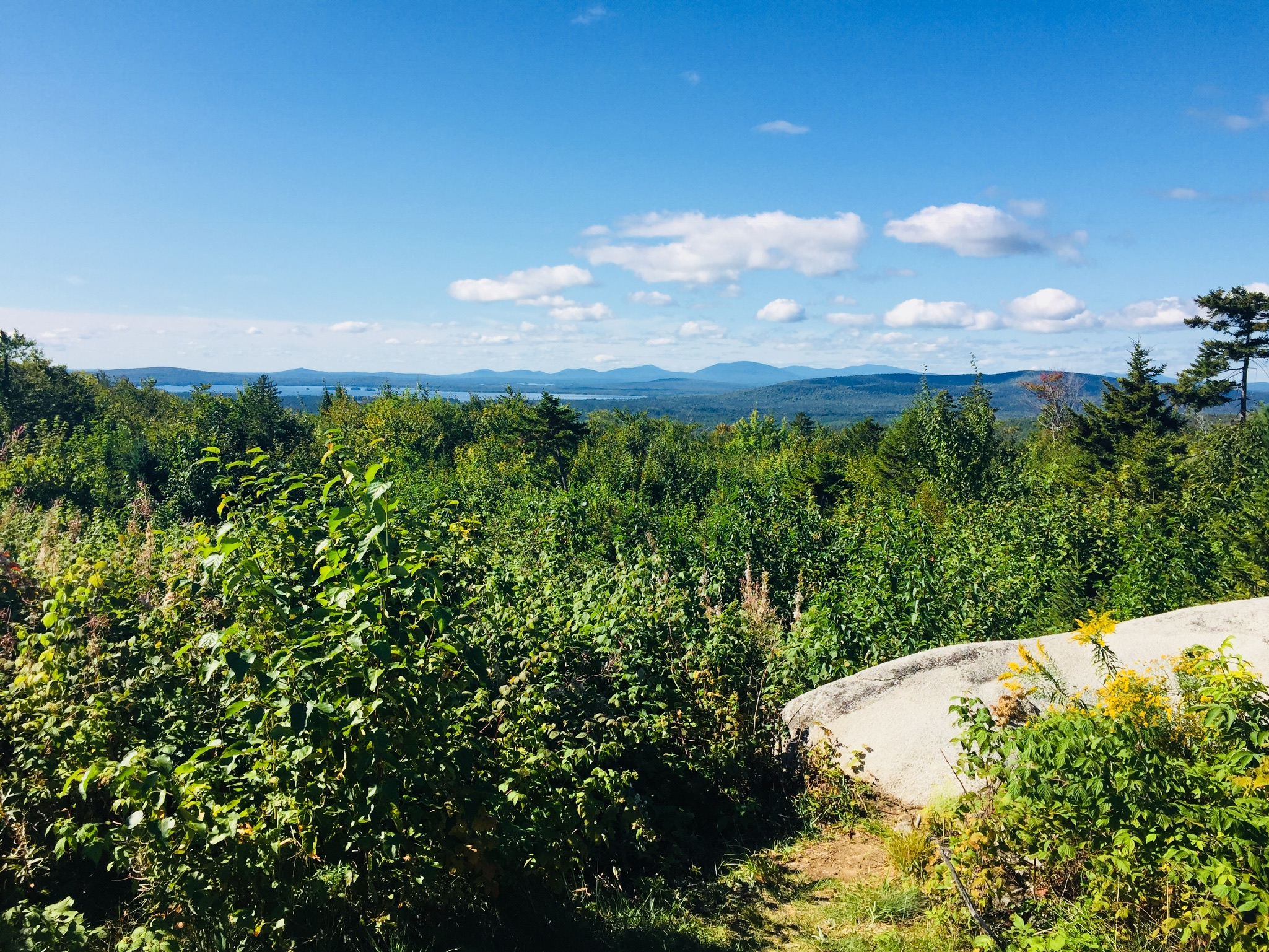
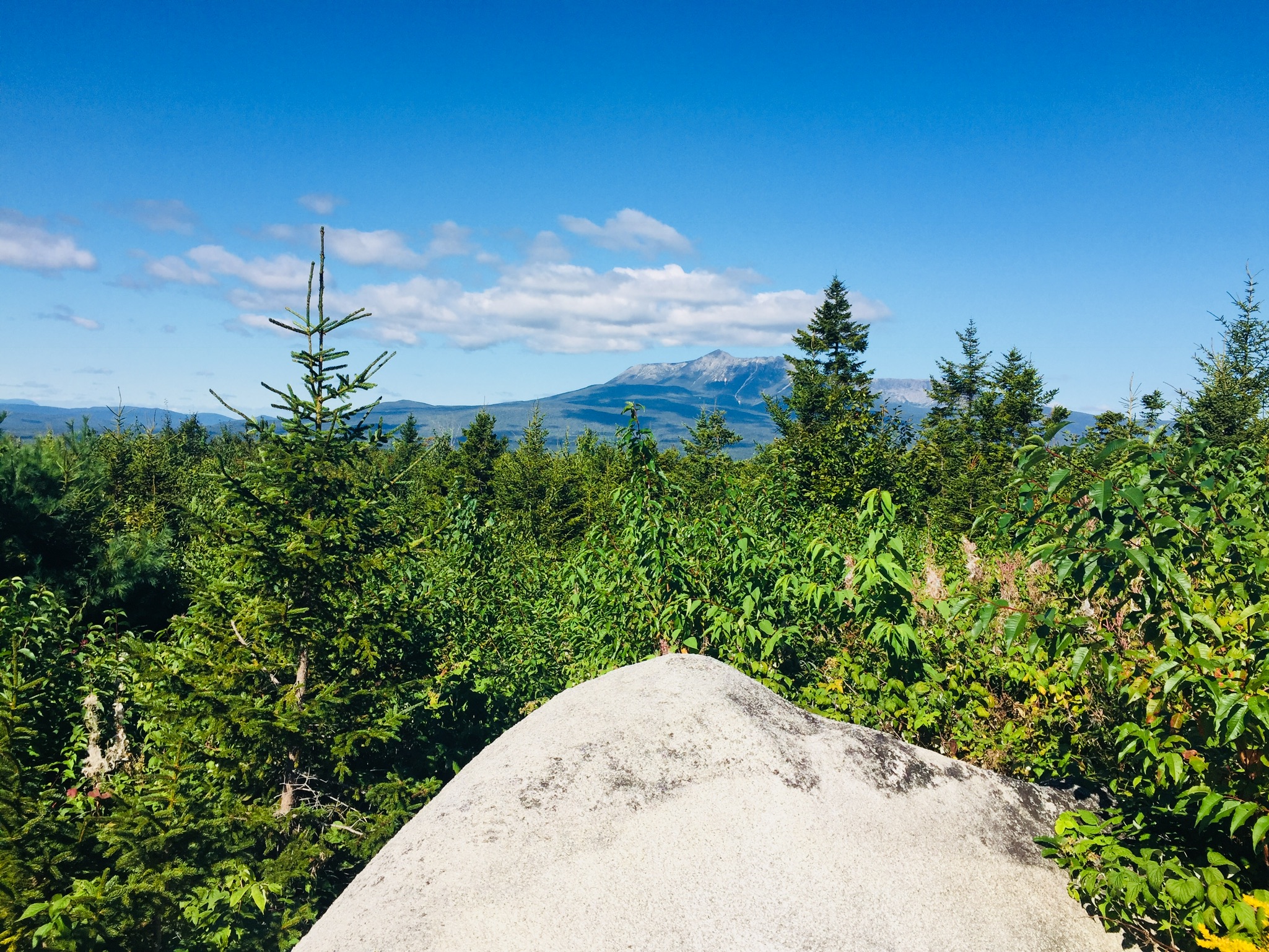
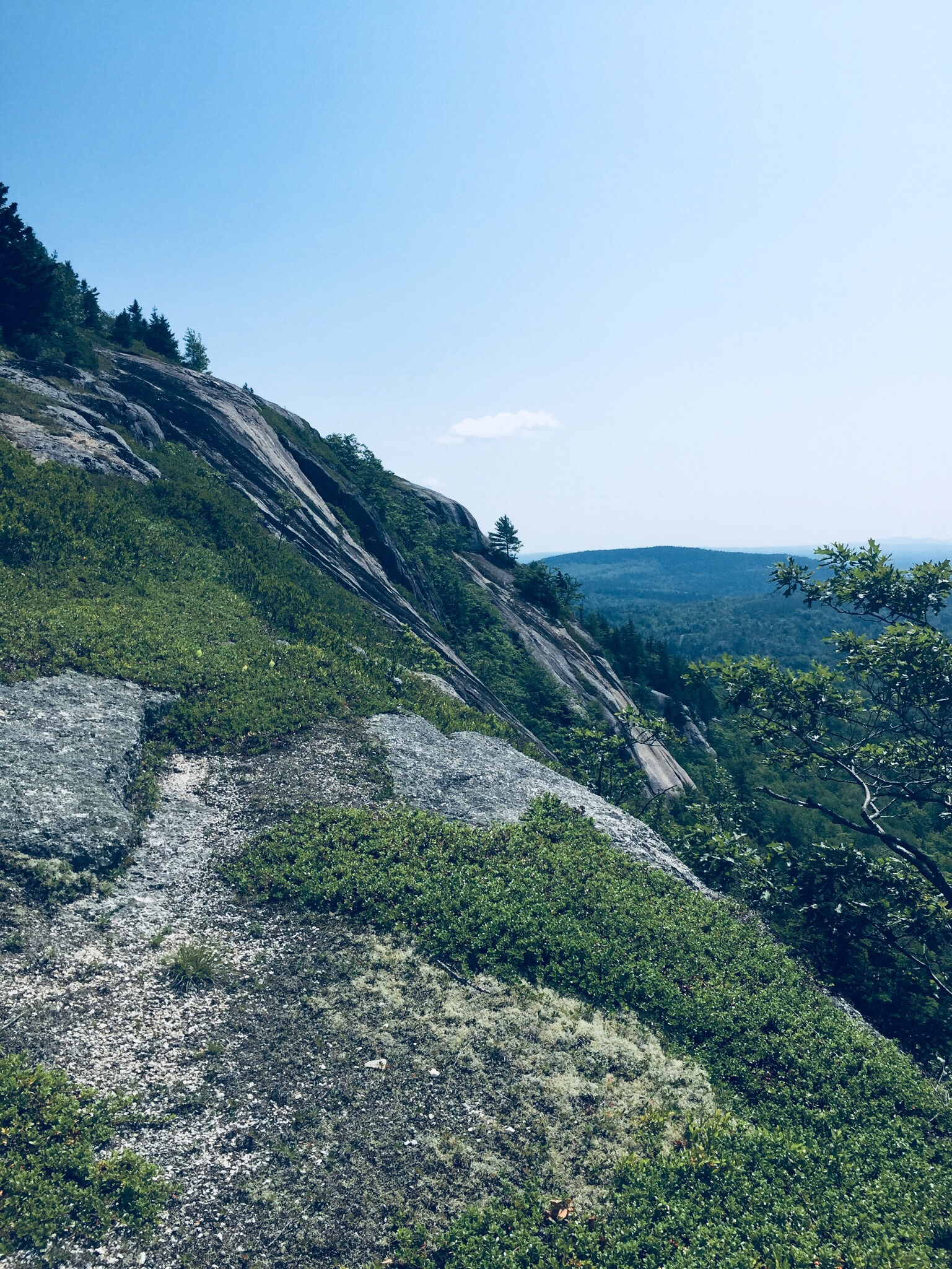
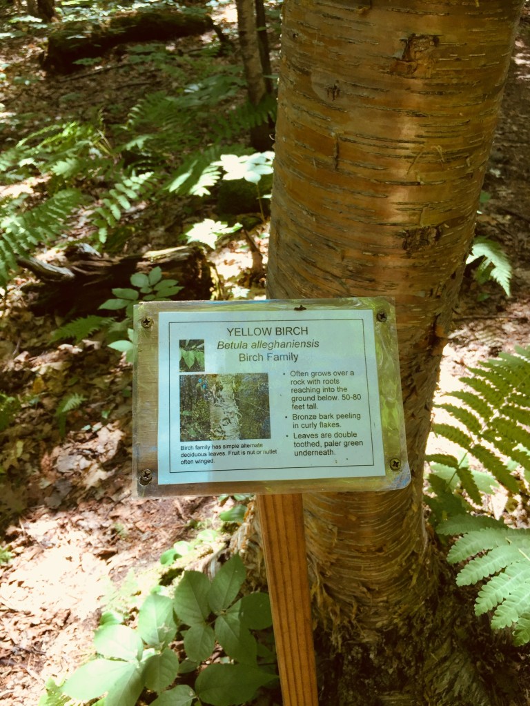
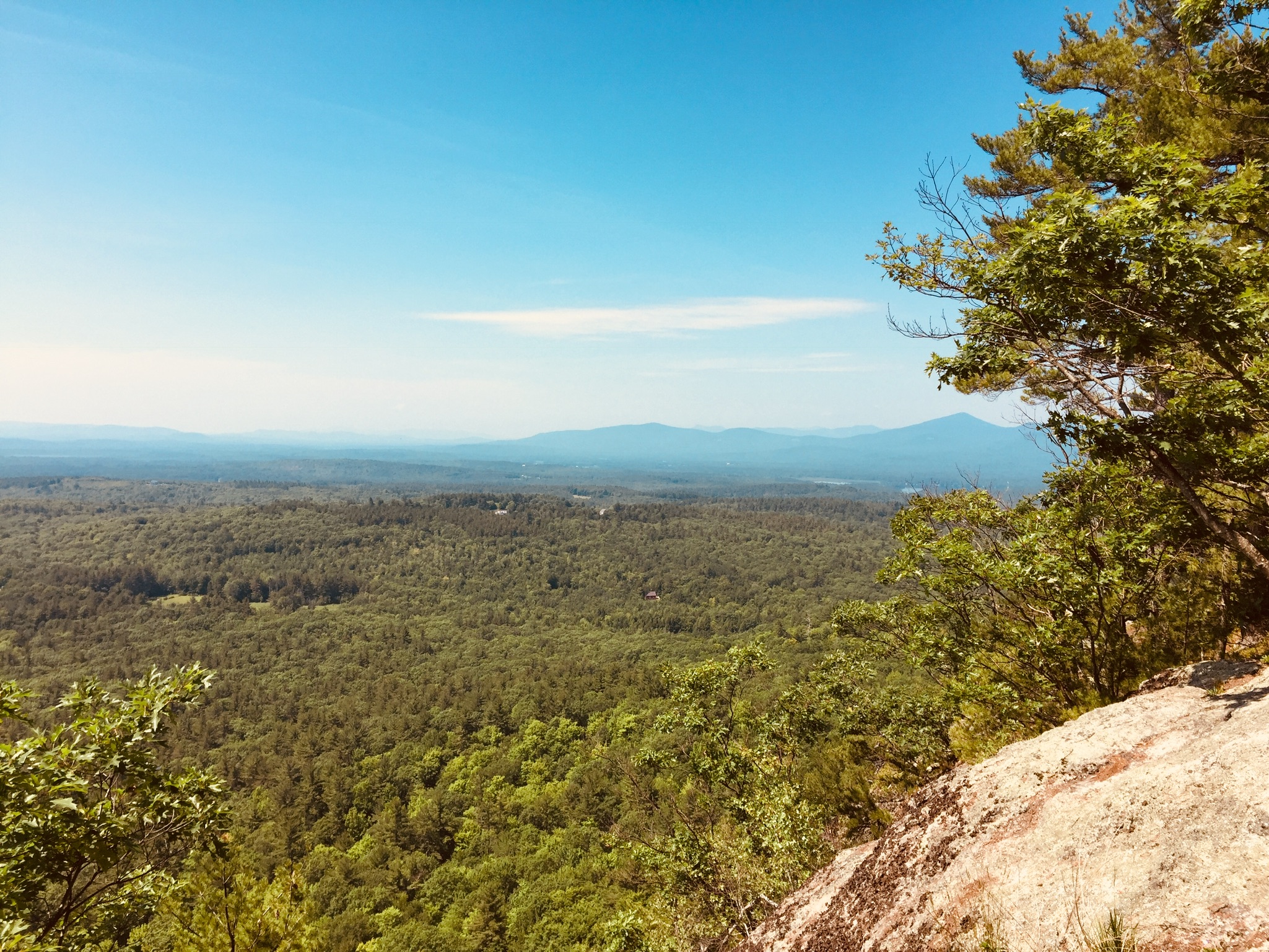
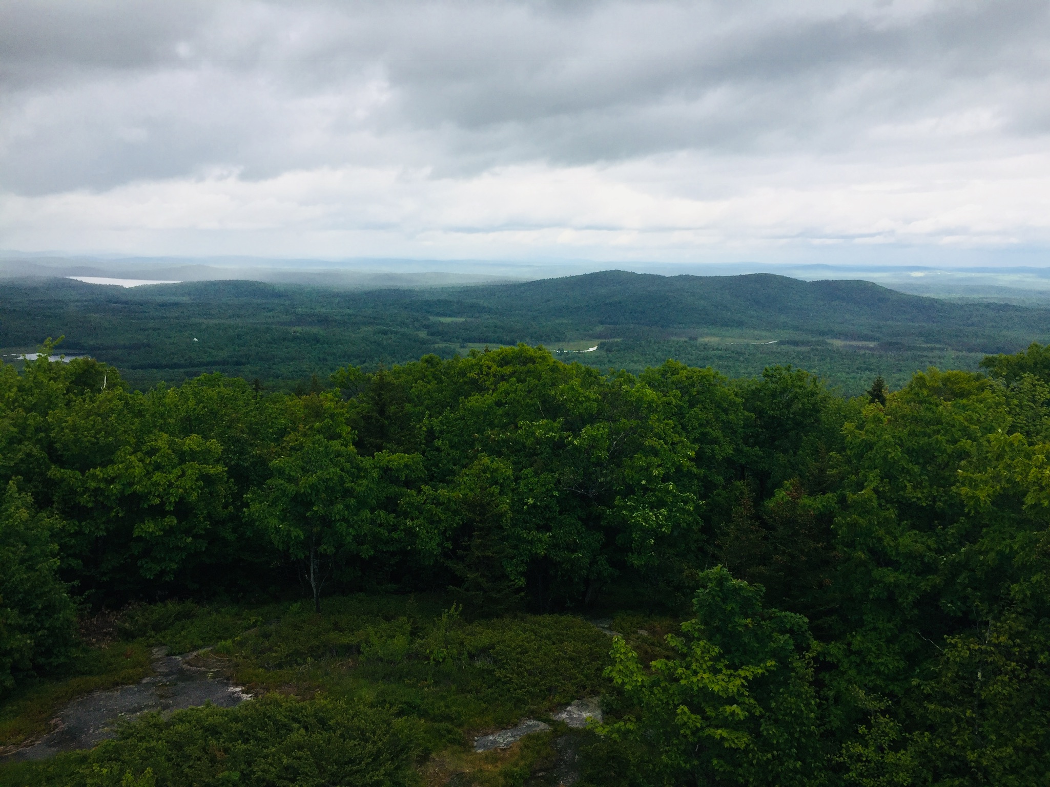
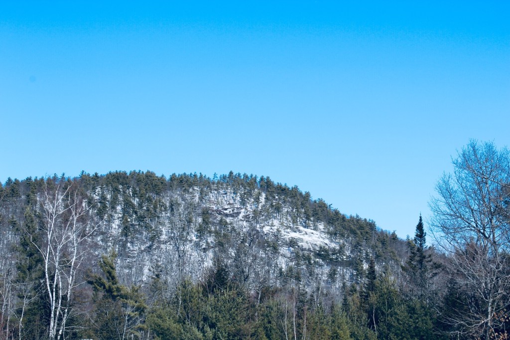
In August 2018, we hiked Peaked Mountain (1,160 ft), also known as Chick Hill, in the Clifton-Amherst area off Route 9.  For years, we had observed the massive cliffs of Peaked and Little Peaked Mountains looming over the Airline, and hiking to the top was a great experience.  We took our instructions from the AMC Maine Mountain Guide, as well as a November 2017 Portland Press Herald article by Carey Kish on Airline Road hikes.  We did this 2.2 mile up-and-back hike during a sweltering heat wave, with temperatures in the nineties, and it took us about an hour, total.

The trail route provided by the AMC guide needs no addition – we easily followed the logging road (fire road 32) from the trailhead, past the turn-off for Little Peaked Mountain, and turned into the woods at utility pole 18.  A steep trail through the woods (which felt like a jungle on this hot, humid day) leads up to the open areas below the summit.

Mom/wife and daughter reached the cliff edge below the summit, and enjoyed the cooler breezes, while Dad continued to the top and looked at the expansive views.  The longer alternative, taken by another group of hikers while we were there, is to take the road all the way to the summit cell tower.

The trip down the mountain was much faster than the way up, descending the gravel road with occasional stops for raspberries and blackberries.  Little Peaked Mountain would have to wait for next time.  Most importantly, a stop on Route 9 in Aurora at Mace’s American Snackbar for cold Gifford’s ice cream capped a great hike.

(Disclaimer: This post contains affiliate links, and as an Amazon Associate Hiking in Maine blog earns from qualifying purchases.)

River Point Conservation Area (Falmouth, ME)

Off the West Falmouth exit of I-95 (exit 53), tucked behind the Hannaford plaza, is a hidden gem.  You can find a detailed description of the land and its history at the Town of Falmouth site regarding the River Point Conservation Area.  This 1.4 mile network of trails also links to the Cross Falmouth trails and Portland Trails, as well as being accessible by canoe from the Presumpscot River.

010ecb899815d7766ef6c8e16ca6f49fe229243068

On the cloudy late July afternoon we visited the trails, mosquitoes were thick, and ticks were abundant in the tall grassy areas, so plan appropriately with insect repellent/gear.  This did not hamper our enjoyment of the flowers and birds throughout the conservation area.  Also, stay on the trails to avoid poison ivy.

016c4812effe902cc47a2142d4dfa5c8ac7cd3c858
Interpretive signs along the trails.

The interpretive signs along the trail would be good for scavenger hunt-type activities with kids, and provide insight to the area, its history, and the flora and fauna that inhabit it.  The signs also disclose that the trail is sponsored by Dunkin Donuts, which has a location at the adjacent shopping center.

01bfeb475f24533e9d1436248ebf98de1fcdf349ac
A massive beetle encountered on the trail.

According to the Town of Falmouth website, River Point was used for thousands of years as a campsite by Native Americans as they traveled seasonally from Sebago Lake to the ocean. The first white settlers homesteaded the original 151-acre property in 1775, and farmed there until 1883, establishing a brickyard and shingle mill on the property. In 1859, the Kennebec & Portland Railroad line bisected the property.  The bridge, the only bridge in Maine built to connect to just one house, provided access to Route 100. The town acquired River Point in 1995 when the shopping center was developed. The Town Council designated the 41-acre property as a conservation area in 2009.

This small conservation area, with a short, flat loop trail, is perfect for a lunchtime or after-work walk in the greater Portland area, and the open fields, with birdhouses, are excellent places to observe songbirds (and in the evening, bats).  The town of Falmouth lists allowable uses as: Hiking, mountain biking, snowshoeing, cross-country skiing, fishing, and nature study.  For those with pets, just check the signs beforehand, as pets are not allowed when birds are nesting.

Mt. Zircon (Peru, ME)

01a8f073468797fb7fb6fb7d50e75af7b0174fcc28
View from the Mt. Zircon summit

Dad and daughter hiked Mt. Zircon (2,240 ft) in Milton and Peru, Maine, on July 21, 2018.  This moderate out and back 5.8 mi hike took us about three hours, with a picnic lunch at the summit, and plenty of breaks to enjoy the scenery.  As described in online articles and guides, the start of the hike, a gravel road off South Rumford Road across from the Androscoggin River, is not the easiest place to find (Google Maps will likely point you to the wrong side of the road).  The best directions we found were in the AMC Maine Mountain Guide – look for the Rumford Water District tree farm sign, and the gravel road leading uphill past a red gate.

The trail starts with a steady uphill climb on a gravel road for 2.1 miles.  This summer day, there were numerous raspberries and wildflowers on the sides of the road and the edges of adjoining woodlots, as well as a variety of colorful butterflies.

018212e0c16b1b8c4ab9d1aa8ddaaf7080513ec704
Butterflies along the Mt. Zircon trail

At about 1.5 miles, we reached a spring house on the left side of the gravel road, with an outlet pipe falling into a mossy hollow on the right side of the road (you can read more about the Moon Tide Spring house and the now-defunct Zircon Water Bottling Company here).  The water was cold and fresh, and we filled our 3L Osprey water bladders to capacity on the return trip, and enjoyed this spring water for several days after the hike.

0155340beb159d20dd6453c593f21c5206c75dd1a3
The Moon Tide Spring House and its outlet

At 2.1 miles, we turned left onto the path to the summit through the woods, which gained elevation quickly along a narrow but well-maintained path.

We saw a variety of toads and a couple wood frogs, as well as the recent tracks of deer.

To our delight, the beginning of the rocky section to the summit was filled with blueberries, our first ripe ones of the season.  The path to the top weaved past several rocky ledges, giving views in almost all directions, including the Whites, Black Mountain and Sunday River.

0186f5d2173874e8a62b33305dbe71e54ed22b692f
A dragonfly zooms past the tattered flag and cairn atop Mt. Zircon.

We had packed a lunch, and enjoyed it in a shady spot between the summit cairn and the fallen fire tower, with squadrons of dragonflies keeping away any biting flies.  After we finished eating, we used the bag and containers from lunch to collect blueberries to bring back for the next morning’s pancakes, being mindful of the fragile plants and lichens surrounding them.

The same path and gravel road brought us back to our car after a relaxed downhill walk.  We had the trail to ourselves most of the time, only seeing a couple people on the gravel road walking their dogs, and two riders on dirt bikes on the ATV section.  Mt. Zircon is a quiet hike which delivers great views, fresh berries, and, as a bonus, cold, clear spring water.

(Disclaimer: This post contains affiliate links, and as an Amazon Associate Hiking in Maine blog earns from qualifying purchases.)

Sabattus Mountain (Lovell, ME)

Sabattus Mountain (1,253 ft) in Lovell, Maine is an easy, family-friendly hike with sweeping views of the Lakes Region and White Mountains.  Dad and Mom completed the 1.6 mile loop in about forty-five minutes at a relaxed pace, and Daughter went on ahead and finished in about half an hour.  You can find a detailed description of this hike in the AMC Maine Mountain Guide, or the AllTrails app (download the map beforehand – not much cell service near the mountain).

01e531dbffc2d5dd5d609192bf60da5c171a545cc0
Can you tell birches apart?  The Sabattus Mountain markers also help with ferns, mosses, and other trees.

The sign at the trailhead, located off Sabattus Mountain Road, credits cooperative efforts between the Maine Bureau of Parks and Lands and the Greater Lovell Land Trust (GLLT) with making possible public access to the area.  A look at GLLT’s web site shows they have many educational activities to offer, and multiple other trails.  The Sabattus Mountain loop trail, which passes through a variety of terrain, includes helpful markers identifying the flora (nice post here on their installation).  We headed left at the loop to go up, and this seems like an easier ascent than the right/westerly path, which could be slick in rainy weather.

01a528098f40f613443bb1ac9fd4976be65c7657d9

The views from the summit were as advertised on this clear day at the end of June, and there are even a couple park benches from which to relax and enjoy the scenery.  Use caution with small children and dogs, as the cliffs drop off steeply.  An observation tower at the loop junction is no longer there – just the base exists now.

019395c993bc6c4ddc1d7be4283f6caa45f54d51d6
Park bench on the summit

After a stop at the summit, we completed the loop, returning to the trailhead.  A great stop before or after this hike is the Center Lovell Market, which has everything you would want for a picnic, as well as a restaurant.  Sabattus Mountain is not that far from beautiful Pietree Orchard in Sweden, which has a farmstand, pick-your-own fruit options, and pizza.  And, as mentioned before on this blog, Ebenezer’s Pub in Lovell is the perfect place to enjoy a Belgian beer.

(Disclaimer: This post contains affiliate links, and as an Amazon Associate Hiking in Maine blog earns from qualifying purchases.)

Douglas Mountain (Sebago, ME)

014edff1bcbccafeed461575b700a6380ffb444827
View from the stone tower at the summit

Douglas Mountain, the highest of the Saddleback hills near Sebago, is the third in a recent trio of Lakes Region hikes, preceded by Bald Pate Mountain and Holt Pond Preserve, all of which are in close proximity (I did the three hikes in a single day, so they are eminently achievable day hikes).  I hiked Douglas Mountain (1,416 ft) in Sebago in June 2018, via the Eagle Scout, Nature Loop, and Ledges Trails (2.3 miles, approximately one hour).  This is a hike we’ve done several times as a family.  These trails, part of the 169 acre Douglas Mountain Preserve, are maintained by the town of Sebago, which has a trail map and guide on its site. As usual, the AMC Maine Mountain Guide has a great description.  A fee of $3 is payable at a kiosk in the parking area.

013343dc41b0f27607365927d0a68563fa1a67dd4b
A mossy brook along the Eagle Scout Trail

The climb is a pleasant walk through the woods on a well-traveled path, with streams and beautiful trees.  On the Nature Loop, you can start to get a sense of height from the ledges, but for the most part, the foliage hides the horizon and longer views until you reach the summit.  As for Nature on the Loop, there were many mourning doves, plenty of wild blueberry plants, and innumerable chipmunks and red squirrels, who seemed suspiciously acclimated to humans.

014ed0a9e2cb4e29e6582805bc6efa5e0c9757ac4b
Two red squirrels hope for a handout along the Eagle Scout Trail

The summit’s stone tower allows for panoramic views, and a pictorial display helps to identify which peaks, lakes, and points of terrain you are able to see on a clear day.

011805f148184b09c0767ecf4a0c898c77b0a6e9fe
Entrance to the climb of the Ledges Trail, or the end of the trail, depending on your direction of travel

A steep descent down the Ledges Trail can be slippery in wet weather, so use caution in selecting your route.  The last .4 miles or so back to the parking lot is reached by walking along Douglas Mountain and Ledges Roads, past beautiful houses.  This route to the summit is substantially shorter than the Eagle Scout Trail, and would be a short, challenging scramble for younger hikers.

(Disclaimer: This post contains affiliate links, and as an Amazon Associate Hiking in Maine blog earns from qualifying purchases.)

Holt Pond Preserve (Bridgton, ME)

0139fae195aab23b10cf1a713859803ec9d827a8d6
Boardwalk leading to Holt Pond

The Lakes Region of Maine continues to be a great place to hike.  I hiked Holt Pond Preserve in Bridgton, what turned out to be a 4.5 mile loop (approximately an hour and forty-five minutes), on a June morning after heavy rains.  Holt Pond Preserve is a preserve of over 400 acres, maintained by the Lakes Environmental Association (LEA), who have a site with interpretive guides and maps.

Holt_Pond_Preserve_FinalMap-Feb_2012_for-web
LEA Map from website

No dogs, bicycles, or ATVs are allowed at Holt Pond. There is, however, a canoe launch, which looks like a great way to see Muddy River and Holt Pond.

01126a70c7d000d416b3fcb5f3c77894eb836f220b

The preserve was alive with the sounds of waterfowl, including ducks and geese, and the distinctive calls of red-winged blackbirds and frogs.  The boardwalk allows for fascinating views of plants that you would normally need hip waders or a kayak to see, particularly pitcher plants.

01a09a08e4798525450fd1683fec1370a7cdd526b9
Pitcher plants next to the boardwalk

These carnivorous plants had flowers above them when I visited, something I had not yet seen. The bog breathed fetid air through the gaps in the boardwalk, a contrast to the cool breezes above.  Animals use the boardwalk pathways, too, and I tagged along at times behind a chipmunk and a small fledgling bird, both of whom were unable to yield the path until they reached solid ground.

01b7ed9e323741bd7d294051e147b8b540d7f45739

The trail’s path changed from bog to pine forest toward Grist Mill Road, and following it became more difficult, as it was overgrown, with a fair amount of upheaval to bridges and boardwalks from spring rains.

01f4ba935a1c166f97c0b6efb2289310fb60b8ed73
The trail was a bit overgrown in places

This moisture also brought with it plenty of mosquitoes.  For those attempting the Southern Shore trail on the far side of Holt Pond, I would highly suggest pants and long sleeves, as well as insect repellent and a weather eye for poison ivy.

This stone wall on the trail bears the telltale sign of chipmunk dens – piles of pine cone scales

The trail skirts private property by moving onto Chaplins Mill Road briefly to the east of the preserve.  I clearly missed the turn back to the trail, so I took Grist Mill Road east (left) to make a loop back to the parking area.

While the full perimeter of Holt Pond might be a bit much for most kids, the boardwalk near the parking lot is a perfect excursion for young ones, particularly using the interpretive guide on LEA’s site.

And, as mentioned in the Bald Pate post, this trail network is connected to the Bald Pate Preserve via the Town Farm Brook Trail, which ascends Southwest to the Bob Chase Scenic Loop.

Bald Pate Mountain (Bridgton, ME)

The Lakes Region of Maine surrounding Sebago is a fantastic area for hiking, with many hikes in striking distance of lakefront idylls and other recreation.  Bald Pate Mountain (1,150 ft) is an easy to moderate hike in Bridgton, Maine, with many trail options, comprising 6.7 miles of trails.

On this June morning, I took the Bob Chase Scenic Loop to the summit, then the South Face Loop Trail, returning the same way to the parking lot, for an approximately 3 mile hike (about an hour and fifteen minutes at a relaxed pace).  Bald Pate trails are well-chronicled in the AMC Maine Mountain Guide, and the trail map and descriptions are available online from the Loon Echo Land Trust, which owns and manages the 486 acre Bald Pate Preserve.

Bob Chase Trailhead at the parking lot/kiosk
Bob Chase Trailhead at the parking lot/kiosk.

Approaching Bald Pate from the south on Route 107, you can see the exposed rock that is the mountain’s namesake.  The parking lot is located on the east side of 107, just south of Five Fields Farm and XC Ski Center, at the top of a large hill.  The climb up 107 allowed the car to do a lot of the work of getting to the summit before I even started hiking.

img_0622
Face of Bald Pate Mountain in winter, Bridgton, Maine

When I arrived, the lot was empty, and a small circle of depressed grass and milkweed next to my car looked like a place where a deer had slept the night before.  I started up the Bob Chase Scenic Loop, with birch trees, lady slippers, wild blueberries, and ferns on either side, and red squirrels chattering loudly.

Views west from the Bob Chase Trail
Views west from the Bob Chase Trail.

A wrong turn took me around a pleasant diversion/backtrack to the other side of the Bob Chase Scenic Loop, and I wound my way back to the summit.  This was not the fault of the trail maintainers, as the Bob Chase Loop is clearly marked in blue, and the South Face Loop is clearly marked in orange.

View from the South Face Loop toward Peabody Pond
View from the South Face Loop toward Peabody Pond.

The summit is easy to reach in 25 minutes or less, with excellent views, and it looks like a riot of wild blueberries awaits those who hike it later in the summer.  The South Face Loop was much more challenging than the Bob Chase Trail, descending steeply, skirting the face of the mountain, and then ascending quickly to rejoin the summit (I thought several times, I already climbed this, didn’t I?).

The Pate Trail is a short, steep (.1 mi with 360 ft of elevation gain) trail connecting the summit to the South Face Loop, and I will have to try this one next time, as well as the Moose Trail, which can create a different loop back to the parking lot.

Don't forget to
Don’t forget to “tip your bartender.”  Conservation takes time and money.

This trail network is connected to the Holt Pond Preserve via the Town Farm Brook Trail, which descends northeast to the Holt Pond Trail, a link which could create a much longer hike in a very different environment (bog walkway). The Bald Pate summit is a nice, short hike, suitable for most age and skill levels, with great vistas along the way.

(Disclaimer: This post contains affiliate links, and as an Amazon Associate Hiking in Maine blog earns from qualifying purchases.)