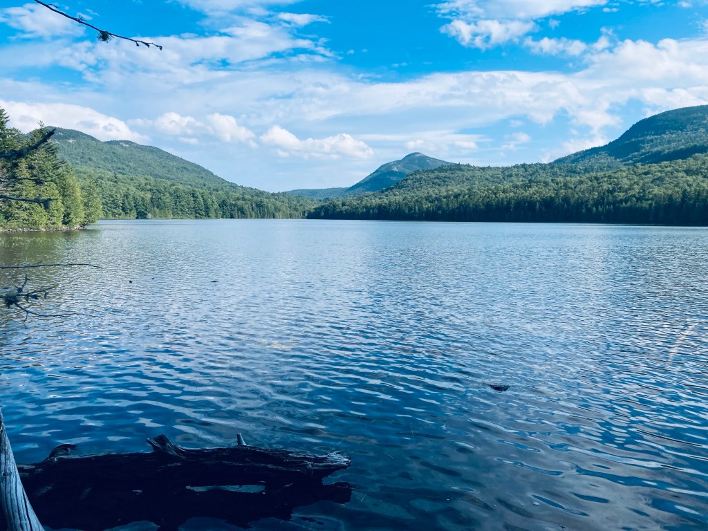
An Amateur’s Guide to Hiking Maine’s 100 Mile Wilderness

View from Barren Ledges on Barren Mountain, 100 Mile Wilderness
View from Barren Ledges on Barren Mountain, 100 Mile Wilderness.

Overview

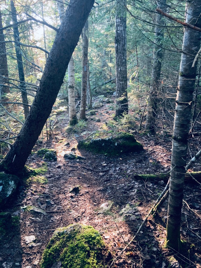
With the right preparation, the 100 Mile Wilderness (100MW) can be a challenging but enjoyable eight-day hike (and for thru-hikers and experienced “speedhikers,” who can rip off 20-mile days, substantially less).  Dad (then 41) and daughter (then 12) completed this in two segments in 2017 and 2018.  We definitely allowed ourselves extra time to enjoy places we liked, or to recover from wet gear or injuries, so plan on ten days.  Our 100 Mile Wilderness journey finally complete, we took a look back and came up with a better plan of attack.  So, here is our guide, with a suggested itinerary, and a packing list.

Direction: There are arguments for going south to north (like we did), or alternately, starting at Abol Bridge, and finishing in Monson.  The northern part is substantially flatter (read: faster) terrain, so starting with a heavy pack might be easier north-south, eating up food weight as you move south.  But starting from the south, and climbing over the Barren-Chairback and White Cap ranges might make your tired legs want to finish with the more gently rolling terrain of the north.

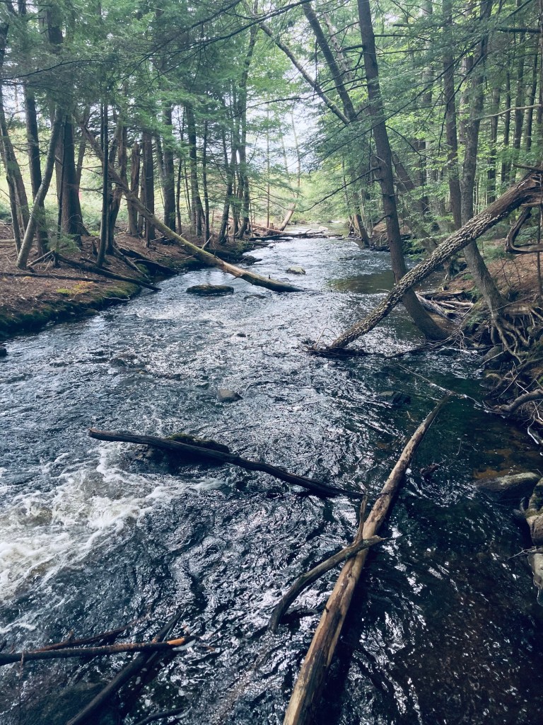
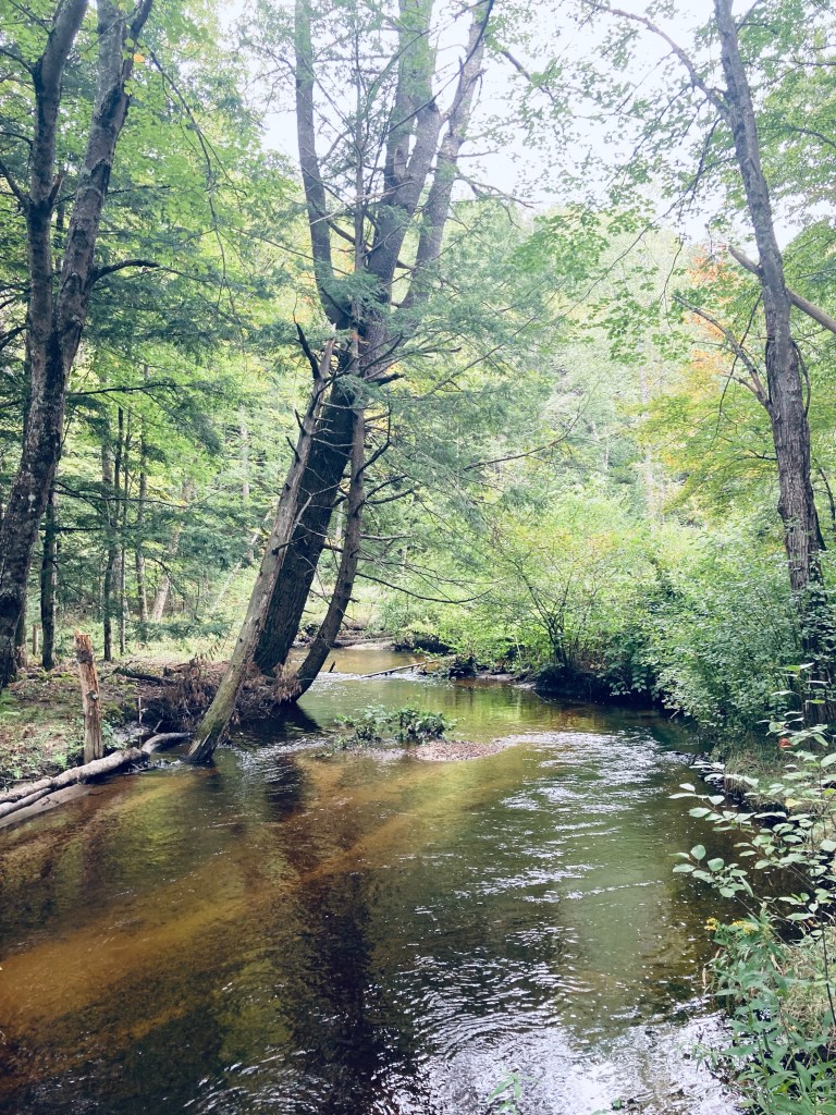
Timing: When we started the 100 MW, we did so at the end of June/beginning of July.  Once we got down from the higher elevations, the heat was oppressive, and the bugs were brutal.  We later finished the 100 MW at the end of September, and it was cold at night, but pleasant during the day, and there were no bugs.  I think a happy medium would be the beginning of September (assuming your work/school/life allows this), which would still be warm enough to enjoy dips in the lakes and streams, cool enough at night to sleep well, and at the very tail end of bug season.  One caveat to this plan – AT Lean-To’s and tent sites may be fairly full, as many thru-hikers will be making their last push to Katahdin. Check out this summary from The Trek of thru-hiker tips for the 100MW, including a 5-day itinerary. Some water sources may also be dry by this time of summer, depending on the rains. Speaking of which, watch the weather forecast – water crossings can be treacherous after heavy rains further upstream.

Resupply: We didn’t do this, but it’s worth considering.  Some purists believe that it’s cheating, but lightening your pack enough to enjoy your walk in the woods might help a great deal, and it’s your hike.  Shaw’s Hiker Hostel (Monson), the Appalachian Trail Lodge (Millinocket), and 100 Mile Wilderness Adventures and Outfitters are reputable providers who can coordinate food drops for you along the 100MW.  They can also provide advice, shuttle service, Baxter/Katahdin permits, help you stage your vehicle at either end, and provide a place to stay before and/or after.

01df1e0a7be2ac53df360898bcd475d90277489006
East Branch, Pleasant River, 100 Mile Wilderness.
Continue reading

Middle Fowler Pond

Fowler Brook Trail, Baxter State Park, Maine

Baxter State Park’s northern half is quiet, filled with remote ponds. The trail south from the park’s Tote Road to Lower and Middle Fowler Ponds was the perfect late afternoon hike on a mid-September day. I followed the description and map from Hiking Maine’s Baxter State Park, and navigated using AllTrails and the Map Adventures’ Katahdin Baxter State Park Waterproof Trail Map. I completed the approximately 5.4 miles in about two hours and 15 minutes as an out-and-back of the Fowler Brook and Middle Fowler Trails, but a shuttle loop is possible, using the Middle Fowler Pond Trail all the way to the trailhead at South Branch Pond Campground, and spotting a bike or a vehicle there.

Egg-like mushrooms on Fowler Brook Trail, Baxter State Park, Maine

From the parking area on the Tote Road, the Fowler Trail glowed in the late afternoon sunlight, with a pine path carved through bright green moss. The forest held a surplus of red squirrels, busy with late summer gathering activities and chattering at me as I continued to cross plank bridges over a swampy area. A larger bridge crossed a wide brook with long green grass swaying in its current. I could see recent trail work, as storms must have felled a large pine and some other trees further along the way.

View across Lower Fowler Pond to Billfish Mountain, Bald Mountain, and Barrell Ridge, Baxter State Park, ME

By about the half-mile mark, I was traversing an elevated portion of land, looking down at a deep gully to my right that continued for a while, while the sounds of the rushing water of Fowler Brook drifted uphill. At about 3/4 of a mile I crossed a small, rocky creek and finally saw Fowler Brook to my right. In the valley by the brook I saw and then heard a northern flicker, which are always larger up close than they seem as they fly away. I also saw a series of puffball mushrooms, stacked like eggs on a mossy log.

View across Middle Fowler Pond to Bald Mountain, Baxter State Park, Maine

Emerging from the forest, I had a beautiful view of Lower Fowler Pond from the launch spot for the Baxter State Park rental canoes, looking across to Barrell Ridge, Bald Mountain, and the Traveler range. Working my way around the shore of Lower Fowler Pond, I spooked some large waterfowl, who took off for the opposite side of the pond. The trail continued past the Middle Fowler Pond Trail intersection through a campsite with a nice view of the water and its own outhouse. I continued through, on a long quiet walk through the woods to Middle Fowler Pond. The sound of rushing water off to the right signaled the outlet of the pond as I got closer, and I finally saw the outflow, with the water moving over and under large slabs of rock, as it trickled down to the pond I had just departed.

Outlet of Middle Fowler Pond, Baxter State Park, Maine

Middle Fowler Pond itself was magnificent, clear and cradled by lonely peaks and surrounded by trees and flowers. The names lower and middle suggest a third Fowler Pond, and it exists just to the east, named Little Fowler Pond, with no trail leading to it. Should you want to continue onward, the trail continues across the outlet and on the south side of Middle Fowler Pond, moving south of Barrell Ridge and between Little and Big Peaked Mountains, before reaching the road to South Branch Pond. Instead, I paused to take in the pond and its surroundings, have a snack and a drink, then I turned to head back the way I came in the fading light.

Afternoon light on Fowler Brook Trail, Baxter State Park, Maine

(Disclaimer: This post contains affiliate links, and as an Amazon Associate Hiking in Maine blog earns from qualifying purchases.)

Mill Brook Preserve (Westbrook, ME)

Mill Brook Preserve, Westbrook, Maine

Westbrook, with its proximity to Portland and its gritty mill background, does not instantly come to mind when thinking about hiking in Maine. But Mill Brook Preserve is a 130-acre section of delightfully unlikely green space in Westbrook along Mill Brook, bounded by Route 302 and Methodist Road. The six miles of trails in the preserve, suitable for hiking, mountain biking, and snowshoeing, can be accessed from four different trailheads. Leashed dogs are welcome, as long as owners pick up after them. The best information and trail map can be found at the website of the Presumpscot Regional Land Trust, which holds this land and coordinates the 28-mile Sebago to the Sea Trail.

Mill Brook Preserve, Westbrook, Maine

I recently re-visited this Preserve in late September, taking a leisurely north to south lollipop loop from the north trailhead at 302 and Methodist Road down to the Southern Loop, with Pig the dog, making for a 6.45 mile hike taking a little under three hours. I’m sure that you could extend this mileage by adding on a side trail or two, but this route stuck to the main attraction, which is Mill Brook. It’s truly impressive that you can find a path through the woods this long in the greater Portland area.

Mill Brook Preserve, Westbrook, ME

In late May and early June, alewives migrate from Casco Bay upstream in the Presumpscot River, then to Highland Lake through this narrow brook, drawing visitors to the flashing, silvery spectacle. Due to the variation in the flow, breadth, and depth of the Brook, two viewing areas (one north, one south) are identified on the trail map for maximum observation of the alewives’ run.

Mill Brook Preserve, Westbrook, Maine

The Northern Fish Viewing Pool is closest to the MAGAN/Willow Dr trailhead, and the Southern Fish Viewing Pool is by the Methodist trailhead. A new bridge connects the southern end of the east side trail to the Perry Court trailhead, avoiding a previously muddy crossing, and this Southern Loop also includes posted Scavenger Hunt signs for kids – you can find the educational flyer and scavenger hunt at the Explore Mill Brook page.

Flora and fauna, Mill Brook Preserve, Westbrook, ME

Alewives are not the only wildlife to be found in the forest valley of Mill Brook Preserve. The Preserve abounds with life, from beautiful and unique insects to small mammals and birds, to wildflowers and vines hanging with Concord grapes. These birds and wildflowers are particularly abundant in the open spaces created by power lines and ATV trails that briefly interrupt the forest. One one trip in the early fall, I saw a handful of garter snakes sunning themselves on the sandy trail near the Perry Court trailhead. On my recent mid-September trip, I saw and heard cardinals, northern flicker, a phoebe, dark-eyed junco, blue jay, sparrows, and chickadees.

Mill Brook Preserve, Westbrook, ME

The mosquitoes and biting flies can be intense in the early summer, especially in the evenings. The trails are quiet and mostly bug-free in the fall, and the spacing of the trees in the young forest creates a patchwork of light and foliage. The Presumpscot Regional Land Trust also opened (in October 2019) a new 1.5 mile loop trail through 32 acres of forest in Mill Brook Preserve South, accessible from a parking area at Millbrook Estates off East Bridge Street in Westbrook. This southernmost trail of the Preserve does not currently connect with the northern side.

Afternoon light, Mill Brook Preserve, Westbrook, ME

The trails are not difficult, overall, but the narrow, winding path up and down ridges in the middle section between the MAGAN and Methodist trailheads might challenge some hikers. Thankfully, the trails provide enough variety that this should not preclude hikers of any ability from enjoying this suburban forest oasis. One suggestion is to pick a theme – for example, the sheer number of fern types is incredible, and counting the different kinds could sustain an entire hike. Navigation along the trails is also forgiving and self-correcting, with maps posted at critical intersections throughout the Preserve. Mill Brook Preserve in Westbrook, ME, is an unexpected swath of forest, water, and wildlife in the Portland metro area, with six miles of trails and activities for everyone.

Pig explores a bend in the river, Mill Brook Preserve, Westbrook, Maine

Fore River Sanctuary (Portland, ME)

Jewell Falls, Fore River Sanctuary, Portland, ME

We’ve explored Portland’s Fore River Sanctuary many times in different seasons and conditions. This preserve, open from dawn to dusk and maintained by Portland Trails, is 85 acres of nature inside Maine’s largest city. Fore River Sanctuary contains a waterfall, as well as a lowland marsh area popular with bird watchers, and is a favorite with dog walkers. It is in fact, featured in the book Dog-Friendly Hikes in Maine, and dogs under control (voice or leash – we saw both) are welcome in the Sanctuary, as long as owners pick up after them. Regarding birds, we encountered a hardy birdwatcher braving morning bugs on a June day on the Forest City Trail (FCT) Canal Path, listening to red-winged blackbirds, song sparrows, and mockingbirds, and we saw many mallard ducks, crows, and a snowy egret.

Snowy egret and mallard ducks, Fore River Sanctuary, Portland, ME

The FCT Canal Path, covered in wildflowers and serenaded by birds, leads past a salt marsh to the alternate parking area on Frost Street at Maine Orthopaedic Center’s lot (parking available only in five marked spaces closest to Frost), and destinations beyond. Parking is also available at the end of Rowe Avenue, on Hillcrest Avenue (as of June 2023, this trailhead is closed due to city sewer work), across the street from the Westbrook Street trailhead, and in designated spaces on Starbird Lane. We’ve enjoyed an out-and-back lollipop loop to Jewell Falls from the Frost Street trailhead, mainly using the FCT, of about 3.2 miles.

Dog/crow encounter, Fore River Sanctuary, Portland, ME
Continue reading

Messalonskee Stream Trail (Oakland, ME)

Sun through the treetops, Messalonskee Stream Trail, Oakland, ME

The Messalonskee Stream Trail is listed alternately as a 3.2, 4 mile, or 6 mile total out-and-back trail along its namesake in Oakland, Maine, open from sunup to sundown. Description and maps are available at the site of Kennebec Messalonskee Trails. I completed this trail in mid-November, and again in early May. On both occasions, they were lightly trafficked, with an emphasis on dog walkers. In November, a notice was posted for hikers to wear orange, due to archery season. In May, there was more mud, more birds, and the streams were running much faster.

Wooden bridge and fall leaves, Messalonskee Stream Trail, Oakland, ME

Parking is available in a small fenced-in lot off Kennedy Memorial Drive, just before the bridge next to the Oakland Town Office. An alternate start point is at the north end, off Rice Rips Road. This is a very quiet, accessible trail for being relatively close to I-95. The trail, constructed by the Maine Conservation Corps, emerges from a gap in the fenced area, and climbs to a ridge overlooking the river. On the opposite side of the stream are the castle-like ruins of the Cascade Woolen Mill, with graffiti and tumbling walls, reminiscent of a Stephen King story.

Messalonskee Stream Trail, Oakland, ME
Continue reading

Royal River Park (Yarmouth, ME)

Royal River Park, Yarmouth, ME

Yarmouth’s Royal River Park, located just outside the small town center, has a short out-and-back trail running alongside the falls of the Royal River. A detailed description is contained in Hiking Waterfalls Maine, including the downstream First Falls, which are separated by Bridge Street from the prior three along the trail. The water “trail” can be explored via canoe, and maps are available from the Royal River Conservation Trust. We walked the easy land route, about 1.4 miles total, in mid-March, taking us less than half an hour. The park itself, used for community concerts, is wide near the parking area, and includes picnic tables, to make a longer trip. A parking area is located across the street from the Yarmouth History Center.

Royal River Park, Yarmouth, ME
Continue reading

Barrell Ridge

View of North Traveler from Barrell Ridge Trail, Baxter State Park, ME

On the last day of a mid-September weekend hiking trip to Baxter State Park, I snuck in a morning hike before I packed up my South Branch Pond campsite, heading to Barrell Ridge (2085 ft) via Middle Fowler Pond Trail. I got the route for this moderate six mile out-and-back hike from Hiking Maine’s Baxter State Park and the suggestion of the South Branch Pond ranger. You can navigate using the South Branch Pond printable map from Baxter State Park. The trailhead is shared with the Ledges Trail and South Branch Nature Trail, a short walk north from South Branch Pond Campground, and branches off toward Middle Fowler Pond after about a third of a mile.

View northwest from ledges on Middle Fowler Pond Trail, Baxter State Park, ME
Continue reading

Machias River Preserve

Railroad Trestle Bridge, Machias River Preserve, ME

Machias River Preserve, located on the banks of its namesake, is a 917-acre area protected by the Downeast Coastal Conservancy (DCC), part of the Two Rivers Conservation Area (see description and map here). On a late September day, I used the parking area on 1A in Whitneyville to walk a lollipop-type loop using the Money Island, Homestead, and Hemlock Trails of about 3.3 miles, taking about an hour and twenty minutes. The Machias River Preserve can also be accessed from a small parking lot off 1A in the town of Machias. According to DCC’s site, “Machias” comes from a Passamaquoddy word meaning “bad little falls,” and I had taken this loop on before as part of the Bad Little Trail run sponsored by DCC and Bold Coast Runners.

Abandoned car on Money Island Trail, Machias River Preserve, Whitneyville, ME

Shortly after the entrance from the small parking area to the blue-blazed Money Island Trail, I saw the telltale signs of bushwhacking and circles in the grass indicating deer had slept here last night. I was almost immediately hit with the pleasant scent of wet pine and sweet fern. The trail narrowed, leading into a root-covered path along a healthy rust colored stream. At about a third of a mile in, just after the hulk of an old, abandoned car, a small side trail leads to the left to a series of pleasant moss-covered cascades where black-capped chickadees serenaded from the surrounding trees. Shortly after returning to the main trail, a small wooden bridge leads back over the stream, and a small spur trail can be taken to the right, for views of the Machias, flowing around Money Island in the middle of the river. The familiar clicking call of a belted kingfisher filled the cool river air.

Waterfall on Money Island Trail, Machias River Preserve, ME
Continue reading

Mount Coe, South Brother, and North Brother

Sun rising on the way up Mount Coe, Baxter State Park, ME

Having explored other difficult but rewarding long hikes in Baxter State Park, I decided to finally try a challenging early fall hike of Mount Coe (3,760 ft), South Brother (3,963 ft), and North Brother (4,052 ft), a 10.1 mi loop (extendable to about 12.5 mi if you include Fort Mountain in the spur hike from North Brother). This exhilarating trek begins with its most difficult ascent first, and hits peaks (including a 4,000 footer) that allow for views on a clear day in all directions of Baxter State Park and its surroundings. I started this hike based upon a route recommended by the book Hiking Maine’s Baxter State Park, a relatively new volume which I have dog-eared, bookmarked, and annotated in pen/pencil. As recommended in that book, every other guidebook, and the Baxter State Park ranger I consulted, I took the loop counterclockwise, in order to tackle the Mount Coe slides uphill, rather than trying to descend (more on that later). To navigate, you can use the free downloadable Kidney-Daicey map from Baxter State Park, or the more durable (my choice) Map Adventures’ Katahdin Baxter State Park Waterproof Trail Map.

Clear brook along Mount Coe Trail, Baxter State Park, ME

The parking area for Mount Coe and the Brothers is on the Park Tote Road just south of Slide Dam picnic area, on the east side of the road. I took a long, quiet morning drive south from South Branch Campground, with the windows down to breathe in the foggy morning dew and listen for about an hour. No moose crossed in front of me, but I saw several ruffed grouse scurrying into the undergrowth lining the Tote Road. At the parking lot, across from Nesowadnehunk Stream, a large hiking group was meeting and beginning to pack up breakfast and coffee in preparation for a hike in smaller pairs and trios. The hike started easily enough on a relatively flat grade, with the trail going across a couple low streambeds. The temperature began to increase as I climbed up and out of the valley, ascending a narrow staircase with the pretty runoff of the stream to my left. At about 1.2 miles, I reached the intersection of the Marston and Mount Coe trails and turned right towards Mount Coe. Almost immediately, I started seeing moose droppings. The trail was flat and mossy, almost downhill at the beginning, with quiet, green Eden-like surroundings of mossy hummocks and clear, cascading brooks.

View of Doubletop and beyond from Mount Coe slides, Baxter State Park, ME

I had arrived at the trailhead about an hour after sunrise, but the sun had still not summited the peaks to the east, so when it did, at around 8 AM, it peered over like a death ray. So, when the trail crisscrossed the cool stream and moved uphill, I missed the air conditioning that the cold running water had provided. Here, I passed a friendly group of three on my way to the final ascent of Mount Coe, then another, even more amiable group of three making their way up the slick, steep slides. It’s difficult to find grumpy people at Baxter State Park. Back to the slides – they were as advertised, difficult, slick with morning dew and runoff, and sharp (I left some blood there on a handhold). I had planned to only use my hiking poles, collapsed and stowed on my pack, on the descent, but thought twice about that plan while navigating the steep, slippery surface. I can’t imagine the difficulty of climbing down this stretch on coltish, tired legs on a clockwise hike. Thankfully, the slide gave way to a thin path through thin spruce with roots and trees for handholds, leading to the Mount Coe summit, with unbelievable views in all directions.

Trail up to South Brother summit, Baxter State Park, ME
Continue reading

Book Review: Hiking Waterfalls Maine by Greg Westrich

I’m hard-pressed to think of anything that is as simultaneously calming and awe-inspiring as a waterfall. Maine’s rugged terrain, many wilderness areas, and large rivers make it a prime spot for waterfalls. There are many websites and apps that aggregate and “rate” waterfall hikes in Maine, New England, and beyond. We even added a Category to this blog for waterfall hikes, even though I still believe that the best waterfall views should come as a surprise. But our favorite travels, particular in the north Maine woods, Downeast, and western Maine, exist outside data service, and I have always enjoyed “analog” guidebooks, particularly those with maps and photos. Enter Falcon Guides’ Hiking Waterfalls Maine: A Guide to the State’s Best Waterfall Hikes, by Greg Westrich (Rowman & Littlefield, 2020).

We have used this guide for the last six months to enjoy waterfall hikes, from roadside stops to short hikes, to waterfalls embedded in longer multi-day hikes. The book lists sixty-seven distinct hikes with over one hundred waterfalls, with a map at the beginning to show the geographic distribution in Maine, as well as a trail finder listing waterfall themes (solitude, swimming, hikes for kids, etc.). Recently, on a trip to Baxter State Park’s northern half, I used the guide to hit four waterfalls (Howe Brook, Sawtelle Falls, Grand Pitch Seboeis River, and Shin Falls) inside and outside the park. Each hike has its own map, as well as any relevant details about the hike and important info like access to dogs and/or hunting.

Throughout the hike descriptions, Westrich describes the geology of the waterfalls, as well as river terminology – horsetails, pitches, plunges, and cascades are all covered, along with historical notes, primarily around Maine’s logging past. These details and the guide format allow visitors to appreciate, rather than compare, waterfall hikes, making this guidebook a must-have for navigating Maine’s waterfalls.

(Disclaimer: This post contains affiliate links, and as an Amazon Associate Hiking in Maine blog earns from qualifying purchases.)