Mount Agamenticus – First, Second, and Third Hill Loop (York, ME)

Mount Agamenticus summit
View of the Atlantic from the summit of First Hill, Mount Agamenticus

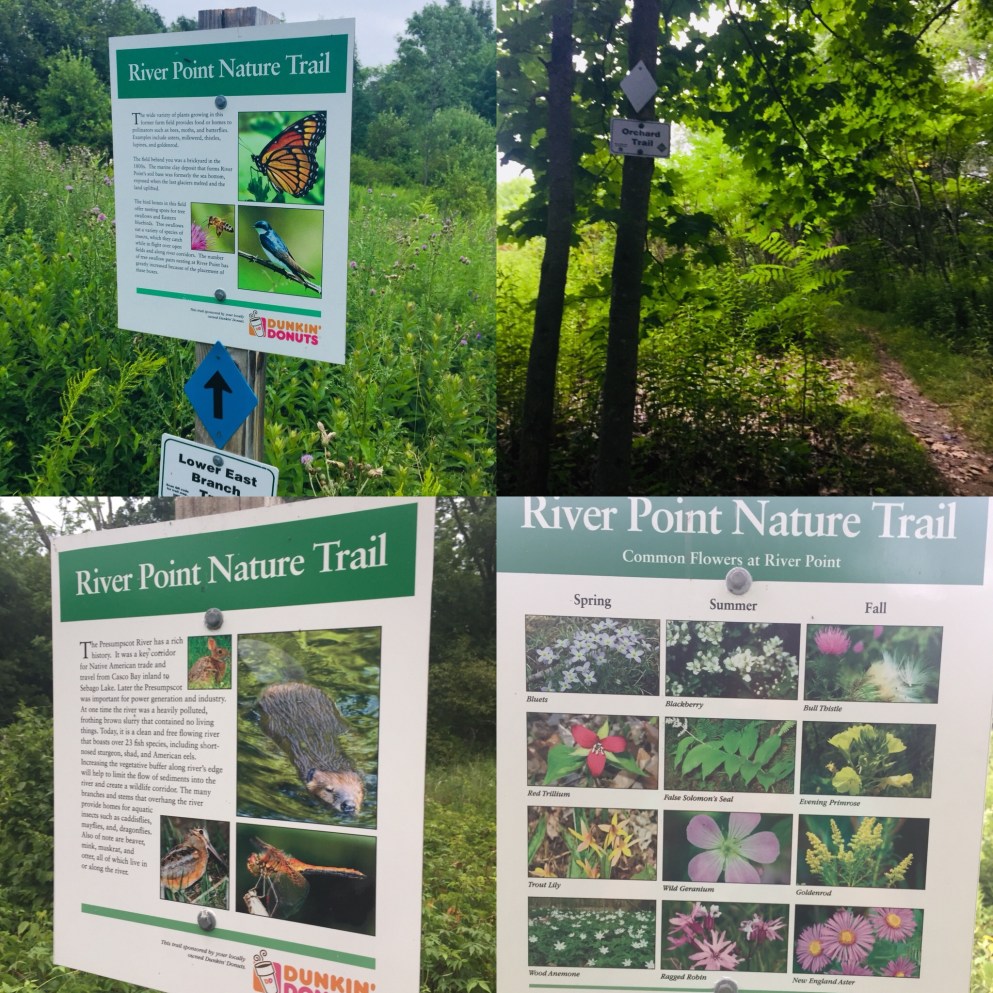
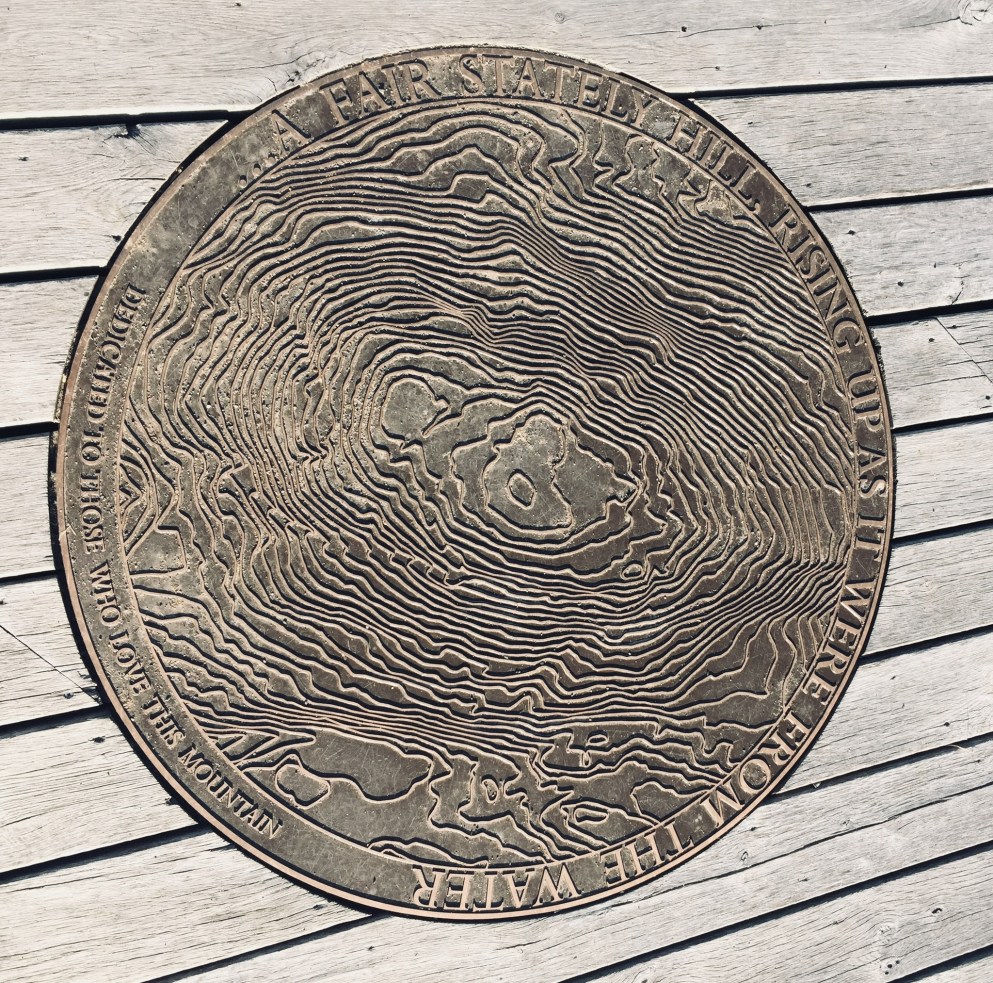
Mount Agamenticus, overlooking the southern Maine coast, apparently derives its name from an Algonquin coastal place name also used in Gloucester and Charlestown, Massachusetts.  It’s not a giant, only 691 feet tall, but is part of the Mount Agamenticus Conservation Region, which covers over 10,000 acres, including over 40 miles of trails, with a trail map here.  Its location in York makes it readily accessible from the Maine Turnpike and Route One.  I had never climbed Mount Agamenticus, and figured that a looping walk over rolling hills would be a perfect spring tune-up hike.

View towards Mount Washington from First Hill, Mount Agamenticus

These trails allow for a variety of hikes by length and ability.  On this spring day, I traversed the First, Second, and Third Hills, using the Ring, Fisher, Big A, Sweet Fern, Chestnut Oak, Ridge, Wheel, Third Hill, and Great Marsh Trails, along with Old Mountain Road, Porcupine, Rocky Road, and, again, Ring Trails to complete a loop of around 7 miles.  Much shorter loops are available (the complete Ring Trail loop is only 1.9 miles), and the Ring (west) and Witch Hazel Trails contain a “Story Walk” that might keep younger hikers moving from storyboard to storyboard, up the hill.

Observation Deck, First Hill, Mount Agamenticus

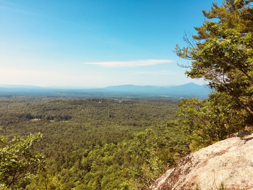
It’s not a long hike from the Mountain Road trailhead to the top of First Hill via the Ring (west) and Fisher Trails – I covered it in fifteen to twenty minutes at a moderate pace.  For those with mobility issues, there are also parking lots closer to the top.  The open summit has observation decks to orient you to the sights in all directions, from the Atlantic to Mount Washington, and a Learning Lodge is open weekends from 11 am to 3 pm from Memorial Day to Columbus Day.

Picnic Tables, First Hill, Mount Agamenticus

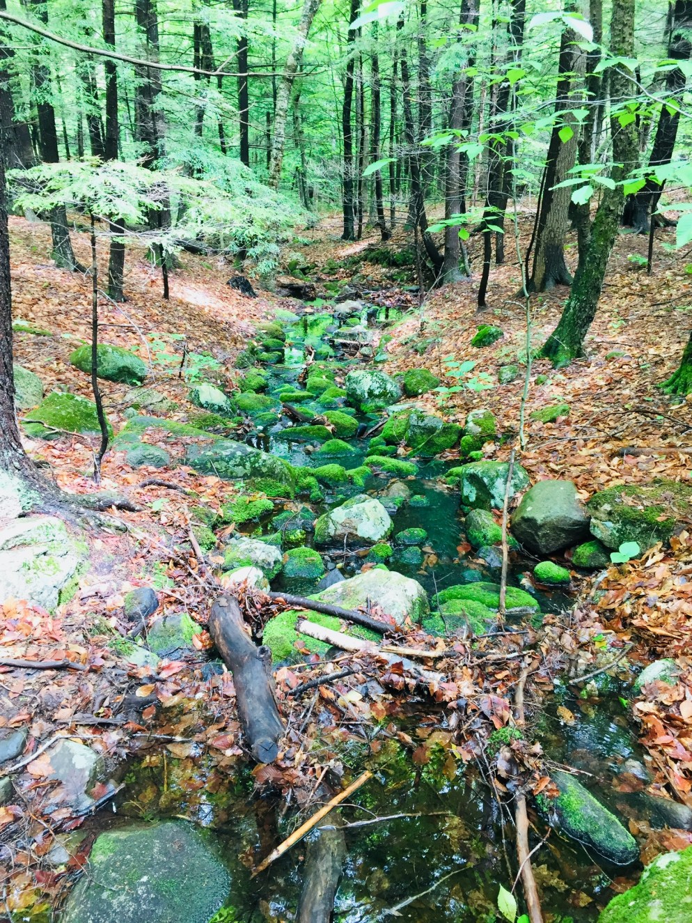
There are picnic tables with views of the ocean, and restroom facilities.  Songbirds abound, and I spotted an American Goldfinch near the old ski lift structures.  Descending toward Second Hill, the trail still held some ice in shaded places, the only sign of winter’s clutches.  The low points around Second and Third Hills were dotted with vernal pools, which were already riotous with the sounds of peepers.

Tree on Second Hill, Mount Agamenticus

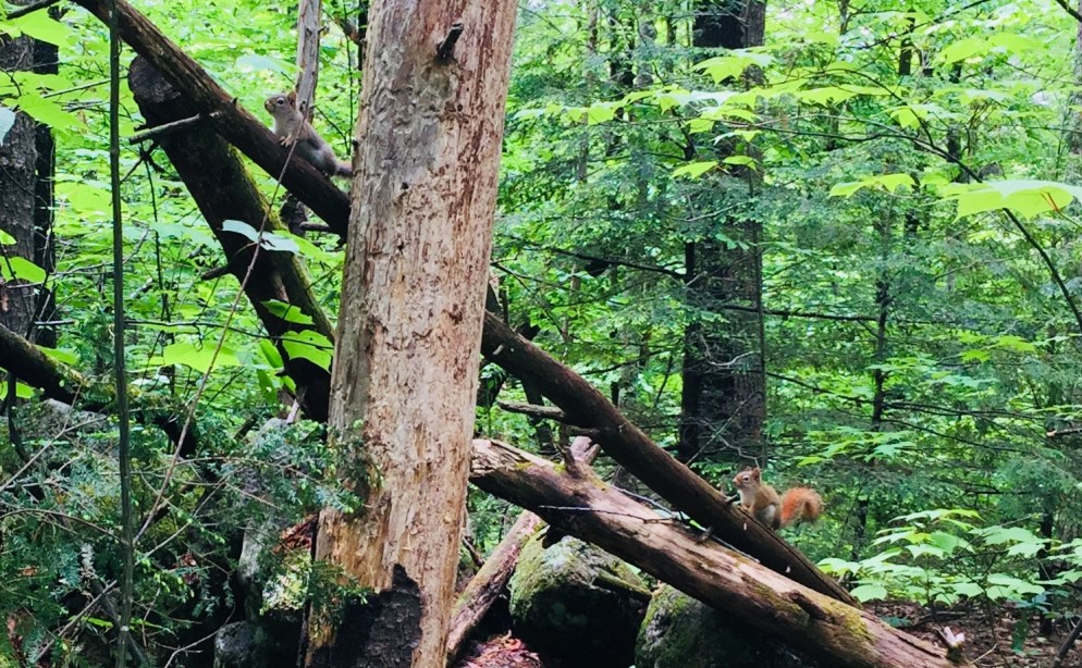
While First Hill is well-trafficked, with trail runners and dog walkers, the only other human being I saw on Second and Third Hills was a mountain biker.  The trails here are not as well-marked as those on First Hill, and I had to double back several times to find the trail, particularly on the Ridge Trail, and Third Hill Trail.  In addition, the summits are wooded, with less spectacular views than that of First Hill.  But the hiking is not strenuous, and the scenery contains peaceful brooks and ample wildlife viewing opportunities.  I saw turkeys, deer, and innumerable songbirds, as well as sizable ant mounds on the way down Third Hill.

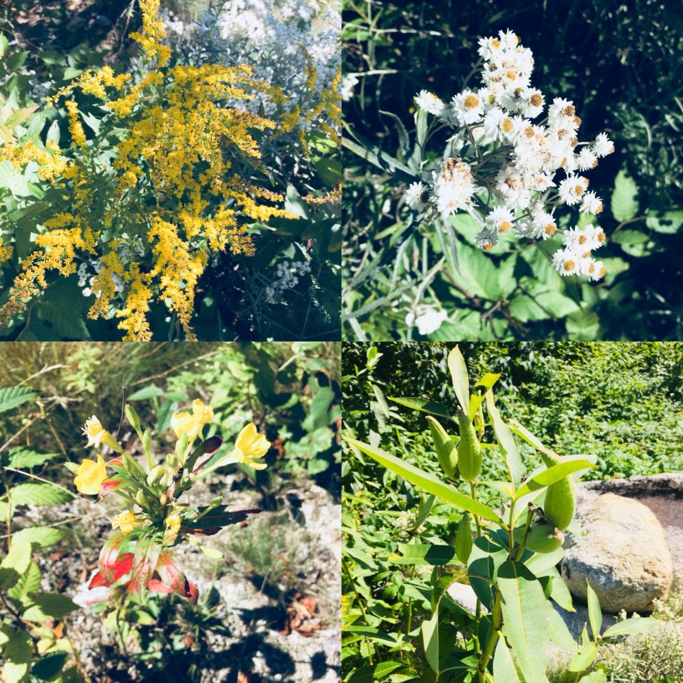
Mount Agamenticus is an easily accessible, family-friendly trail network which allows the user to build his/her own itinerary based on activity, ability, and time, and provides boundless opportunities for observing fauna and flora.

Seal on observation deck, First Hill, Mount Agamenticus

Mowry Beach (Lubec, ME)

Mowry Beach Trail from the Pleasant Street trailhead
Mowry Beach Trail from the Pleasant Street trailhead.

A short distance from downtown Lubec, the easternmost town in the U.S., Mowry Beach is a quiet 48-acre conservation area overlooking Deep Cove, Lubec Channel and Canada’s Campobello Island.  This area, managed by the Downeast Coastal Conservancy (DCC), offers a .4 mile trail from Lubec’s Consolidated School on South Street to a parking area at the end of Pleasant Street, including a 1,700 foot boardwalk.  The DCC publishes a map and brochure, available on their website.

View of downtown Lubec and the international bridge to Campobello from Mowry Beach
View of Lubec village and the international bridge to Campobello from Mowry Beach.

We learned of this beach through a great Cobscook Trails Map and Guide published by Cobscook Trails, with hikes throughout the Cobscook Bay region, a free and widely available (at local businesses) pamphlet which I would recommend for anyone exploring the area.  At the Pleasant Street end of the trail, which we accessed via a short walk from downtown, is 1,800 feet of shorefront along a sand beach.  According to guides, ancient tree stumps can be seen along the lower portions of the beach at low tide, a forest that was present during an era with lower water levels.

On the October day we visited, seals were active, using the rapidly outgoing tide to move swiftly east at waterskiing speeds in the Lubec Channel in search of food.  For sea-glass collectors, this working waterfront has a variety of shiny objects along the shore.  During our walk, we also encountered two people helpfully picking up any garbage left on the beach.

Boardwalk on Mowry Beach Trail
Boardwalk on Mowry Beach Trail.

We turned into the trail, passing bright beach rose bushes. The trail and boardwalk are alive with birds, and we startled a large bird of prey that had been resting in a tree next to the boardwalk, which took off almost straight up, like a rocket (which, in turn, startled us).  DCC’s guide lists rough-legged hawks, northern harriers, and northern shrikes as frequent visitors to the conservation area.

Mowry Beach conservation area from the playground of Lubec Consolidated School
Mowry Beach conservation area from the playground of Lubec Consolidated School.

We continued through the coastal bog and an area lined with cattails and small trees, emerging behind the Lubec Consolidated School.  For those with mobility issues, intimidated by longer hikes, or entertaining smaller children, this relatively short walk on wide paths and boardwalk is a great side excursion from the village of Lubec.

Quoddy Head State Park (Lubec, ME)

Rocky beach off the Coastal Trail, Quoddy Head State Park.

The word “Easternmost” is prominently advertised in many places across Lubec, including Quoddy Head State Park, which comprises 541 acres at the tip of the U.S.’s eastern reach.  By the time you reach Quoddy Head State Park, off South Lubec Road, you will likely have seen many advertisements for all things “easternmost” (campgrounds, gift shops, etc).  But beyond the quick tour stop and lighthouse “selfies,” this park offers an array of trails for all abilities with impressive ocean views and a variety of coastal vegetation.  The best guide to the park’s trails is the map provided by the state of Maine: Quoddy Head State Park Guide & Map.

We started with the Coast Guard Trail, a 1-mile trail north of the entrance, which includes an overlook of the Lubec Channel, as well as a view of the town of Lubec back to the west, after a short climb up a wooden staircase.  According to the Quoddy Head Guide, the first .5 miles of the western part of this trail is accessible by motorized wheelchair. After the lookout, the Coast Guard Trail then descends through the thick coastal woods to the lighthouse, passing several viewpoints along the volcanic rocks.  The path was full of birds and squirrels gathering food on this warm, sunny October day.

West Quoddy Head Lighthouse, Lubec, ME

The small lighthouse museum (free, but donations always help) includes displays featuring the history of the lighthouse, flora and fauna of the area, and a guide to whales, commonly sighted off the coast.  The area around the lighthouse contains a large number of picnic tables with excellent views, and the only restrooms in the park (easternmost privies in the U.S.?  Probably).  From the lighthouse area and most of the coastal trails, the cliffs of the Canadian island of Grand Manan are visible across the Quoddy Channel.

The terrain was impressive, and those with small children need to keep them close, as there are plenty of dizzying cliffs on the U.S. side, as well.  The beaches are rocky, but make a far more interesting sound than sand beaches, combining the tidal roar with a rattling, suction sound as the rocks move together when the waves recede.

Coastal Trail at Quoddy Head State Park, Lubec, ME
Coastal Trail at Quoddy Head State Park, Lubec, ME.

The Coastal Trail travels west along the shore past incredible views and scenic points like Gulliver’s Hole, High Ledge, and Green Point, with frequent stops in between to take in the powerful ocean.  We did not linger at Green Point, a ledge with paths down to a beach, as we may have interrupted two hikers in some sort of extracurricular activity there (The trails became more and more empty the farther we got from the lighthouse).

01d86651433eae65716d0e041ead3749e4e0c98292

At Carrying Place Cove, Thompson Trail heads back east, inland towards the parking area, with the short .2 mile spur of Bog Trail along the way.  This side of the trail, in particular the sand beach at Carrying Place Cove, is also accessible from South Lubec Road.  The Bog Trail includes a boardwalk and interpretive signs explaining the coastal plateau bog, also called a heath, according to the Quoddy Head Guide.

Thompson Trail is, for the most part, an easier walk than the coastal trail, with a few brief climbs.  The best feature of this trail was the scent of pine, which created a perfumed evergreen tunnel in the narrower sections, redolent with notes of citrus and vanilla.

016a4d2b896b7e773458c7efef1f50a941c64f476b.jpg

We completed most of the trails in the park, and stopped plenty of times to relax and take photos, making this about a three-hour visit.  The difficulty level is described in the park guide as moderate, which seems about right. There are no strenuous climbs, but consistent steps over rocks and roots could make this more difficult for some hikers. There weren’t any bugs during this Columbus Day weekend, but the boggy areas guarantee mosquitoes and black flies in late spring and summer, and repellent would be a must.  I would also suggest waterproof shoes, or at least wearing something on your feet that you don’t mind getting wet or muddy.  Depending on your roaming plan, you may want to put your phone in airplane mode, as it will likely be using Canadian towers along this shore.

01341e22f0c5ed11f9f93a014921757af70f9993e4
Lubec fishing fleet at dusk

Lubec, across a narrow channel from Canada’s Campobello Island, is the closest town nearby, but Machias is not that far away, and many smaller towns in Downeast Maine and the Cobscook Bay region are worth a visit.  After the hike, if you can catch them open during fall hours, try the craft beer and pizza at Lubec Brewing Company or upscale pub cuisine at Cohill’s Inn on Water Street in Lubec.  If you are headed south, go to Skywalker’s Bar and Grille in Machias (try the fish tacos) for a great menu and Machias River Brewing Company beers.

Quoddy Head, though remote, is hardly a secret anymore- we joked that AirBnB renters and vacationers from New York outnumbered locals in Lubec. But steps beyond the famous lighthouse is a surprisingly wild Maine coast to explore.

Katahdin Woods and Waters National Monument (Katahdin Loop Road)

01fb28221881b3f66f6417691e990ce16d393b995f

(Note: The Katahdin Loop Road opened for the 2020 season on Saturday, May 23. U.S. National Park Service advises to drive with caution and be alert for soft spots and rough road sections. Haskell and Big Spring Brook Huts are temporarily closed, and updates will be posted to the NPS website.)

During a visit to Baxter State Park, dad and daughter found ourselves with sore legs and a half-day to explore, and we decided to check out Katahdin Woods and Waters National Monument via the Katahdin Loop Road.  We got our direction from a Katahdin Chamber of Commerce visitor’s guide and a pamphlet from Natural Resources Council of Maine (NRCM), but we had followed the progress of the Monument since its creation in August 2016.

The standard route into the South Entrance is via Route 11 from E. Millinocket/Medway to the Swift Brook Road along the Katahdin Woods and Waters Scenic Byway, but we were feeling adventurous, and took the Stacyville Road north from Millinocket to where it meets the Swift Brook Road.  We savored the lonely ride along this quiet logging road, occasionally startling game birds (this is not the way to take a low-clearance or non 4×4 vehicle).

The 17-mile loop of Katahdin Loop Road is punctuated by meadows, bogs, and ridges, and the south and west parts of the loop boast excellent views of Katahdin and the surrounding area.  This is an opportunity to see the Monument and cover distance in a vehicle, while having the chance to get out and explore at a variety of hiking paths and overlooks.  The best map of the loop we found (which I wish we had when we were there, as it is also an excellent interpretive guide) was from the Friends of Katahdin Woods and Waters, and can be found here.

01956851ac4c035ab5352c3bdbf2b168afa977f722
Lynx Pond

The Lynx Pond Walk is shortly past the Loop Road Gate, on the right just past the Mile 2 marker.  Shortly after the trailhead is a parking area on the left of the Loop Road.  This is a very short walk through the woods to a small boardwalk by the pond, and a spot for quiet reflection and wildlife viewing.

01d653ad792defeda6d7ee61dfda750f88aec17e0c
Looking south from The Overlook on Katahdin Loop Road.  The large lake is Millinocket Lake.
0128123aefc231d99d78e21014caffb04b28152f10
Views of Katahdin from The Overlook on Katahdin Loop Road

Katahdin towers over the loop, and there are multiple spots around the Loop Road with views of the lakes and mountains to the west and south, particularly The Overlook, between Miles 6 and 7, which conveniently has a picnic spot and a toilet.

We continued around the Loop Road, and got out to stretch our legs again at the International Appalachian Trail (IAT) and trail to Barnard Mountain, passing over Katahdin Brook and by the IAT lean-to.  This wide logging road made for a sunny trail, and though we did not make the turn towards the Barnard Mountain summit, we enjoyed the walk, and the familiar plants and animals that inhabit newly overgrown woodcuts, with blue jays diving across our path and into the trees.  The Barnard Mountain trail itself is a moderate 4-mile round trip with summit views of Katahdin and Katahdin Lake to the west.

0162945685aea994ce4c9bc0e69edac7f7ef89bdac
Late summer flowers and plants along the IAT

The IAT continues from the northern terminus of the Appalachian Trail at Baxter Peak across Maine, into Canada, across to Greenland, and Europe, to the Atlas Mountains of Morocco.  For a great exploration of the concept of the IAT, see On Trails by Robert Moor, reviewed on this blog.

01b5f4816d5a5e0f24f63f8ce23c3ebb07ec640256
Moose tracks and droppings on the IAT

There are seven mountains in the Monument to hike, including Barnard, as well as paddling opportunities and waterfalls.  The Loop Road was quiet, as were the trails, with natural sounds, and only a few others exploring the area.  A bumpy drive back down Stacyville Road took us to Millinocket, where we devoured a Hawaiian pizza without remorse at the Millinocket House of Pizza.

Katahdin Woods and Waters National Monument is a special place, and we will be back there for hiking, biking, and paddling.  The views during peak foliage season must be spectacular.  Ensure you plan ahead, bring maps, and a cooler with water and snacks, as there are no facilities at the Monument, and cell coverage ranges from little to non-existent.  But that’s probably what you’re looking for in the first place.

Peaked Mountain (Clifton, ME)

Peaked Mountain
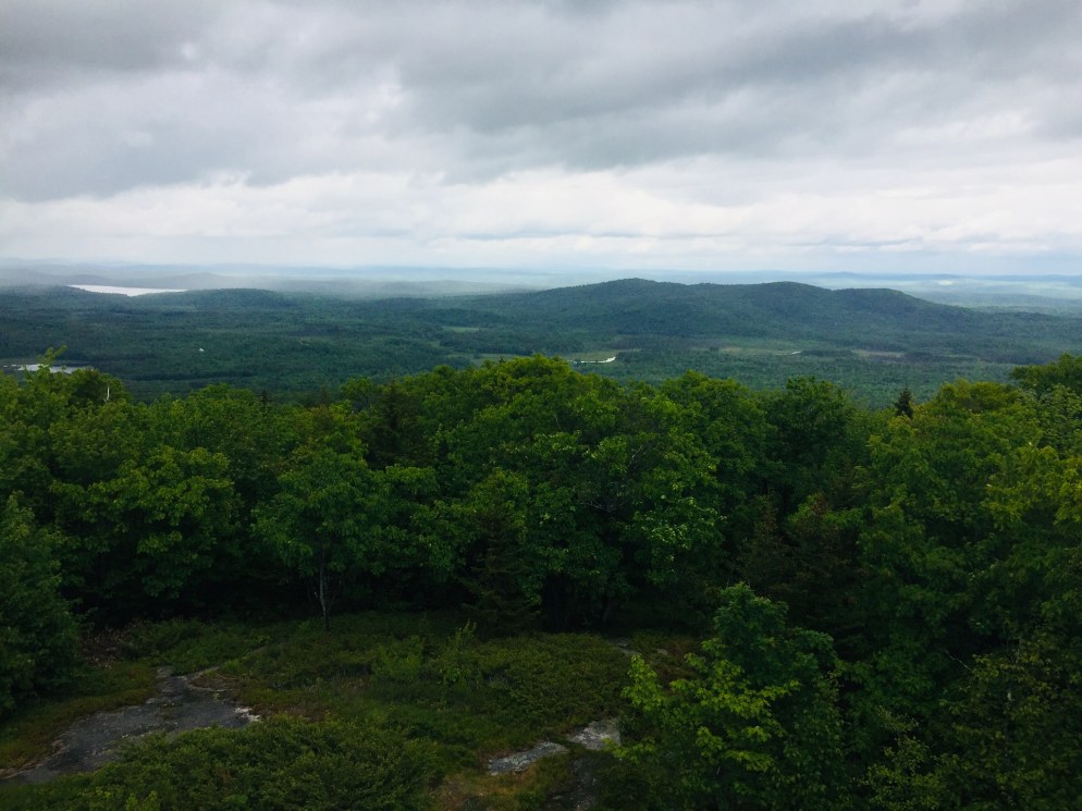
In August 2018, we hiked Peaked Mountain (1,160 ft), also known as Chick Hill, in the Clifton-Amherst area off Route 9.  For years, we had observed the massive cliffs of Peaked and Little Peaked Mountains looming over the Airline, and hiking to the top was a great experience.  We took our instructions from the AMC Maine Mountain Guide, as well as a November 2017 Portland Press Herald article by Carey Kish on Airline Road hikes.  We did this 2.2 mile up-and-back hike during a sweltering heat wave, with temperatures in the nineties, and it took us about an hour, total.

The trail route provided by the AMC guide needs no addition – we easily followed the logging road (fire road 32) from the trailhead, past the turn-off for Little Peaked Mountain, and turned into the woods at utility pole 18.  A steep trail through the woods (which felt like a jungle on this hot, humid day) leads up to the open areas below the summit.

Mom/wife and daughter reached the cliff edge below the summit, and enjoyed the cooler breezes, while Dad continued to the top and looked at the expansive views.  The longer alternative, taken by another group of hikers while we were there, is to take the road all the way to the summit cell tower.

The trip down the mountain was much faster than the way up, descending the gravel road with occasional stops for raspberries and blackberries.  Little Peaked Mountain would have to wait for next time.  Most importantly, a stop on Route 9 in Aurora at Mace’s American Snackbar for cold Gifford’s ice cream capped a great hike.

(Disclaimer: This post contains affiliate links, and as an Amazon Associate Hiking in Maine blog earns from qualifying purchases.)

River Point Conservation Area (Falmouth, ME)

Off the West Falmouth exit of I-95 (exit 53), tucked behind the Hannaford plaza, is a hidden gem.  You can find a detailed description of the land and its history at the Town of Falmouth site regarding the River Point Conservation Area.  This 1.4 mile network of trails also links to the Cross Falmouth trails and Portland Trails, as well as being accessible by canoe from the Presumpscot River.

010ecb899815d7766ef6c8e16ca6f49fe229243068

On the cloudy late July afternoon we visited the trails, mosquitoes were thick, and ticks were abundant in the tall grassy areas, so plan appropriately with insect repellent/gear.  This did not hamper our enjoyment of the flowers and birds throughout the conservation area.  Also, stay on the trails to avoid poison ivy.

016c4812effe902cc47a2142d4dfa5c8ac7cd3c858
Interpretive signs along the trails.

The interpretive signs along the trail would be good for scavenger hunt-type activities with kids, and provide insight to the area, its history, and the flora and fauna that inhabit it.  The signs also disclose that the trail is sponsored by Dunkin Donuts, which has a location at the adjacent shopping center.

01bfeb475f24533e9d1436248ebf98de1fcdf349ac
A massive beetle encountered on the trail.

According to the Town of Falmouth website, River Point was used for thousands of years as a campsite by Native Americans as they traveled seasonally from Sebago Lake to the ocean. The first white settlers homesteaded the original 151-acre property in 1775, and farmed there until 1883, establishing a brickyard and shingle mill on the property. In 1859, the Kennebec & Portland Railroad line bisected the property.  The bridge, the only bridge in Maine built to connect to just one house, provided access to Route 100. The town acquired River Point in 1995 when the shopping center was developed. The Town Council designated the 41-acre property as a conservation area in 2009.

This small conservation area, with a short, flat loop trail, is perfect for a lunchtime or after-work walk in the greater Portland area, and the open fields, with birdhouses, are excellent places to observe songbirds (and in the evening, bats).  The town of Falmouth lists allowable uses as: Hiking, mountain biking, snowshoeing, cross-country skiing, fishing, and nature study.  For those with pets, just check the signs beforehand, as pets are not allowed when birds are nesting.

Sabattus Mountain (Lovell, ME)

Sabattus Mountain (1,253 ft) in Lovell, Maine is an easy, family-friendly hike with sweeping views of the Lakes Region and White Mountains.  Dad and Mom completed the 1.6 mile loop in about forty-five minutes at a relaxed pace, and Daughter went on ahead and finished in about half an hour.  You can find a detailed description of this hike in the AMC Maine Mountain Guide, or the AllTrails app (download the map beforehand – not much cell service near the mountain).

01e531dbffc2d5dd5d609192bf60da5c171a545cc0
Can you tell birches apart?  The Sabattus Mountain markers also help with ferns, mosses, and other trees.

The sign at the trailhead, located off Sabattus Mountain Road, credits cooperative efforts between the Maine Bureau of Parks and Lands and the Greater Lovell Land Trust (GLLT) with making possible public access to the area.  A look at GLLT’s web site shows they have many educational activities to offer, and multiple other trails.  The Sabattus Mountain loop trail, which passes through a variety of terrain, includes helpful markers identifying the flora (nice post here on their installation).  We headed left at the loop to go up, and this seems like an easier ascent than the right/westerly path, which could be slick in rainy weather.

01a528098f40f613443bb1ac9fd4976be65c7657d9

The views from the summit were as advertised on this clear day at the end of June, and there are even a couple park benches from which to relax and enjoy the scenery.  Use caution with small children and dogs, as the cliffs drop off steeply.  An observation tower at the loop junction is no longer there – just the base exists now.

019395c993bc6c4ddc1d7be4283f6caa45f54d51d6
Park bench on the summit

After a stop at the summit, we completed the loop, returning to the trailhead.  A great stop before or after this hike is the Center Lovell Market, which has everything you would want for a picnic, as well as a restaurant.  Sabattus Mountain is not that far from beautiful Pietree Orchard in Sweden, which has a farmstand, pick-your-own fruit options, and pizza.  And, as mentioned before on this blog, Ebenezer’s Pub in Lovell is the perfect place to enjoy a Belgian beer.

(Disclaimer: This post contains affiliate links, and as an Amazon Associate Hiking in Maine blog earns from qualifying purchases.)

Douglas Mountain (Sebago, ME)

014edff1bcbccafeed461575b700a6380ffb444827
View from the stone tower at the summit

Douglas Mountain, the highest of the Saddleback hills near Sebago, is the third in a recent trio of Lakes Region hikes, preceded by Bald Pate Mountain and Holt Pond Preserve, all of which are in close proximity (I did the three hikes in a single day, so they are eminently achievable day hikes).  I hiked Douglas Mountain (1,416 ft) in Sebago in June 2018, via the Eagle Scout, Nature Loop, and Ledges Trails (2.3 miles, approximately one hour).  This is a hike we’ve done several times as a family.  These trails, part of the 169 acre Douglas Mountain Preserve, are maintained by the town of Sebago, which has a trail map and guide on its site. As usual, the AMC Maine Mountain Guide has a great description.  A fee of $3 is payable at a kiosk in the parking area.

013343dc41b0f27607365927d0a68563fa1a67dd4b
A mossy brook along the Eagle Scout Trail

The climb is a pleasant walk through the woods on a well-traveled path, with streams and beautiful trees.  On the Nature Loop, you can start to get a sense of height from the ledges, but for the most part, the foliage hides the horizon and longer views until you reach the summit.  As for Nature on the Loop, there were many mourning doves, plenty of wild blueberry plants, and innumerable chipmunks and red squirrels, who seemed suspiciously acclimated to humans.

014ed0a9e2cb4e29e6582805bc6efa5e0c9757ac4b
Two red squirrels hope for a handout along the Eagle Scout Trail

The summit’s stone tower allows for panoramic views, and a pictorial display helps to identify which peaks, lakes, and points of terrain you are able to see on a clear day.

011805f148184b09c0767ecf4a0c898c77b0a6e9fe
Entrance to the climb of the Ledges Trail, or the end of the trail, depending on your direction of travel

A steep descent down the Ledges Trail can be slippery in wet weather, so use caution in selecting your route.  The last .4 miles or so back to the parking lot is reached by walking along Douglas Mountain and Ledges Roads, past beautiful houses.  This route to the summit is substantially shorter than the Eagle Scout Trail, and would be a short, challenging scramble for younger hikers.

(Disclaimer: This post contains affiliate links, and as an Amazon Associate Hiking in Maine blog earns from qualifying purchases.)

Holt Pond Preserve (Bridgton, ME)

0139fae195aab23b10cf1a713859803ec9d827a8d6
Boardwalk leading to Holt Pond

The Lakes Region of Maine continues to be a great place to hike.  I hiked Holt Pond Preserve in Bridgton, what turned out to be a 4.5 mile loop (approximately an hour and forty-five minutes), on a June morning after heavy rains.  Holt Pond Preserve is a preserve of over 400 acres, maintained by the Lakes Environmental Association (LEA), who have a site with interpretive guides and maps.

Holt_Pond_Preserve_FinalMap-Feb_2012_for-web
LEA Map from website

No dogs, bicycles, or ATVs are allowed at Holt Pond. There is, however, a canoe launch, which looks like a great way to see Muddy River and Holt Pond.

01126a70c7d000d416b3fcb5f3c77894eb836f220b

The preserve was alive with the sounds of waterfowl, including ducks and geese, and the distinctive calls of red-winged blackbirds and frogs.  The boardwalk allows for fascinating views of plants that you would normally need hip waders or a kayak to see, particularly pitcher plants.

01a09a08e4798525450fd1683fec1370a7cdd526b9
Pitcher plants next to the boardwalk

These carnivorous plants had flowers above them when I visited, something I had not yet seen. The bog breathed fetid air through the gaps in the boardwalk, a contrast to the cool breezes above.  Animals use the boardwalk pathways, too, and I tagged along at times behind a chipmunk and a small fledgling bird, both of whom were unable to yield the path until they reached solid ground.

01b7ed9e323741bd7d294051e147b8b540d7f45739

The trail’s path changed from bog to pine forest toward Grist Mill Road, and following it became more difficult, as it was overgrown, with a fair amount of upheaval to bridges and boardwalks from spring rains.

01f4ba935a1c166f97c0b6efb2289310fb60b8ed73
The trail was a bit overgrown in places

This moisture also brought with it plenty of mosquitoes.  For those attempting the Southern Shore trail on the far side of Holt Pond, I would highly suggest pants and long sleeves, as well as insect repellent and a weather eye for poison ivy.

This stone wall on the trail bears the telltale sign of chipmunk dens – piles of pine cone scales

The trail skirts private property by moving onto Chaplins Mill Road briefly to the east of the preserve.  I clearly missed the turn back to the trail, so I took Grist Mill Road east (left) to make a loop back to the parking area.

While the full perimeter of Holt Pond might be a bit much for most kids, the boardwalk near the parking lot is a perfect excursion for young ones, particularly using the interpretive guide on LEA’s site.

And, as mentioned in the Bald Pate post, this trail network is connected to the Bald Pate Preserve via the Town Farm Brook Trail, which ascends Southwest to the Bob Chase Scenic Loop.

Bald Pate Mountain (Bridgton, ME)

The Lakes Region of Maine surrounding Sebago is a fantastic area for hiking, with many hikes in striking distance of lakefront idylls and other recreation.  Bald Pate Mountain (1,150 ft) is an easy to moderate hike in Bridgton, Maine, with many trail options, comprising 6.7 miles of trails.

On this June morning, I took the Bob Chase Scenic Loop to the summit, then the South Face Loop Trail, returning the same way to the parking lot, for an approximately 3 mile hike (about an hour and fifteen minutes at a relaxed pace).  Bald Pate trails are well-chronicled in the AMC Maine Mountain Guide, and the trail map and descriptions are available online from the Loon Echo Land Trust, which owns and manages the 486 acre Bald Pate Preserve.

Bob Chase Trailhead at the parking lot/kiosk
Bob Chase Trailhead at the parking lot/kiosk.

Approaching Bald Pate from the south on Route 107, you can see the exposed rock that is the mountain’s namesake.  The parking lot is located on the east side of 107, just south of Five Fields Farm and XC Ski Center, at the top of a large hill.  The climb up 107 allowed the car to do a lot of the work of getting to the summit before I even started hiking.

img_0622
Face of Bald Pate Mountain in winter, Bridgton, Maine

When I arrived, the lot was empty, and a small circle of depressed grass and milkweed next to my car looked like a place where a deer had slept the night before.  I started up the Bob Chase Scenic Loop, with birch trees, lady slippers, wild blueberries, and ferns on either side, and red squirrels chattering loudly.

Views west from the Bob Chase Trail
Views west from the Bob Chase Trail.

A wrong turn took me around a pleasant diversion/backtrack to the other side of the Bob Chase Scenic Loop, and I wound my way back to the summit.  This was not the fault of the trail maintainers, as the Bob Chase Loop is clearly marked in blue, and the South Face Loop is clearly marked in orange.

View from the South Face Loop toward Peabody Pond
View from the South Face Loop toward Peabody Pond.

The summit is easy to reach in 25 minutes or less, with excellent views, and it looks like a riot of wild blueberries awaits those who hike it later in the summer.  The South Face Loop was much more challenging than the Bob Chase Trail, descending steeply, skirting the face of the mountain, and then ascending quickly to rejoin the summit (I thought several times, I already climbed this, didn’t I?).

The Pate Trail is a short, steep (.1 mi with 360 ft of elevation gain) trail connecting the summit to the South Face Loop, and I will have to try this one next time, as well as the Moose Trail, which can create a different loop back to the parking lot.

Don't forget to
Don’t forget to “tip your bartender.”  Conservation takes time and money.

This trail network is connected to the Holt Pond Preserve via the Town Farm Brook Trail, which descends northeast to the Holt Pond Trail, a link which could create a much longer hike in a very different environment (bog walkway). The Bald Pate summit is a nice, short hike, suitable for most age and skill levels, with great vistas along the way.

(Disclaimer: This post contains affiliate links, and as an Amazon Associate Hiking in Maine blog earns from qualifying purchases.)