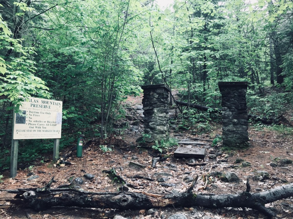
Douglas Mountain, the highest of the Saddleback hills near Sebago, is the third in a recent trio of Lakes Region hikes, preceded by Bald Pate Mountain and Holt Pond Preserve, all of which are in close proximity (I did the three hikes in a single day, so they are eminently achievable day hikes). I hiked Douglas Mountain (1,416 ft) in Sebago in June 2018, via the Eagle Scout, Nature Loop, and Ledges Trails (2.3 miles, approximately one hour). This is a hike we’ve done several times as a family. These trails, part of the 169 acre Douglas Mountain Preserve, are maintained by the town of Sebago, which has a trail map and guide on its site. As usual, the AMC Maine Mountain Guide has a great description. A fee of $3 is payable at a kiosk in the parking area.
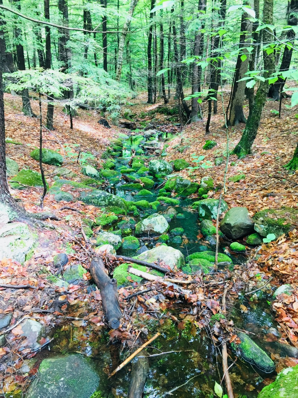
A mossy brook along the Eagle Scout Trail
The climb is a pleasant walk through the woods on a well-traveled path, with streams and beautiful trees. On the Nature Loop, you can start to get a sense of height from the ledges, but for the most part, the foliage hides the horizon and longer views until you reach the summit. As for Nature on the Loop, there were many mourning doves, plenty of wild blueberry plants, and innumerable chipmunks and red squirrels, who seemed suspiciously acclimated to humans.
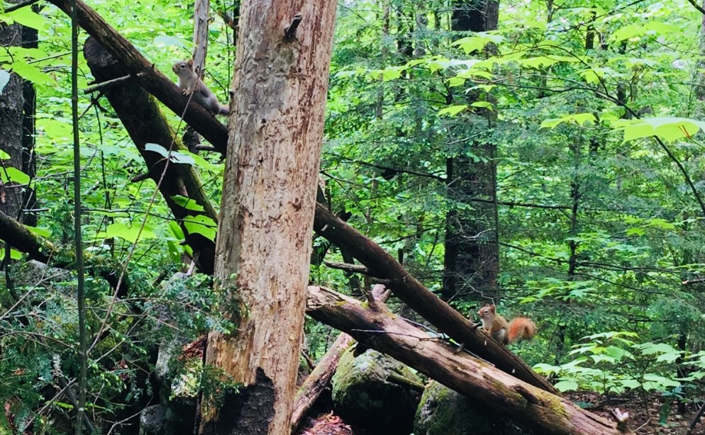
Two red squirrels hope for a handout along the Eagle Scout Trail
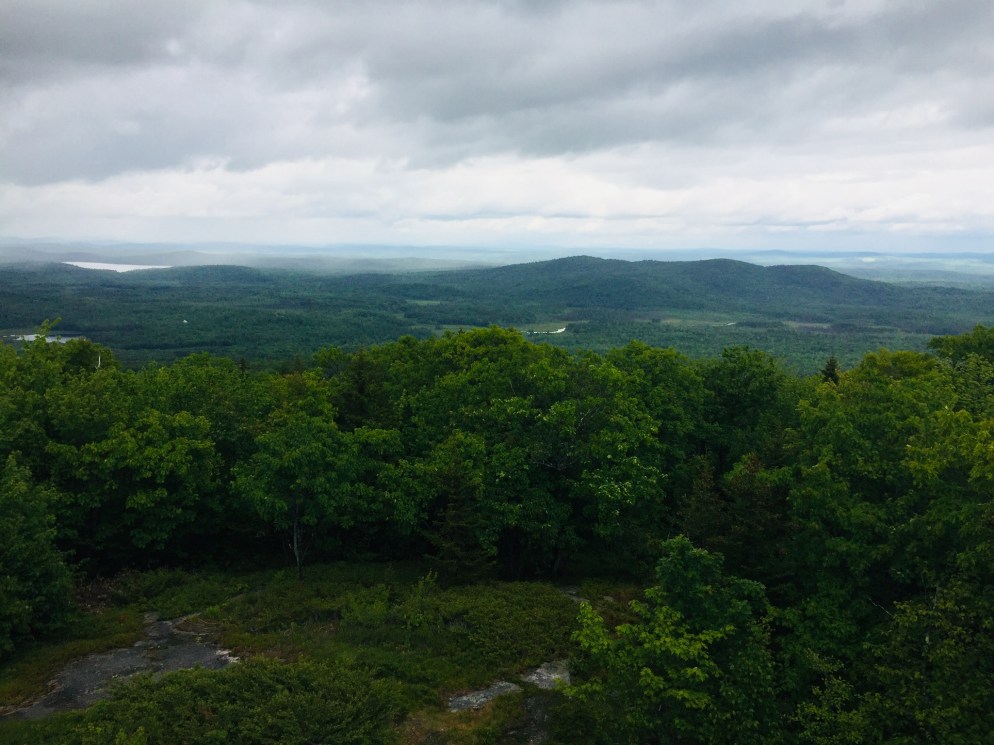
The summit’s stone tower allows for panoramic views, and a pictorial display helps to identify which peaks, lakes, and points of terrain you are able to see on a clear day.
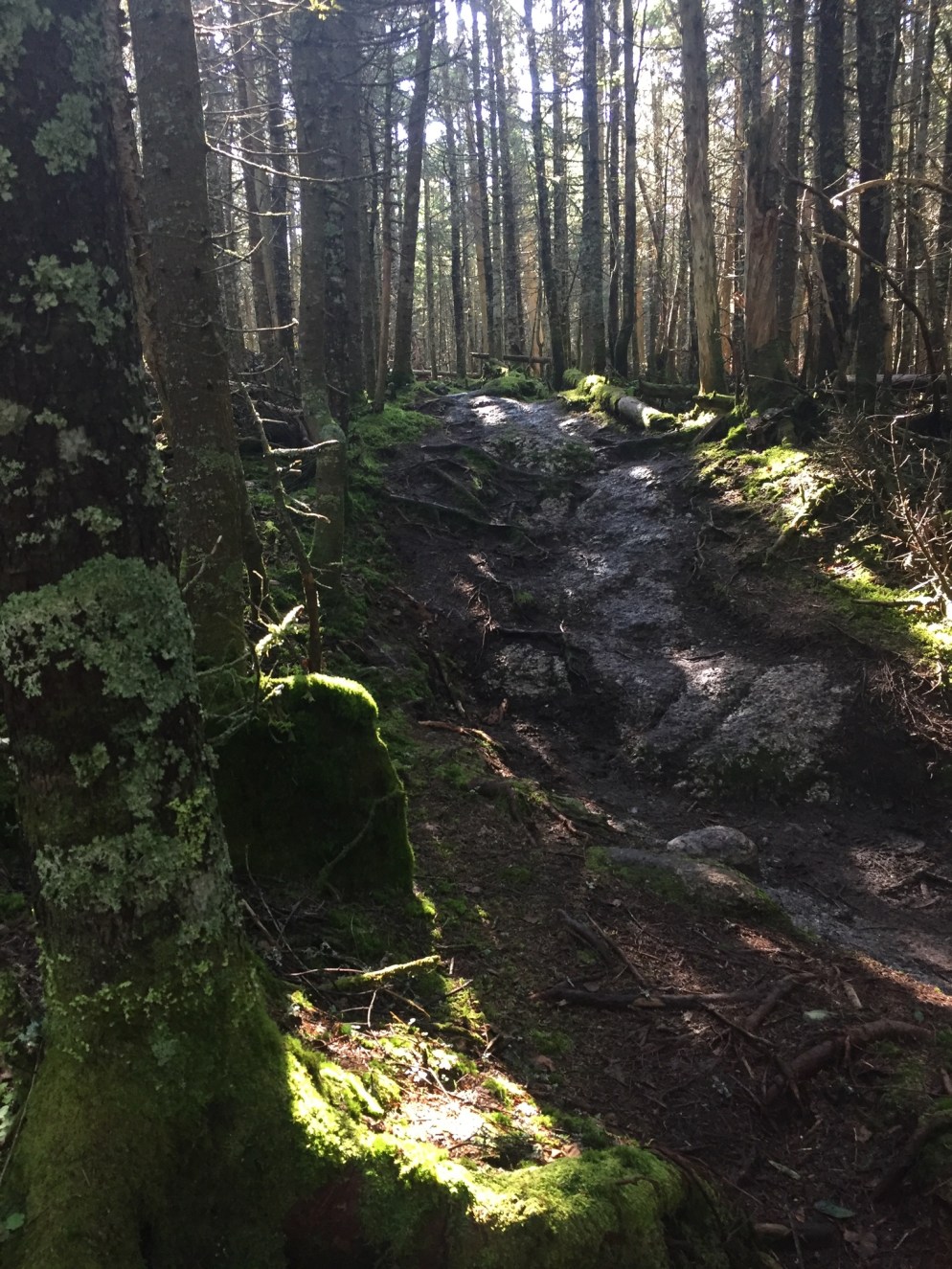
Entrance to the climb of the Ledges Trail, or the end of the trail, depending on your direction of travel
A steep descent down the Ledges Trail can be slippery in wet weather, so use caution in selecting your route. The last .4 miles or so back to the parking lot is reached by walking along Douglas Mountain and Ledges Roads, past beautiful houses. This route to the summit is substantially shorter than the Eagle Scout Trail, and would be a short, challenging scramble for younger hikers.
(Disclaimer: This post contains affiliate links, and as an Amazon Associate Hiking in Maine blog earns from qualifying purchases.)
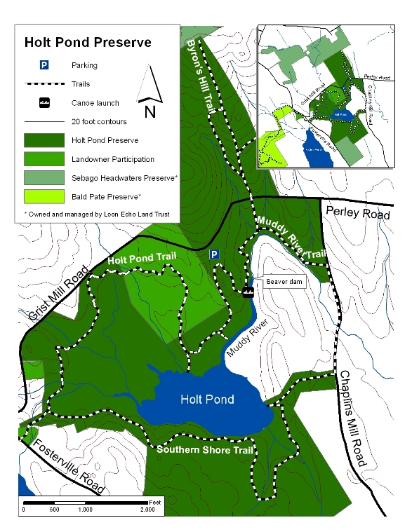
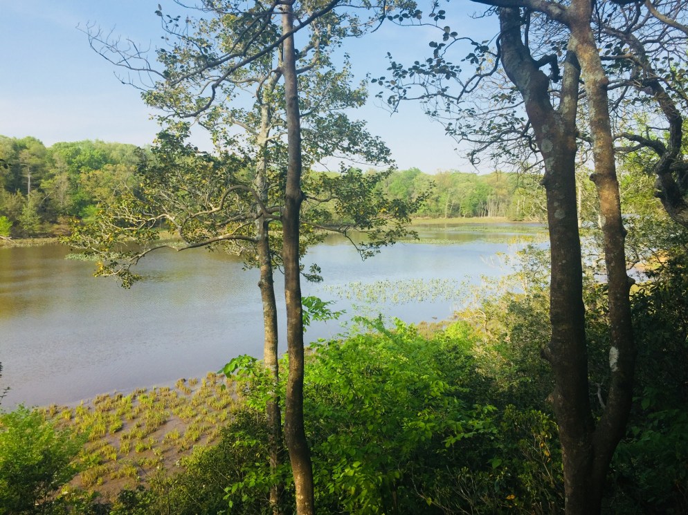
The Lakes Region of Maine continues to be a great place to hike. I hiked Holt Pond Preserve in Bridgton, what turned out to be a 4.5 mile loop (approximately an hour and forty-five minutes), on a June morning after heavy rains. Holt Pond Preserve is a preserve of over 400 acres, maintained by the Lakes Environmental Association (LEA), who have a site with interpretive guides and maps.
LEA Map from website
No dogs, bicycles, or ATVs are allowed at Holt Pond. There is, however, a canoe launch, which looks like a great way to see Muddy River and Holt Pond.
The preserve was alive with the sounds of waterfowl, including ducks and geese, and the distinctive calls of red-winged blackbirds and frogs. The boardwalk allows for fascinating views of plants that you would normally need hip waders or a kayak to see, particularly pitcher plants.
Pitcher plants next to the boardwalk
These carnivorous plants had flowers above them when I visited, something I had not yet seen. The bog breathed fetid air through the gaps in the boardwalk, a contrast to the cool breezes above. Animals use the boardwalk pathways, too, and I tagged along at times behind a chipmunk and a small fledgling bird, both of whom were unable to yield the path until they reached solid ground.
The trail’s path changed from bog to pine forest toward Grist Mill Road, and following it became more difficult, as it was overgrown, with a fair amount of upheaval to bridges and boardwalks from spring rains.
The trail was a bit overgrown in places
This moisture also brought with it plenty of mosquitoes. For those attempting the Southern Shore trail on the far side of Holt Pond, I would highly suggest pants and long sleeves, as well as insect repellent and a weather eye for poison ivy.
This stone wall on the trail bears the telltale sign of chipmunk dens – piles of pine cone scales
The trail skirts private property by moving onto Chaplins Mill Road briefly to the east of the preserve. I clearly missed the turn back to the trail, so I took Grist Mill Road east (left) to make a loop back to the parking area.
While the full perimeter of Holt Pond might be a bit much for most kids, the boardwalk near the parking lot is a perfect excursion for young ones, particularly using the interpretive guide on LEA’s site.
And, as mentioned in the Bald Pate post, this trail network is connected to the Bald Pate Preserve via the Town Farm Brook Trail, which ascends Southwest to the Bob Chase Scenic Loop.
The Lakes Region of Maine surrounding Sebago is a fantastic area for hiking, with many hikes in striking distance of lakefront idylls and other recreation. Bald Pate Mountain (1,150 ft) is an easy to moderate hike in Bridgton, Maine, with many trail options, comprising 6.7 miles of trails.
On this June morning, I took the Bob Chase Scenic Loop to the summit, then the South Face Loop Trail, returning the same way to the parking lot, for an approximately 3 mile hike (about an hour and fifteen minutes at a relaxed pace). Bald Pate trails are well-chronicled in the AMC Maine Mountain Guide, and the trail map and descriptions are available online from the Loon Echo Land Trust, which owns and manages the 486 acre Bald Pate Preserve.
Bob Chase Trailhead at the parking lot/kiosk.
Approaching Bald Pate from the south on Route 107, you can see the exposed rock that is the mountain’s namesake. The parking lot is located on the east side of 107, just south of Five Fields Farm and XC Ski Center, at the top of a large hill. The climb up 107 allowed the car to do a lot of the work of getting to the summit before I even started hiking.
Face of Bald Pate Mountain in winter, Bridgton, Maine
When I arrived, the lot was empty, and a small circle of depressed grass and milkweed next to my car looked like a place where a deer had slept the night before. I started up the Bob Chase Scenic Loop, with birch trees, lady slippers, wild blueberries, and ferns on either side, and red squirrels chattering loudly.
Views west from the Bob Chase Trail.
A wrong turn took me around a pleasant diversion/backtrack to the other side of the Bob Chase Scenic Loop, and I wound my way back to the summit. This was not the fault of the trail maintainers, as the Bob Chase Loop is clearly marked in blue, and the South Face Loop is clearly marked in orange.
View from the South Face Loop toward Peabody Pond.
The summit is easy to reach in 25 minutes or less, with excellent views, and it looks like a riot of wild blueberries awaits those who hike it later in the summer. The South Face Loop was much more challenging than the Bob Chase Trail, descending steeply, skirting the face of the mountain, and then ascending quickly to rejoin the summit (I thought several times, I already climbed this, didn’t I?).
The Pate Trail is a short, steep (.1 mi with 360 ft of elevation gain) trail connecting the summit to the South Face Loop, and I will have to try this one next time, as well as the Moose Trail, which can create a different loop back to the parking lot.
Don’t forget to “tip your bartender.” Conservation takes time and money.
This trail network is connected to the Holt Pond Preserve via the Town Farm Brook Trail, which descends northeast to the Holt Pond Trail, a link which could create a much longer hike in a very different environment (bog walkway). The Bald Pate summit is a nice, short hike, suitable for most age and skill levels, with great vistas along the way.
(Disclaimer: This post contains affiliate links, and as an Amazon Associate Hiking in Maine blog earns from qualifying purchases.)
A bend in Quantico Creek at Prince William Forest Park
This blog has been quiet for a few weeks. When you’re out of town, whether for business or vacation, you can easily get locked in to indoor spaces because of the comfort of a hotel room or the challenge of unfamiliar surroundings, particularly in a place that seems like it’s hopelessly locked in suburban sprawl. But that would be a shame, as there are always new trails to explore via hiking and/or trail running which may hold surprisingly different flora and fauna.
Bird’s nest at Locust Shade Park
I spent a few weeks in northern Virginia, and found that there are wild spaces to be found- not as wild as Maine, but still beautiful and historic, and blooming in what seemed to be a full season ahead of the Northeast. I used the All Trails app, National Park Service, state and county government websites, and word-of-mouth to find parks. Here are a few:
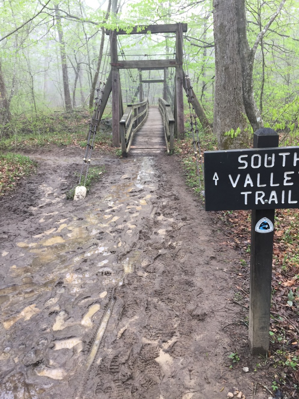
South Valley Trail to North Valley Trail at Prince William Forest Park
A $20 per vehicle admission fee (valid for 7 consecutive days) gets you entrance to a beautiful forest sanctuary in Triangle, VA with miles of trails (see official park maps here). I chose a fairly aggressive loop from the Visitor Center parking lot, using the Laurel, South Valley and North Valley Trails, Burma Road, Scenic Drive, Oak Ridge and (again) South Valley and Laurel Trails to create a tour of the park that spanned almost 15 miles.
Like the other trails and parks I will describe below, this park appeared to have sustained heavy trail damage from storms, and trail crews had been busy. The loop took me through rolling hills, and included waterfalls, dogwood blossoms, and a large variety of wildflowers.
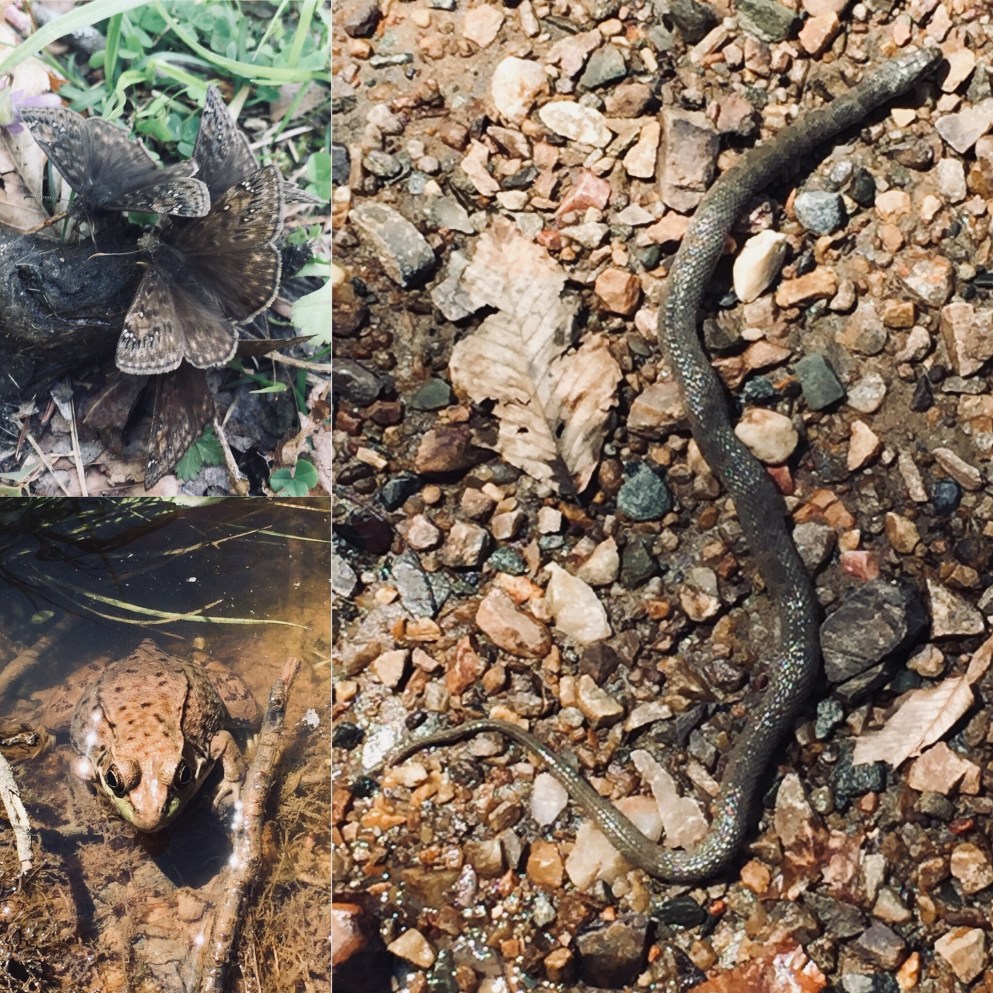
There were also animals to be found, including birds, butterflies, frogs, and what looked like a large water snake (I had no idea what “large” was- more on that at Mason Neck).
This was a beautiful, uncrowded, quiet park, minutes from terrible I-95 traffic and shopping malls, and a welcome respite. Originally built by the Civilian Conservation Corps (CCC) as the Chopawamsic Recreational Demonstration Area (RDA), it is a triumph of land management, including the reclamation of an old pyrite mine and its former pollution of the surrounding streams.
View from the Observation Blind overlooking Kane’s Creek at Mason Neck State Park
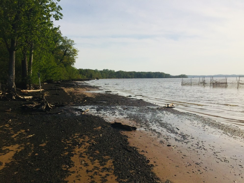
Mason Neck, located in Lorton, VA, is a peninsula on the Potomac River, with miles of hiking trails (see park map here), and water/paddling activities available, as part of the Occoquan Water Trail. Again, $7 for out-of-state residents. I was there on a weekday evening, and took the Kane’s Creek (1.2 mi) and Eagle Spur (1.29 mi) Trails, as well as the Bayview Trail (1.02 mi). This is a place to see bald eagles, and an observation blind sits at the end of the Eagle Spur Trail.
Bayview Trail, Mason Neck State Park
I didn’t see any eagles or osprey. What I ended up seeing on the Bayview Trail were snakes. Lots of snakes. Big water snakes.
But I didn’t bother the snakes, and they didn’t bother me. Mason Neck is, again, right next to the I-95 corridor, but a beautiful, well-maintained park. Each trail has its own self-guided tour, with brochures available at the map/kiosk next to each trailhead, and plenty of green space and benches to enjoy the scenery.
Locust Shade Park is sandwiched between I-95 and U.S. Route One, but has some great trails in between, with a listed length of four miles (see map here), full of birds, flowers, and lizards. A word of caution – the AllTrails app appears to have this trail transposed a mile or so to the east, which would put someone who used the app for navigation at the gates of the Quantico Marine base.
Yeah, you can see I-95 from the trails at Locust Shade
I visited this park in the late afternoon, and the nearby highway was jammed with traffic, making me feel lucky to walk or run on trails. The terrain was rolling, with a few hills and streams, and made for a pleasant hike, rather than the usual rocky challenge of Maine trails. The trail also has a Fitness Trail loop, with self-guided stations for exercises.
One thing that makes Locust Shade special is its proximity to the National Museum of the Marine Corps, and the Locust Shade trails connect at their northeast terminus to the silent looping trails of memorials winding around the museum by the side of well-laid brick walkways. Nobody does tradition like the Marine Corps.
Evening light at Locust Shade ParkTrail Map at Government Island
Government Island is a small park and historic site, originally a quarry purchased for the federal government in 1791 by Pierre L’Enfant, where freestone was extracted for construction of the White House and the Capitol. Navigation using Google Maps can be difficult, but using the physical address, 191 Coal Landing Road, Stafford, Virginia, seemed to work.
Admission is free, and the trails are only about a 1.5 mile out and back loop around the island on Aquia Creek (see the trail map above), full of birds and trees.
Overlooking Aquia Creek from Government Island
So, next time you find yourself somewhere different with time on your hands, look up a trail, and start walking. You never know what you might see.
Thru-hikers can have many different reasons to attempt the Appalachian Trail (AT), whether it be the fulfillment of a dream, a personal challenge, or any number of life events, and in Hike It Forward: Hiking the Appalachian Trail Strong, Safe and in the Spirit, (self-published, 2015) David Rough recounts his successful 2014 thru-hike from Georgia to Maine, as part of an “unavoidable call” and an effort to improve tuition assistance at the Christian school system in Ohio of which he was Academic Dean at the time. Rough blogged about his hike in the Hike It Forward blog.
Rough (trail name: Rowdy) details his preparations for the hike, and how these preparations stood up to the 2,186 mile test, including gear and clothing. In addition, Rough’s book includes three bonus features: Trail Preparation, Trail Journal, and a State-by-State guide. A bibliography includes everything from A Walk in The Woods to The Lord of the Rings.
Rough breaks down AT lingo, most importantly explaining the HYOH concept: Hike Your Own Hike, respecting the different goals, motivations, and methods of other hikers. Rough also converts the “trail magic” concept to “trail blessings,” which reflects Rough’s Christian faith. Most of the blessings involve food, which is central to the thoughts and well-being of thru-hikers.
The book reveals a daily life on the trail containing surprises, nasty falls, and unexpected acts of kindness. These vignettes range from uplifting conversations with other thru-hikers, most of them referenced by trail name, to lighthearted musings on moose encounters, to an incident with a peeping tom at a hostel.
These stories illustrate lessons learned by Rough, and his trail journal provides a sense of scale regarding the sheer mileage of a thru-hike, and its effect on his mood. Additionally, Rough is careful to credit his wife and sister, and the many others who supported his hike, showing that while an AT hike is inherently a solitary endeavor, the added motivation and encouragement to see it through can be the difference between success and failure.
Rough also discusses the challenges faced in adjusting to normal life again after his AT experience, and how small things like shoes, being inside, and changing his diet caused stress, and how Rough dealt with this, and how reconnecting with friends from the AT cushioned some of the loss felt upon leaving the trail. Rough concludes:
The Appalachian Trail is forever etched into my life. God allowed me to experience a path that few have walked. My hike was so uniquely mine and the spiritual journey so personally embraced me that words cannot describe its intimacy. A one hundred and fifty-two day walk incorporates 3,648 hours of experiences and people and blessing and adversity and adventure. To capture it in a book, to recall it in words, to reflect it in pictures, or even to fully understand it myself seems to evade my abilities.
Overall, Rough’s narrative effectively describes his initial romantic view of the trail being replaced by hardship, but then re-forged, one step at a time, hiking his own hike, into an appreciation of the trail as it is.
(Disclaimer: This post contains affiliate links, and as an Amazon Associate Hiking in Maine blog earns from qualifying purchases.)
Maine’s seasons are different than those of our neighbors to the south- sometimes the resolutions of the New Year are still buried under several feet of snow, even at the beginning of Daylight Savings. I believe it’s important to get outside in the winter either way, but this article will focus on planning for the traditional hiking season.
Step 1: Create a difficult, even unrealistic goal.
How we did it in 2017: In the winter of 2016-2017, we decided to attempt the 100 Mile Wilderness. The difficulty of this task forced us to create a training schedule, and to prepare our gear and bodies one piece at a time for a “capstone” hike, so that we were not fully ready for it until we stepped onto the trail. The training then became part of the journey, instead of being a series of unrelated excursions. And we also had a blast doing it.
How you can do it in 2018: Pick a goal, and plan for it. Check out this great article by Carey Kish on Ten Great Hikes You Should Do in 2018. Or this one, again from Maine Today, on 10 Brag-Worthy Hikes in New England. Pick one outside your comfort zone, something you haven’t done before. If you are a more experienced hiker or backpacker, do the same with longer, multi-day hikes. Try the Section Hiker blog for ideas. Great ideas in the area include Maine’s Bigelow Range, the Presidential Traverse in New Hampshire, and even the Long Trail in Vermont. Or maybe you are tired of explaining why you have lived in Maine for X number of years, and never been to Katahdin’s summit. Make it challenging.
Step 2: Make yourself accountable, find a partner if you can, and lock in your plans.
How we did it in 2017: Daughter and dad agreed on our training plan and final goal. Hiking together is fun. We told people (family, friends, co-workers, gear salespeople) we were going to hike the 100 Mile Wilderness together. That made it hard to back out. We also set aside vacation days for the attempt, and later, booked a Baxter State Park parking pass ahead of time for Katahdin. Planning is fun, too, and having these outdoor excursions to look forward to can be soothing, depending on your life situation and “day job.”
How you can do it in 2018: Start with the end goal in mind, and back up to the current day, making incremental additions to your training plan. For accountability, book your arrangements early (vacation days, lodging, re-supply) so you are motivated to follow up on your investment. Put everything on a calendar. In general, buying a state park season pass is a good deal, and will prompt you to get out there. Maine’s is $55 for individuals, or $105 for a vehicle pass, and free for seniors. The White Mountain National Forest offers an annual pass for $30, and an annual household pass for $40. These passes also allow you to forgo the hassle of trying to find a pen and exact change at the many self-service kiosks at trailheads, and to support our great parks.
Step 3: Let experts do the work for you.
How we did it in 2017: We devoured the books and blog posts we could find on the 100 Mile Wilderness (check this out), and purchased the Appalachian Mountain Club Guide to Maine, as well as the maps for the 100 Mile. For our training hikes, we consulted the Maine Mountain Guide and the White Mountain Guide (skip to Recommended Hikes, get in the car, and go).
How you can do it in 2018: Buy the AMC Maine Mountain Guide and White Mountain Guide. Just do it. They come with maps, they are well-researched, portable, and can serve as a journal for hikes completed. Also, follow Philip Werner’s Section Hiker blog (mentioned above) and Carey Kish’s columns on Maine Today.com. Ask at Information Centers for actual information, and engage with park rangers and volunteers. In addition, join the Appalachian Mountain Club. It’s cheap, most of the membership fee is tax deductible, it supports trails, and they sponsor a ton of group activities/hikes for all skill levels. Follow the people above on Twitter to get updates and ideas, as well as publications like Backpacker Magazine and Outside, which also has an excellent podcast series.
Step 4: If your plans are disrupted, do “something” anyway.
How we did it in 2017: We couldn’t always get out on the trail. School, work, travel, injuries, commitments came up that kept us out of the woods. But we figured out ways to work through. Daughter played basketball, and dad focused on weight room exercises (lunges, box jumps, squats) that strengthened legs for the terrain of the 100 Mile. We skied. On a couple weekends we couldn’t hike, or were out of town somewhere, we signed up for several 5K road races – try Running In The USA. The way to get better at doing hard things is to do hard things. Just do something.
How you can do it in 2018: Shorter hikes can be very rewarding when time is not on your side. Try a big-payoff one like Burnt Meadow Mountain or Pleasant Mountain, steep hikes with great views. Try trail running, which is just hiking’s skinnier cousin. There are trail running groups throughout Maine. Baxter Outdoors does a great race series, which might take you to some places you haven’t been, help you meet some like-minded people, benefit charity, and get some free beer. Here are some tips to get ready for hiking with a pack from Backpacker Magazine. Understand your limits, particularly with an injury, but focus on the things that you can do. For example, dad broke his right wrist descending Katahdin in September 2017, and this precluded a lot of activities, but still allowed him to hike, and as a result he developed more dexterity in his left hand. A caveat: all these things help, but hiking with a pack seems to be a singular exercise, and the best way to get better at hiking is to hike (see above regarding hard things).
Step 5: Let the momentum propel you to staying on the path.
How we did it in 2017: Despite our difficulties at the end of the 100 Mile attempt, we were both invigorated by the hiking we’d done, and talked about more goals. Daughter had never climbed Mt. Washington or Katahdin, and felt strong after our training. It was only mid-July, so the good times we’d had kept us hiking, and we completed both of these mountains, as well as some great hikes in between. We started taking more pictures, and talked about capturing our adventures in this blog, which we began last fall, right after our Katahdin hike.
How you can do it in 2018: Use the aforementioned accountability to keep you going, locked in to activities, and check in with people who are doing the same. You will feel stronger each time you get out there, and maybe your goals will change by the time you hit your big hike. You will see intriguing side trails and places along the way. If you are into social media, use it to catalog your progress. You won’t find any “look at me shirtless doing yoga on top of a mountain” selfies on this blog, but if that’s your thing, and helps you… Either way you will have fun and get outside.
(Disclaimer: This post contains affiliate links, and as an Amazon Associate Hiking in Maine blog earns from qualifying purchases.)
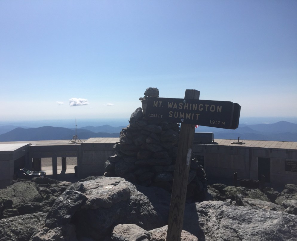
On July 23, 2017 we hiked Mt. Washington (6,288 feet) from the AMC Pinkham Notch Visitor Center via the Tuckerman Ravine Trail and the Lion Head Trail (4.3 miles). The best road map for this strenuous hike is the AMC White Mountain Guide, which contains maps and trail descriptions. The Pinkham Notch Visitor Center also sells maps for a nominal fee, has free advice and info, and a scale model of the mountain and its trails.
Having attempted the 100 Mile Wilderness two weeks earlier, we now set our sights on Katahdin later in the summer, and focused on getting in some climbing to prepare for this capstone hike. We packed light, though, and focused on water and snacks. Dad carried a pack with clothing and essentials, and daughter used a small Camelbak pack that held a water bladder and not much else.
Knowing that the parking lot and the trail would be busy on a Sunday in the summer, we got an early start, signing the trail log and beginning our hike before 7 am. Still, we were not the first ones to hike the mountain that day, because a scary fit guy wearing no gear came running hard down the trail, having already been to the top.
Crystal Cascade.
About 0.3 miles up, we stopped to take a picture of Crystal Cascade. The next two miles were a steady climb upward on a wide, rocky trail. We shed some layers as the sun rose higher in the sky, then took the right-hand turn onto the Lion Head Trail.
Lion Head Trail on Mount Washington.
The trail became a lot steeper as we approached the edge of the tree line. We took a break shortly after clearing the tree line to apply sunscreen and eat some peanut butter M&Ms, a favorite of ours. Hiking a mountain with such light packs seemed easy, after our 100 Mile ordeal.
Tuckerman Ravine.
The open climb and bright summer morning gave us excellent views of Tuckerman Ravine below. We also paused several times to admire the foliage in an area close to the Alpine Garden Trail.
There is so much more to see, and this is a great video describing some of the varieties of plants and flowers in the Alpine Garden.
The final climb to the summit, .4 miles, which seemed to go straight up, with no end in sight, ended abruptly at the parking lot near the summit. This has always seemed a strange juxtaposition, to be immersed in nature, then to have so much commerce at the top of New England’s highest peak, but we also enjoyed the opportunity to buy a chili dog and slices of pizza in the snack bar. For round-trip hikers, there are restrooms, as well, and water points to refill for the descent.
We made the decision to purchase tickets for the van shuttle back down to the Pinkham Notch Visitor’s Center, rather than hiking the descent, as daughter was fighting a headache, and we had done the fun part of the climb already. The price was reasonable ($31 for dad, $13 for daughter), and included a pass to the Mt. Washington weather museum, which we visited while waiting for our scheduled van. The moral of the stories contained in the museum seemed to be: be careful on Mt. Washington in the winter. Daughter purchased a plush moose she instantly named Tuckerman, and a clever cat-themed t-shirt (“The Meow-ntains are calling, and I must go”).
Mt. Washington Summit.
You can see how volatile the weather can be from the featured image at the top of this post – immediately above is a photo from dad’s summit in June 2016, with better visibility. Dad usually climbs Mt. Washington once per summer, via the Tuckerman Ravine or Lion Head routes.
After a short jaunt down the auto road in the van, and back to our car at Pinkham Notch, we drove the 15 minutes south to Jackson, NH, where we cooled off in Jackson Falls and picked blueberries by the side of the river to end the day.
The combination of a March Nor’easter and a good book given to me by a friend convinced me that winter was a good time to add a Book Review section to the Hiking In Maine blog. On Trails: An Exploration by Robert Moor (Simon and Schuster, 2016) is a perfect first entry in that section, as the book blends a description of the practical realities of hiking with the deeper and more existential reasons for these exertions.
The book opens with a prologue containing Moor’s description of his 2009 thru-hike of the Appalachian Trail (trail name: Spaceman), and how he came to be there. It also quickly reaches the questions raised by this journey:
As hundreds – and then thousands – of miles of trails passed beneath my eyes, I began to ponder the meaning of this endless scrawl. Who created it? Why does it exist? Why, moreover does any trail?
And so, Moor dives deep, not just into his own Appalachian Trail experience, but into the history of the Appalachian Trail, and the origin of all trails, those created by humans and others: pre-historic organism, slugs, ants, caterpillars, elephants. In-depth scientific and psychological explorations are punctuated by colorful, whimsical vignettes from Moor’s life, including an amusing stint as a shepherd assisting a Navajo couple in Arizona.
These stories help to anchor the larger themes of the book, including the complicated relationships between man and wilderness, and the American rediscovery of this concept. In describing the forests of New England, Moor says, “Walking through them- wolf trees, walls, and all – one starts to realize that the only thing more beautiful than an ancient wilderness is a new one.” Moor skillfully interweaves insights like this one with his section hike of the Appalachian Trail in New Hampshire alongside Gilliam Jackson, a Cherokee man, and the other hikers along the way.
A trip to the Atlas Mountains in Morocco to scout routes for the International Appalachian Trail (IAT) ends the main section of the book, and again, Moor blends explorations of the concept of the trail with humorous and poignant anecdotes of his interactions with the people involved, from planners in Maine and Iceland, to guides, to a prickly Moroccan dog owner.
Moor brings the book to a close with a superb epilogue, in which he connects the trails he has described with the paths taken in life, illustrated by the parallel lives of Han-shan, an ancient Chinese poet, and M.J. Eberhart, AKA Nimblewill Nomad, a legendary modern hiker who has given away most of his possessions, and makes observations on why we hike:
One of the chief pleasures of the trail is that it is a rigidly bounded experience. Every morning, the hiker’s options are reduced to two: walk or quit. Once that decision is made, all the others (when to eat, where to sleep) begin to fall into place. For children of the Land of Opportunity – beset on all sides by what the psychologist Barry Schwartz has called “the paradox of choice” – the newfound freedom from choices comes as an enormous relief.
Moor’s book has the character of a journal entry that expanded and took on a life of its own, supported by anecdotes, science, and literature. In the hands of a less capable writer, this concept could sprawl endlessly and without direction, but here it flows brilliantly. Moor’s book is truly a meditative exploration, as the sub-title indicates, and its composition is as excellent as Moor’s insightful prose. Where he could create trite axioms or smug conclusions, Moor acts instead as a skilled guide, allowing the journey to create a deep question, and leaving the final destination to the reader.
(Disclaimer: This post contains affiliate links, and as an Amazon Associate Hiking in Maine blog earns from qualifying purchases.)
On July 16, 2017, dad did a solo hike (daughter had a planned visit to Aquaboggan) of Old Speck Mountain (4,270 ft), a fairly strenuous 7.6 miles, the fourth-highest peak in Maine, located inside Grafton Notch State Park, via the Old Speck Trail and Mahoosuc Trail, with guidance from the AMC Maine Mountain Guide and the Maine State Parks and Public Lands site, which has a map here.
Parking was available at the trailhead off ME 26, and the self-service payment was a $3 fee for Maine residents. This was dad’s first hike after the 100 Mile attempt ended the previous weekend, and he got an early start.
The falling water off Cascade Brook was running beside the trail, which is part of the AT, and the morning sun made for great light variations along the path. Very few hikers were around, due to the hour.
Dad surprised a big snowshoe hare, still in its summer brown, with white feet, partway up the mountain in a clearing, and it galloped off before he could take a picture.
At the summit was an observation tower, which, when climbed, provides panoramic views of the surrounding mountains.
The descent was fast, despite some lingering knee and hip pain from the 100 Mile, and dad took a chilly dip in the shallow waters upstream of Screw Auger Falls to cool off. Like the Chocorua climb and Lower Falls Recreation Site, it is a great summer combo, covered by the same use fee. Nearby are Mother Walker Falls, Moose Cave, and the Spruce Meadow Picnic Area.
(Disclaimer: This post contains affiliate links, and as an Amazon Associate Hiking in Maine blog earns from qualifying purchases.)
Good morning. Enjoying snowfall and making some improvements to the Hiking In Maine blog.
Check out our Interactive Map, which will include our hikes in Google Maps as we add them, and assist in planning your own hikes, based on location. This is a work in progress, so feedback is welcome.
We are now also on Twitter as @HikingMaineBlog, so please follow us to get updates on new content and info from other places about hiking in Maine (as we figure out what a “twitter” is). We are now on Facebook, as well.
And our 100 Mile Wilderness section is now complete with 2017 info, and consolidated on one page for your convenience. Much more to follow with our after-action thoughts, packing lists, and plans for completion. We are very excited for the 2018 hiking season.