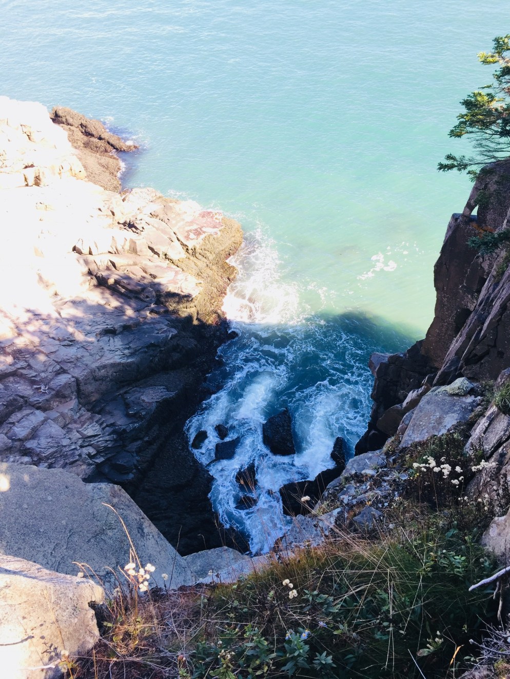
Rocky beach off the Coastal Trail, Quoddy Head State Park.
The word “Easternmost” is prominently advertised in many places across Lubec, including Quoddy Head State Park, which comprises 541 acres at the tip of the U.S.’s eastern reach. By the time you reach Quoddy Head State Park, off South Lubec Road, you will likely have seen many advertisements for all things “easternmost” (campgrounds, gift shops, etc). But beyond the quick tour stop and lighthouse “selfies,” this park offers an array of trails for all abilities with impressive ocean views and a variety of coastal vegetation. The best guide to the park’s trails is the map provided by the state of Maine: Quoddy Head State Park Guide & Map.
We started with the Coast Guard Trail, a 1-mile trail north of the entrance, which includes an overlook of the Lubec Channel, as well as a view of the town of Lubec back to the west, after a short climb up a wooden staircase. According to the Quoddy Head Guide, the first .5 miles of the western part of this trail is accessible by motorized wheelchair. After the lookout, the Coast Guard Trail then descends through the thick coastal woods to the lighthouse, passing several viewpoints along the volcanic rocks. The path was full of birds and squirrels gathering food on this warm, sunny October day.
West Quoddy Head Lighthouse, Lubec, ME
The small lighthouse museum (free, but donations always help) includes displays featuring the history of the lighthouse, flora and fauna of the area, and a guide to whales, commonly sighted off the coast. The area around the lighthouse contains a large number of picnic tables with excellent views, and the only restrooms in the park (easternmost privies in the U.S.? Probably). From the lighthouse area and most of the coastal trails, the cliffs of the Canadian island of Grand Manan are visible across the Quoddy Channel.
The terrain was impressive, and those with small children need to keep them close, as there are plenty of dizzying cliffs on the U.S. side, as well. The beaches are rocky, but make a far more interesting sound than sand beaches, combining the tidal roar with a rattling, suction sound as the rocks move together when the waves recede.
Coastal Trail at Quoddy Head State Park, Lubec, ME.
The Coastal Trail travels west along the shore past incredible views and scenic points like Gulliver’s Hole, High Ledge, and Green Point, with frequent stops in between to take in the powerful ocean. We did not linger at Green Point, a ledge with paths down to a beach, as we may have interrupted two hikers in some sort of extracurricular activity there (The trails became more and more empty the farther we got from the lighthouse).
At Carrying Place Cove, Thompson Trail heads back east, inland towards the parking area, with the short .2 mile spur of Bog Trail along the way. This side of the trail, in particular the sand beach at Carrying Place Cove, is also accessible from South Lubec Road. The Bog Trail includes a boardwalk and interpretive signs explaining the coastal plateau bog, also called a heath, according to the Quoddy Head Guide.
Thompson Trail is, for the most part, an easier walk than the coastal trail, with a few brief climbs. The best feature of this trail was the scent of pine, which created a perfumed evergreen tunnel in the narrower sections, redolent with notes of citrus and vanilla.
We completed most of the trails in the park, and stopped plenty of times to relax and take photos, making this about a three-hour visit. The difficulty level is described in the park guide as moderate, which seems about right. There are no strenuous climbs, but consistent steps over rocks and roots could make this more difficult for some hikers. There weren’t any bugs during this Columbus Day weekend, but the boggy areas guarantee mosquitoes and black flies in late spring and summer, and repellent would be a must. I would also suggest waterproof shoes, or at least wearing something on your feet that you don’t mind getting wet or muddy. Depending on your roaming plan, you may want to put your phone in airplane mode, as it will likely be using Canadian towers along this shore.
Lubec fishing fleet at dusk
Lubec, across a narrow channel from Canada’s Campobello Island, is the closest town nearby, but Machias is not that far away, and many smaller towns in Downeast Maine and the Cobscook Bay region are worth a visit. After the hike, if you can catch them open during fall hours, try the craft beer and pizza at Lubec Brewing Company or upscale pub cuisine at Cohill’s Inn on Water Street in Lubec. If you are headed south, go to Skywalker’s Bar and Grille in Machias (try the fish tacos) for a great menu and Machias River Brewing Company beers.
Quoddy Head, though remote, is hardly a secret anymore- we joked that AirBnB renters and vacationers from New York outnumbered locals in Lubec. But steps beyond the famous lighthouse is a surprisingly wild Maine coast to explore.
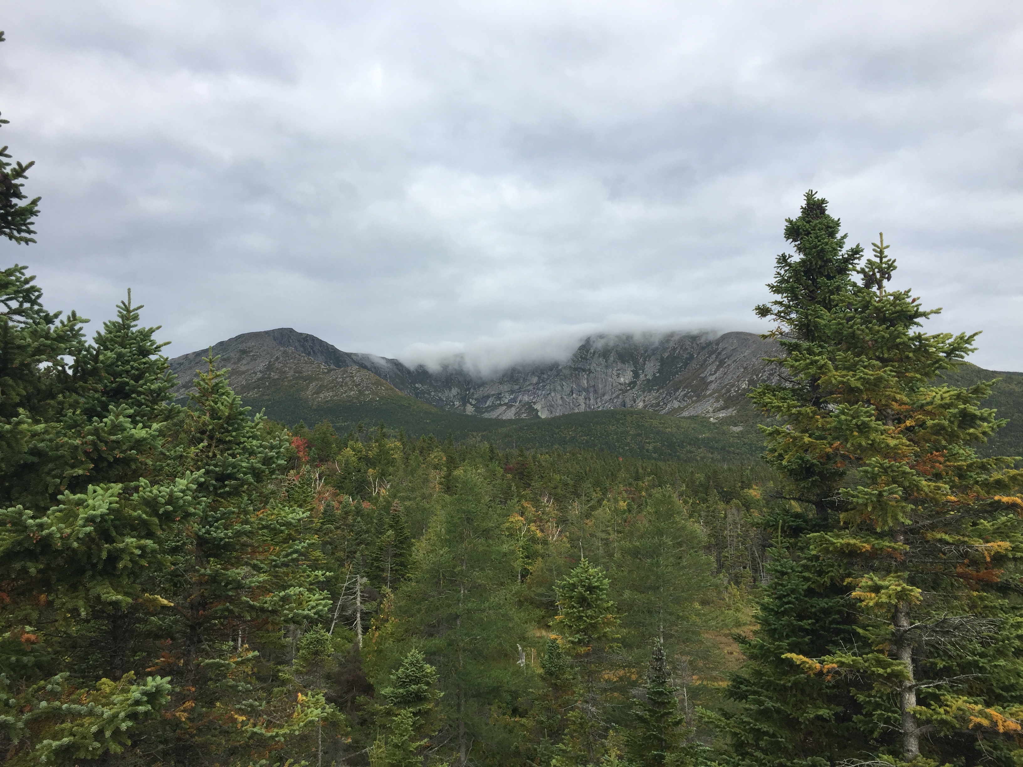
Fall colors on Pollywog Stream, 100 Mile Wilderness
[Note: this is the ninth and final part of a series begun in summer 2017 of an attempt at the 100 Mile Wilderness by dad, 41, and daughter, 12]
Should it take ten days to do the 100 Mile Wilderness? Probably not. Should it take eight days in 2017, and two days in 2018? Doesn’t matter- it did. As described on the 100 Mile Wilderness page, we started in 2017, had a great time together, but dad and daughter decided after 75 miles that we would continue some other time. This summer, we were dying to get back out there, and when the last weekend in September 2018 opened up for us, we jumped at the chance to complete the final 25 miles.
By definition, it’s a wilderness, so starting 25 miles south of Abol Bridge took logistical support. For that, we were helped by the friendly people at the Appalachian Trail Lodge in Millinocket, a hostel open during the hiking season until October 15th. We were greeted by Ole Man (these are trail names) upon our arrival, stayed at the Earl Shaffer Room (clean, two twin beds, shared bathroom, WiFi) for $55 the night before, got delicious breakfast sandwiches and a massive chocolate donut down the street at the Appalachian Trail Cafe the morning we left, and used the reasonably priced Appalachian Trail Lodge shuttle service to leave our truck at Abol Bridge, and get dropped off at the south end of Lake Nahmakanta. We swapped shuttles halfway, as the larger van we rode back to Millinocket from Abol Bridge was needed for the eager thru-hikers headed to Baxter State Park, and we traveled south in an SUV that had recently been repaired after a charging moose had broken off the driver’s side mirror.
We learned a lot on our shuttle ride from NoKey, a 2012 AT thru-hiker working at the Appalachian Trail Lodge, who was friendly, professional, and added all kinds of value to what otherwise would have been just a cab ride over logging roads. We had just missed a large bull moose on the Golden Road, of which NoKey showed us a picture. We got the scoop on good (most) and bad (very few) shuttle services/guides, places to stay near Millinocket, the effect of the Katahdin Woods and Waters National Monument on tourism, area wildlife and history, saw a lynx crossing the road, got an update on bear activity in the area, and even got a lesser-known trail recommendation (Turtle Ridge Trail in Nahmakanta Public Lands). We also passed a large encampment by Cooper Brook, which was the location of an L.L. Bean promotional “Trail Magic” campaign along the AT.
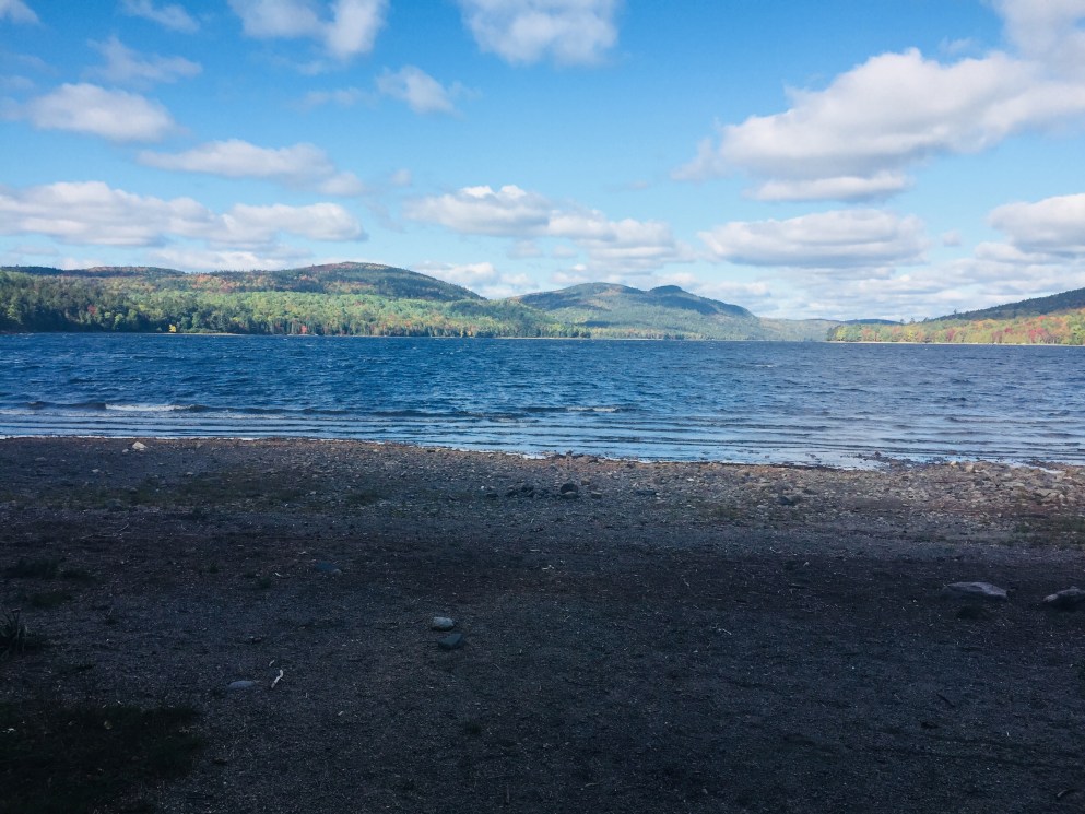
The beach at the south end of Lake Nahmakanta.
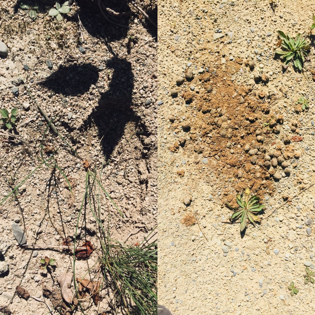
With that preamble, we got a mid-morning start at the south end of Lake Nahmakanta, and after a nostalgic moment on the windy beach, started walking north through the remote Nahmakanta Public Lands. Quickly, we saw large moose tracks and fresh droppings along the trail, and quickened our pace to try to see this animal, without success. We grudgingly adapted to having the heavy packs on our backs, and adjusted our day-hiker pace downward to accommodate the extra weight (we packed too much food). We stopped briefly at Wadleigh Stream Lean-to to crack open our Peanut Butter M&M’s, and noticed a plaque inside the lean-to honoring a hiker named Buffalo Bobby, who had passed away near this spot exactly 7 years before, 38 miles from finishing his third AT thru-hike. Wow. Rest in peace, BB.
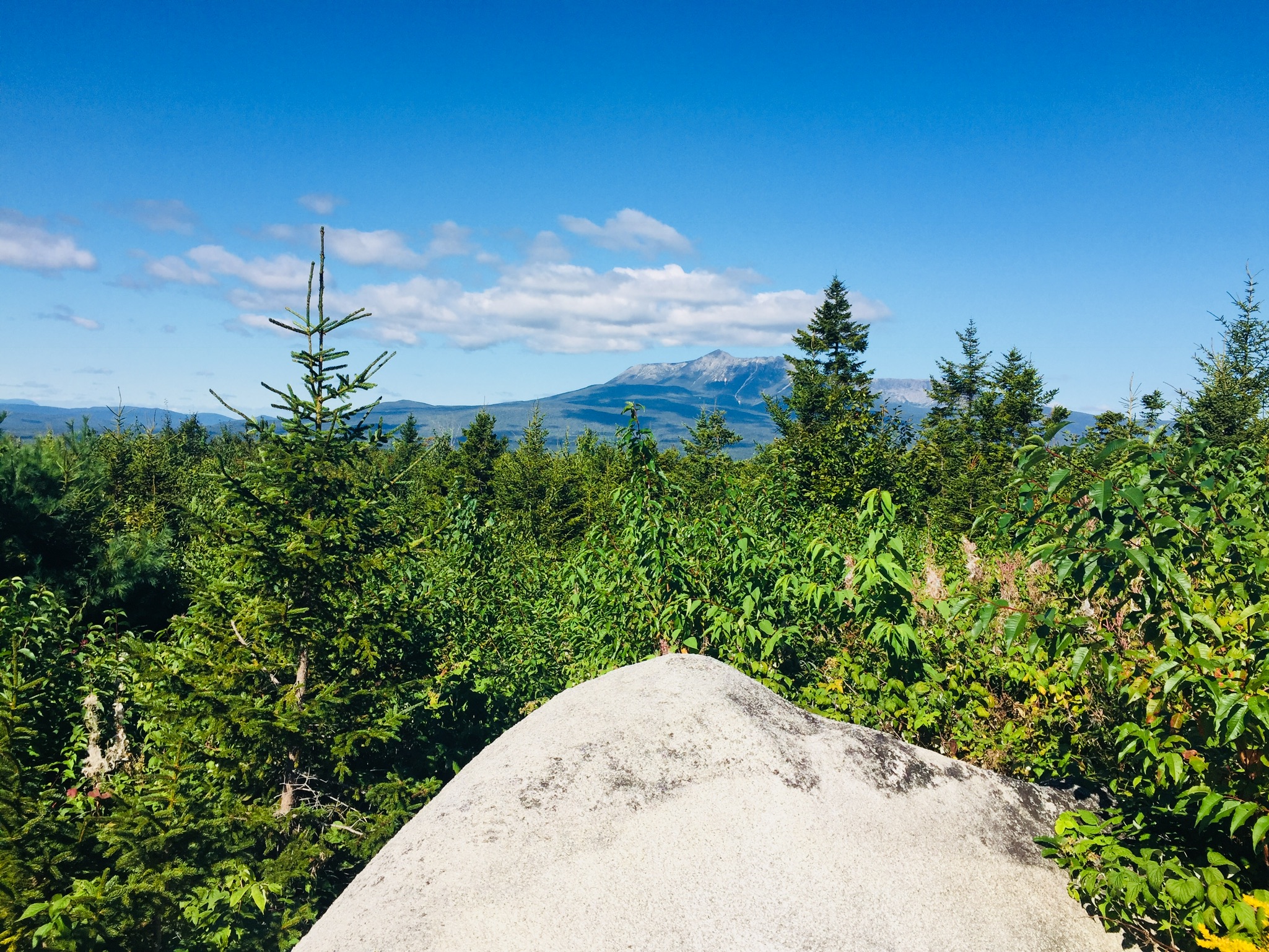
Landscape and foliage views from north summit of Nesuntabunt Mountain.
By about 1 pm, we had reached the north summit of Nesuntabunt Mountain, and took the short side trail to view Nahmakanta Lake and far-off peaks. Then we sat down to make ourselves lunch, the same peanut butter, banana, and Nutella wraps we had used for energy on Katahdin a couple weeks before. A quick descent took us to the base of the mountain and around Crescent Pond to Pollywog Gorge.
Fall colors on the AT near Pollywog GorgeChanging leaves along Pollywog Stream.
The cliffs surrounding the gorge were impressive, but we were beginning to wear down, and didn’t linger. We crossed Pollywog Stream on a bridge, and made our way up Rainbow Stream to Rainbow Stream Lean-to a little before 5 pm, where a male thru-hiker and two female multi-day hikers we had seen earlier were getting ready for the night. This made it only a 10.7 mile day for us, but it felt like a lot more. The lean-to area quickly filled up with thru-hikers as the sun set. The thru-hikers we saw were exhausted, broken, and profane, but unfailingly friendly, polite, and focused on the last stretch of trail to Katahdin.
We set up our tent, which was complicated by a broken pole, repaired with a mostly ineffective combination of duct tape, twine, and tent stakes. We lay out our bedding, refilled our water, cooked dinner (Chicken Teriyaki Mountain House meal), hung our food in a bear bag, and were in our sleeping bags by 7 pm, fading into sleep despite the loud conversations by the lean-to campfire.
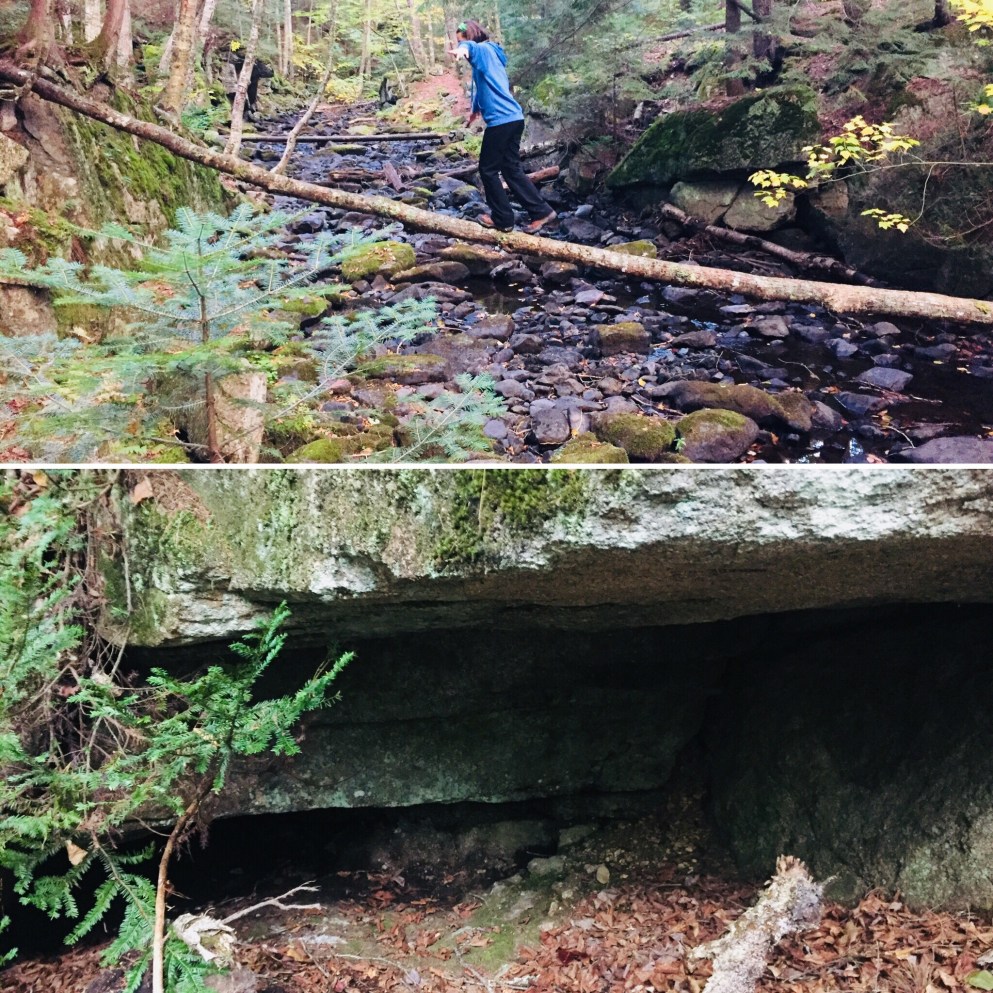
Log bridge and animal den.
It was a cold night, and we were uncomfortable, with neither of us sleeping well. Our sleeping bags and pads were up to the task, but we both agreed in the morning that we need to figure out how to pack pillows with us. Also, dad’s snoring woke up daughter, and daughter poking dad to stop his snoring woke up dad, creating the worst sort of perpetual motion machine throughout the night.
Daughter explored the campsite area in the morning, finding a precarious log bridge across Rainbow Stream to an animal den in a rock cave, possibly the former resting place of a bear. We peeked inside the den, seeing the small skull of an unfortunate prey animal. Dad made instant coffee and mixed in one of daughter’s hot chocolate packets for some more flavor in an attempt to wake up.
Morning light on the Rainbow Deadwaters.
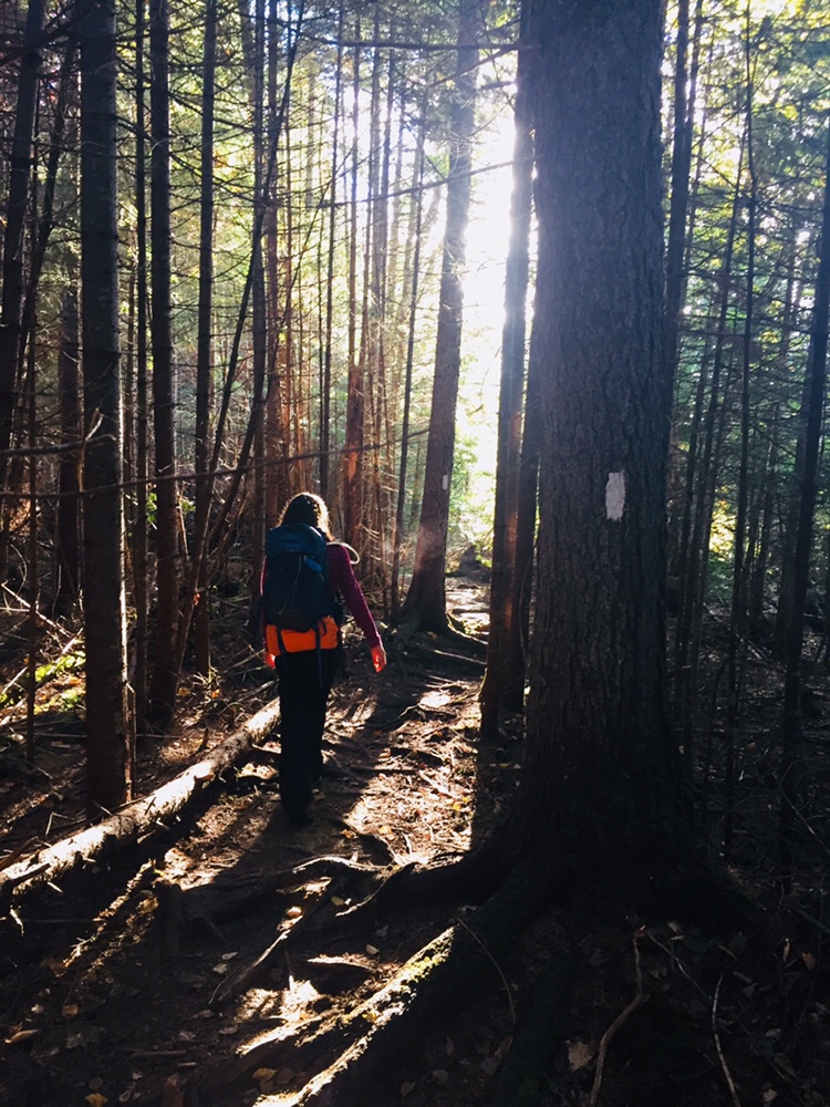
We packed quickly and got moving around 7:30 AM, moving along the edge of the Rainbow Deadwaters. The trail was beautiful, and we marveled at spiderwebs covered in dew, and the unique morning light in the North Woods. We also heard late-season loons calling from Rainbow Lake.
Illuminated trail by Rainbow Lake.
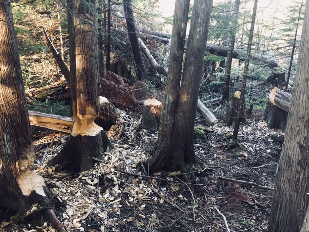
Daughter said that the Hobbit movies could have been filmed here, a recognition of the dramatic, colorful terrain that we tend to associate with movies, and so rarely see in person. We saw a root formation overtaking a tree that looked like a giant spider. As far as mythical creatures go, the west end of Rainbow Lake was the site of what can only be described as a beaver Armageddon, with fallen trees every which way across the trail.
Beaver Armageddon
We stopped for a break by Rainbow Spring Campsite. The privy there was filled with trail graffiti, including the signature of someone whose trail name was “The Privy Destroyer.” This harkened back to irreverent trail names scrawled inside the Appalachian Trail Cafe that had amused daughter, including “Swamp Butt.”
We continued past side trails to Rainbow Mountain and Big Beaver Pond in the Debsconeag Lakes Wilderness Area, stopping to check out Rainbow Lake (the largest lake on the 100 MW) from several rocky openings along the trail. On one stop, we cooked a Mountain House chicken and rice meal for lunch, and let it cool while we walked. When we sat down about fifteen minutes later to eat, it was perfect. Daughter was already sick of the Nutella and lavash bread, so the hot lunch was a good change-up. We also used this time to air out our feet, and change into clean, dry socks.
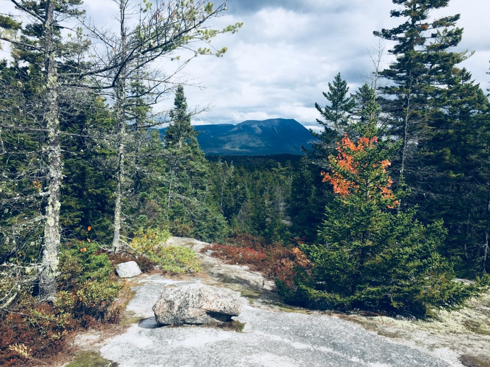
View of Katahdin from Rainbow Ledges.
Rainbow Ledges was a steady climb, with colorful foliage and views from the high point back to the White Cap range, and forward, towards Katahdin. We remembered crossing the White Cap range a year ago on the 4th of July, and the pea soup fog that hindered our summit views that day. Sadly, we ran out of Peanut Butter M&M’s during this Rainbow Ledges ascent, which had a devastating effect on morale. From here, we descended through the ever-changing forest and down well-set rock staircases to Hurd Brook Lean-To.
Different vegetation, incline, and make-up of the trail over just a 25-mile section.
The last few miles seemed to last the longest, as they always do. There weren’t many landmarks on the home stretch to Abol Bridge. The descriptive note, “Interesting area of large boulders and large hemlock trees,” on AT Map 1 at 2.2 miles from Abol Bridge, seemed superfluous after 100 miles of interesting rocks and trees. Suddenly, we were faced with a sign warning us that we were 100 miles north of Monson, and that we should have a minimum of 10 days supplies if we were heading south. We realized we were almost done, and saw the Golden Road peeking through the trees ahead.
Katahdin and the West Branch of the Penobscot from Abol Bridge.
We trudged across Abol Bridge in the late afternoon, completing our 15 mile day. We stopped by the Abol Bridge Campground store to buy some Gatorade, then got back in our truck, and drove out the Golden Road towards Millinocket. The Millinocket House of Pizza is daughter’s restaurant of choice, and she called in an order enroute for a large Hawaiian pizza as soon as cell service returned.
The soreness in our shoulders and knees and the chafing from the packs would fade in time, but completing the 100 Mile Wilderness together had been important to both of us. The cool, bug-free fall weather and colorful foliage were unexpected bonuses. To immerse yourself into the Wilderness, to walk there, sleep there on the ground, listen to the sounds of birds, bathe in the lakes, and then bring back out everything you came in with, is to feel shared ownership of this special place, where most people never go. Even in our weary haste at the end to finish, we had talked about new challenges, and also bringing memories of this hike back with us. As we split the pizza, we talked about our hike, and planned a lazy day for tomorrow.
We had hiked Katahdin, but daughter had never taken the legendary Knife Edge Trail, the narrow 1.1 mile stretch (and Maine rite of passage) from Pamola Peak to Baxter Peak. At age 12, it was time. On September 9, 2018, we hiked together to Baxter Peak on Mt. Katahdin via the Helon Taylor Trail to cross the Knife Edge. On the way down, dad and daughter took the Saddle and Chimney Pond Trails (total R/T appx 10.2 mi). (For maps, other routes, and links to Baxter State Park’s great resources, see our September 2017 Mt. Katahdin post.)
On the way in to Millinocket the night before, we stopped at Hannaford to stock up on supplies before staying at the Parks Edge Inn. In preparation, we went with a chocolate and peanut butter theme, and for our lunches, wrapped Nutella, peanut butter, and bananas in lavash bread like some Willy Wonka burritos, and grabbed peanut butter chocolate chip Larabars and peanut butter M&M’s to snack on.
To get into line at the Baxter State Park gate the next morning, we woke up around 5 am, and signed in to start hiking at Roaring Brook at 6:47 am. The $5 Day Use parking pass for Maine residents has to be the most value Mainers can get for $5. This easy online step is essential to guarantee a spot in the park, which is kept wild in many ways, including the limitation on daily access to the park.
The climb up Helon Taylor Trail was steady and tough, but we took our time, and enjoyed the changing vegetation and ubiquitous chattering of red squirrels, often looking back to enjoy the views behind us to the east, as we slowly emerged from the forest, patches of scrub pine, and finally above the tree line, reaching Pamola Peak around 10 am.
Getting ready to descend into the beginning of the Knife Edge.
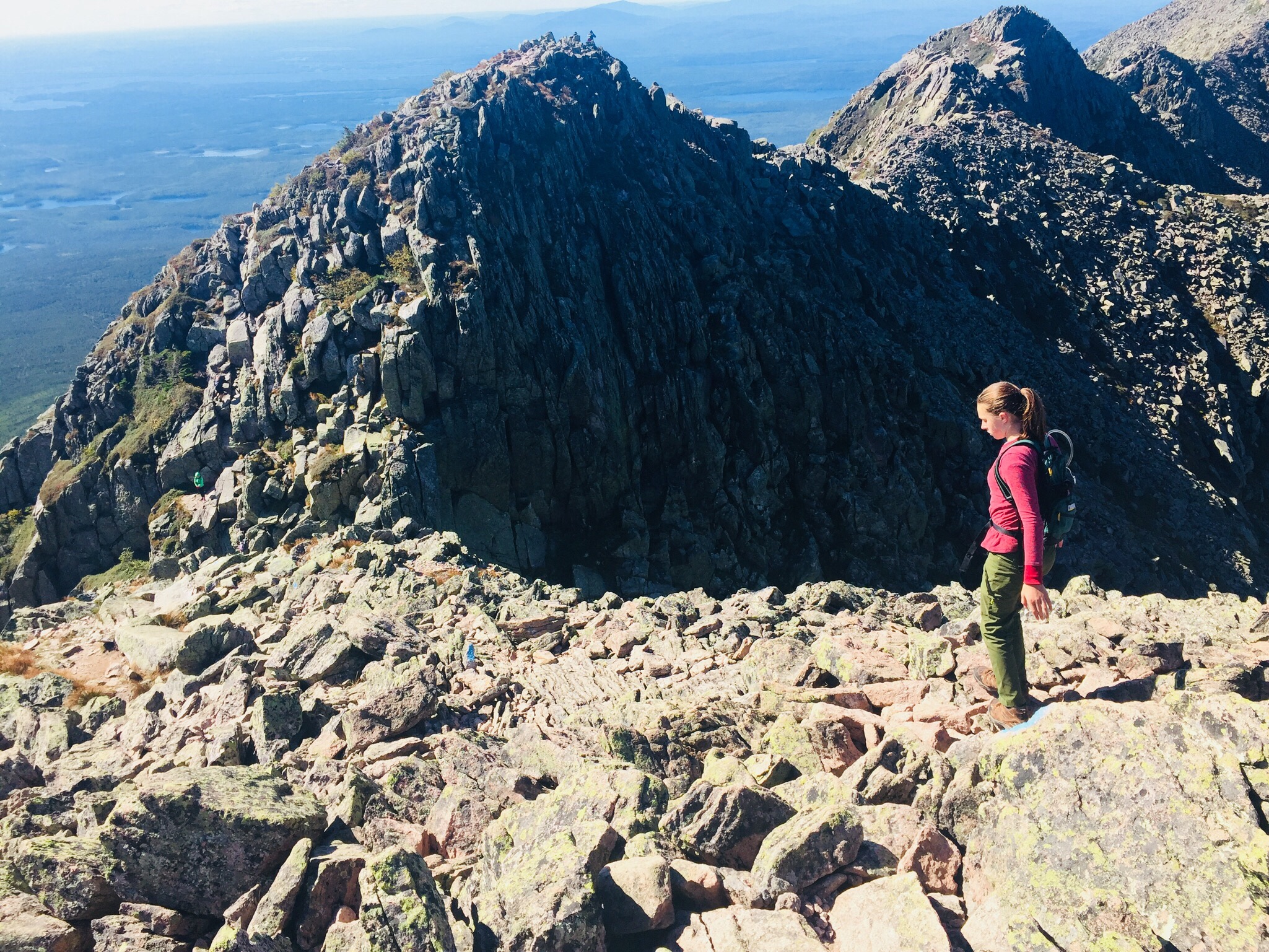
The first step of the Knife Edge was the descent into the chimney adjoining Pamola, then a quick climb back up, setting the tone for a fun traverse. We saw several other groups of people crossing the Knife Edge, including some coming from the direction of Baxter Peak, one of which contained the only other child we saw, a nimble little boy, younger than daughter, leaping from rock to rock.
The Knife Edge Trail is a dizzying series of up and down climbs.
After the climb up Helon Taylor, exposed to the wind, and steeply ascending until our legs ached, we agreed that the Knife Edge was more mentally than physically challenging, and stopped frequently to gaze down into the bowl created by the steep cliffs of Katahdin, look at rock slides down the cliffs to the south, and watch ravens wheel and glide on the air currents below us.
We did not spend long on the summit of Baxter Peak, which was crowded with thru-hikers and large groups, with a long line to take pictures at the summit sign. Millennial-types used the cell service available due to the summit’s elevation to FaceTime with friends (“You’ll never guess where I am right now”) and send Instagram pictures ad nauseam. Daughter waited for a quick break in the action and snapped a ghost summit photo.
A weather-worn sign cautions hikers on the Saddle to take care with alpine plants.
Much more interesting was our meeting on the way down to the Saddle Trail with a Baxter State Park ranger, who educated us about the fragility of alpine plants. She told us that even a small patch can take up to one hundred years to grow back, and can be killed by as few as seven footsteps on it. We asked a number of questions we had gathered during our hike, including why some slides looked different- she explained that the slides where the trees were laying downhill were caused by avalanches in the winter, but that when the mountainside was denuded of vegetation, it meant that a rockslide had occurred. This ranger, from Asheville, North Carolina, works at Baxter from May to October educating hikers, conducting rescues, and sometimes climbs Katahdin every day.
Relaxing on the descent by Chimney Pond.
Our descent of the Saddle Trail was slowed by the onerous process of passing what looked like a large school group, and we got to Chimney Pond around 1:40 PM, where we took a long break to enjoy the sunshine, air out our feet, and birdwatch.
From there, it was a downhill walk over rocks and roots to Roaring Brook and our car, getting back around 3:30, for a total of almost nine hours of hiking. During this last stretch, one of dad’s hiking poles snapped, but our hike was otherwise uneventful.
So what worked? Obviously, chocolate and peanut butter. But daughter felt good about her hiking and running in the weeks leading up to the Knife Edge, and it got her into shape for the climb.
Mentally, we had talked about the challenges, and even used technology to our advantage, watching YouTube videos of the Knife Edge (the volume was quickly muted) to dispel fears. We started hiking with the agreement that we would not stupidly try to push through bad weather, and even reserved another parking spot for the following day, just in case.
We had a ton of water, using our 3 Liter Osprey hydration systems (Dad still ran out with a mile or two left to go). Dad carried a light pack with extra clothing layers and food. Daughter stayed with a Camelbak pack that allowed her to carry water and a few energy bars, but didn’t hinder her while climbing.
We shared a great hike, and daughter enjoyed being the tallest thing in Maine, even for a few seconds. With the right attitude, preparation, and training, the Knife Edge can be an incredible, unforgettable experience for kids, as part of an exploration of Maine’s tallest mountain and the limits within themselves. Even an unsuccessful attempt, safely and properly handled, can create a goal for future conquest, and build decision-making and risk management skills.
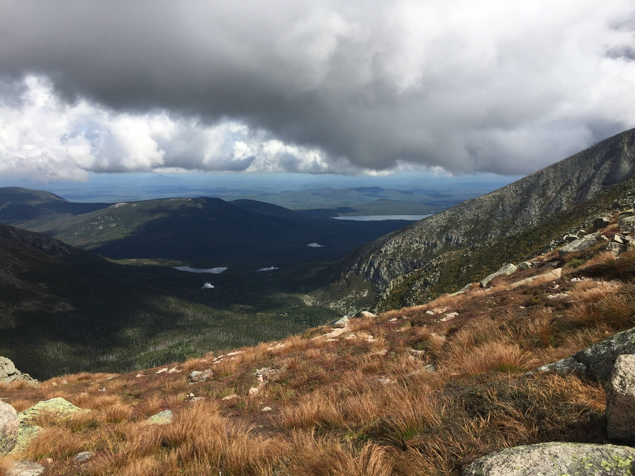
Keeping an eye on the weather on our descent down the Saddle Trail.
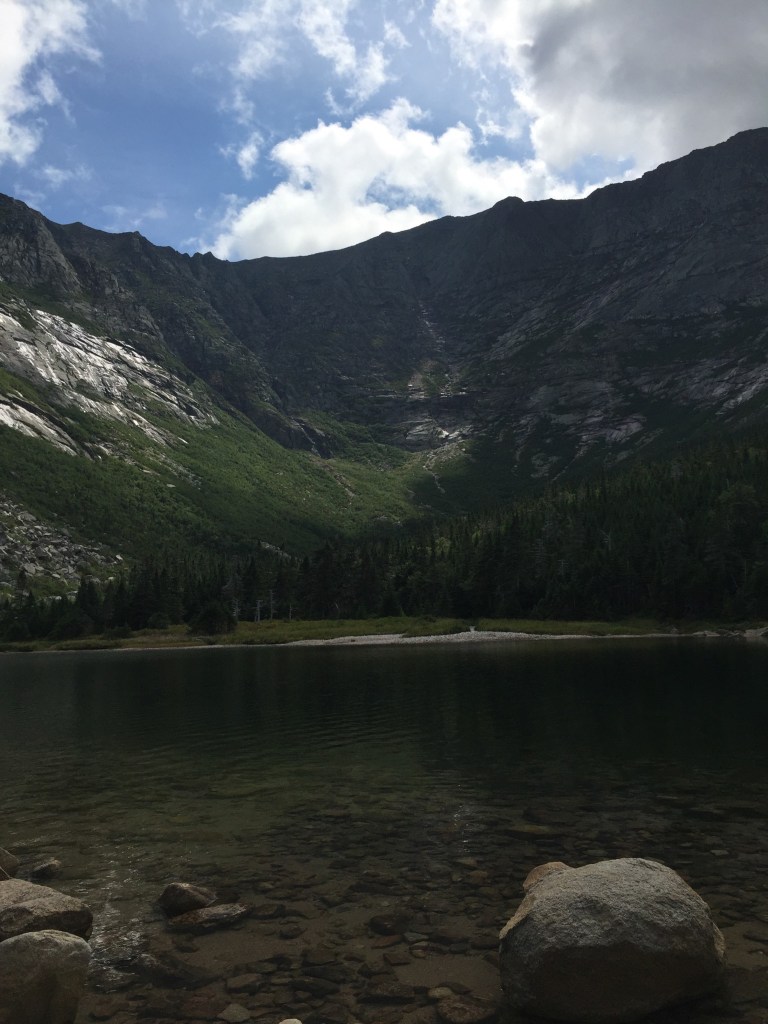
Katahdin is the grandfather of Maine mountains, and the northern terminus of the Appalachian Trail. It’s hard to describe the way Katahdin’s bulk dominates the landscape without actually seeing it for yourself. Dad and daughter climbed Katahdin’s Baxter Peak (5,268 ft) via the Chimney Pond, Cathedral, and Saddle Trails (total R/T appx 10.5 mi) on September 9, 2017 to cap off our spring and summer of hiking. Dad had previously hiked Katahdin via the Hunt Trail (11 mi R/T), and via the Helon Taylor, Knife Edge, Saddle, and Chimney Pond Trails (total R/T appx 10.2 mi), but this was daughter’s first ascent.
(Note: for a deeper dive on the Knife Edge Trail, check out this update in September 2018.)
Here is the Katahdin trail map from the Baxter State Park website, which wisely suggests allowing 8 to 12 hours for a Katahdin hike, and has all the info you will need for a successful hike:
Climbing Katahdin requires some prior planning, due to the remoteness of Baxter State Park. We stayed in Millinocket the night before our climb, as well as the night after, as not much was available for campsites within the park. We booked late, and due to a good deal, stayed both nights at a large suite in the Parks Edge Inn, which was more space than we needed, but it would be a perfect arrangement for a larger group of hikers, as it was cozy, friendly, there was a kitchen, and there were plenty of places to sleep.
View of Katahdin from the Chimney Pond Trail.
Our day started early, with the drive out to wait in line by the park’s gate. Luckily, dad had secured a parking pass for the Roaring Brook campground beforehand, and we weren’t turned away, as some in line were. Definitely plan ahead, and allow yourself the time to get to Baxter State Park’s gate, as well as the time for the slow drive on the Park’s dirt roads to wherever your trailhead is, as this will always take longer than you think.
The Knife Edge from Chimney Pond.
We parked at Roaring Brook, took a look at the scale model of the mountain at the ranger station there, signed the log, and began our trek beside Roaring Brook on the Chimney Pond trail.
Chimney Pond is beautiful, and a great jumping-off point for multiple hikes, as well as family-friendly ranger-led programs in the summertime. With ominous clouds moving in, we signed the trail log, got advice from the ranger at Chimney Pond to avoid descending the Cathedral Trail, and decided to make our push up Cathedral, and to return via the Saddle Trail. We decided we would forgo the Knife Edge, and take it the next time the weather allowed us to.
The Knife Edge on a previous ascent – not for the faint of heart.
Dad and daughter started the steep climb, and mom, who had accompanied us on this trip and hiked with us as far as the Chimney Pond Campground, then turned back to wait at the Roaring Brook lot for us as we climbed to the top. We felt strong, and our packs were intentionally light, focused on water, food, and light rain gear (in that order).
Dad/daughter each carried a 3 Liter Osprey water bladder (dad is one of those humans who just flat-out uses a lot of water), and we left daughter’s less full to reduce weight. Water on Katahdin is crucial, as straining leg muscles can easily dehydrate and cramp up, making for a difficult trip. In addition to water, eating bananas, and/or taking small amounts of salt and magnesium with food can help counter this cramping.
Daughter pushing up the Cathedral Trail.
We encountered several other pairs of hikers, who we spoke to briefly as we leap-frogged our way past and then behind them again during rest breaks. Cathedral was a serious climb, with a few hand-over-hand scrambles to follow the blue blazes.
We didn’t linger long at the summit of Baxter Peak, or stay for our planned lunch break. There was a large crowd that had come up the Hunt Trail, and the clouds did not look friendly. When dad did this hike the first time, it had been an icy affair, with stinging hail and ice, combined with a steady rain, and sure enough, we heard distant thunder, and started to feel a few drops.
Looking back at Pamola Peak and the Knife Edge from the Saddle Trail.
We scrambled down the Saddle Trail as the rain began to pick up, and about halfway down, dad’s feet went out from under him on a wet rock, and he took the weight on his wrist. The pain was dazzling, and we looked at the joint and the hand, but besides the discomfort, it appeared to be fine, so dad pulled it into his stomach to minimize the jostling as we descended, and we kept going.
The rain really began coming down, and we stopped in the treeline to put covers on our packs, and for daughter to don her rain jacket. The rain began to lighten while we stopped to enjoy some PB+J in a covered shelter at the Chimney Pond Campground. From there, we covered the ground quickly down the Chimney Pond Trail to the Roaring Brook lot, and our truck.
Getting back in the truck, dad realized that he couldn’t shift, steer, or turn the keys in the ignition with his right hand, and used his left to reach over the wheel for these tasks. As we wrote in our brief post on this hike to start this blog back in September 2017, it turned out, after X-rays a couple weeks later, that the wrist was broken. Bummer. Again, a great argument for the utility of hiking poles on a slippery descent, which would likely have mitigated this injury.
Daughter and dad agreed that Katahdin was the most challenging mountain of the summer, far surpassing Washington. We were happy with our route, and would suggest it to those tackling Katahdin when the Knife Edge is not a good idea due to weather. Cathedral offered us incredible views, and we used our rest breaks to turn and survey our progress and the landscape. We are looking forward to hiking Katahdin again, as well as exploring more of the newly established Katahdin Woods and Waters National Monument.
A Post Script….
We did enjoy a great mini-hike the following day on the way home, as we had a full day available to us. We stopped on the way south at the Orono Bog Walk, a 1-mile boardwalk loop that starts at the Bangor City Forest.
We really like plaid.
This was fascinating, particularly for the opportunity to see pitcher plants, which we had seen in the Barren-Chairback range during our 100 Mile hike, and for the many varieties of birds along the route.
Views from the Orono Bog boardwalk.
It was also a relatively easy loop, and an opportunity to stretch our legs after Katahdin the day before. Larger loops are well-marked and available for running and walking within the adjacent City Forest. Just get there early- parking was at a premium.
(Note: The Katahdin Loop Road opened for the 2020 season on Saturday, May 23. U.S. National Park Service advises to drive with caution and be alert for soft spots and rough road sections. Haskell and Big Spring Brook Huts are temporarily closed, and updates will be posted to the NPS website.)
The standard route into the South Entrance is via Route 11 from E. Millinocket/Medway to the Swift Brook Road along the Katahdin Woods and Waters Scenic Byway, but we were feeling adventurous, and took the Stacyville Road north from Millinocket to where it meets the Swift Brook Road. We savored the lonely ride along this quiet logging road, occasionally startling game birds (this is not the way to take a low-clearance or non 4×4 vehicle).
The 17-mile loop of Katahdin Loop Road is punctuated by meadows, bogs, and ridges, and the south and west parts of the loop boast excellent views of Katahdin and the surrounding area. This is an opportunity to see the Monument and cover distance in a vehicle, while having the chance to get out and explore at a variety of hiking paths and overlooks. The best map of the loop we found (which I wish we had when we were there, as it is also an excellent interpretive guide) was from the Friends of Katahdin Woods and Waters, and can be found here.
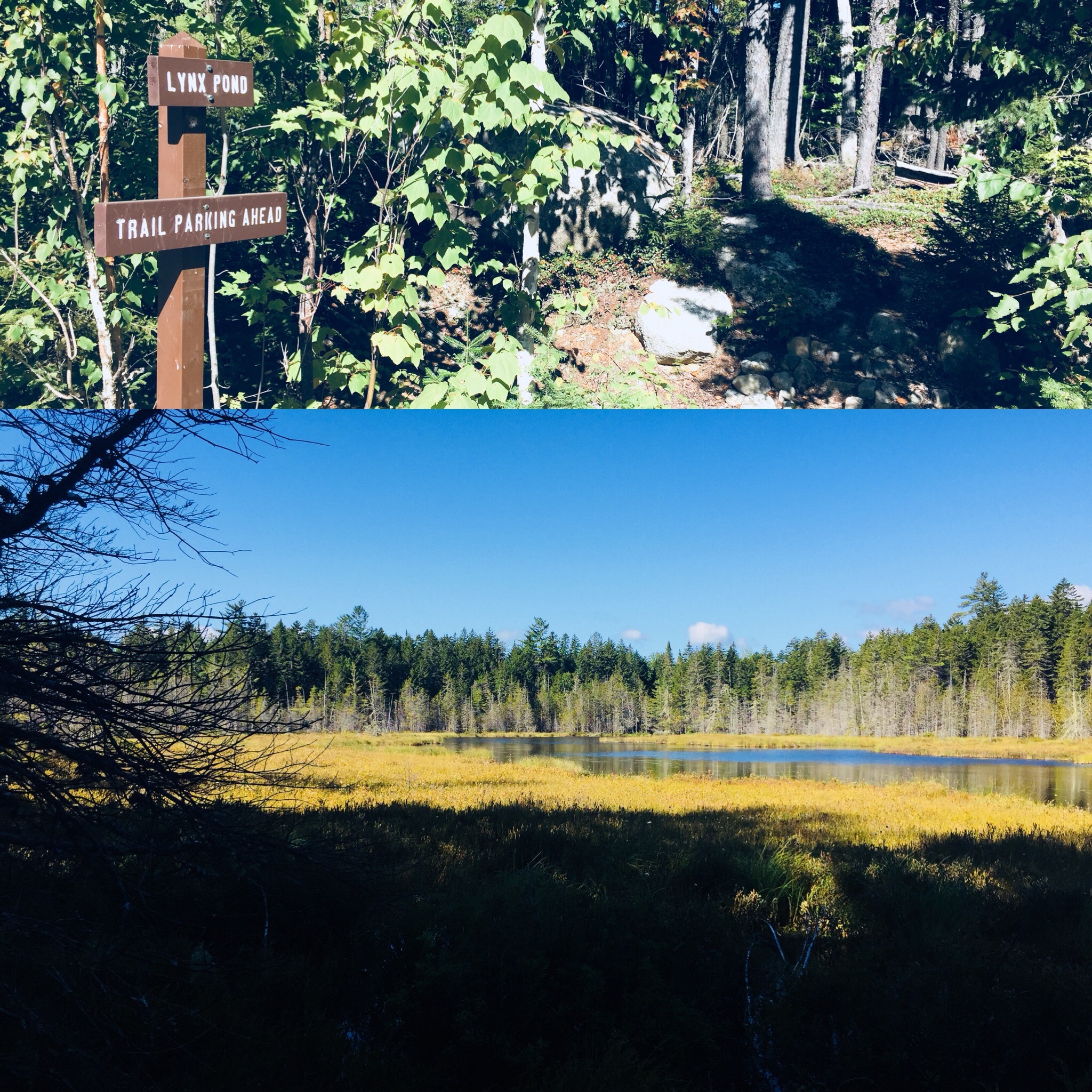
Lynx Pond
The Lynx Pond Walk is shortly past the Loop Road Gate, on the right just past the Mile 2 marker. Shortly after the trailhead is a parking area on the left of the Loop Road. This is a very short walk through the woods to a small boardwalk by the pond, and a spot for quiet reflection and wildlife viewing.
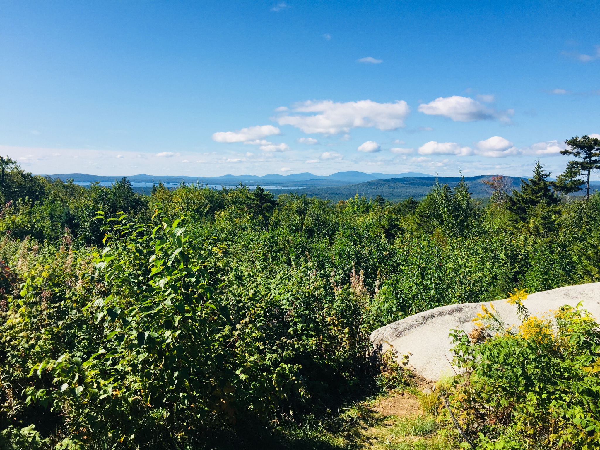
Looking south from The Overlook on Katahdin Loop Road. The large lake is Millinocket Lake.
Views of Katahdin from The Overlook on Katahdin Loop Road
Katahdin towers over the loop, and there are multiple spots around the Loop Road with views of the lakes and mountains to the west and south, particularly The Overlook, between Miles 6 and 7, which conveniently has a picnic spot and a toilet.
The IAT and trail to Barnard Mountain
IAT Lean-To (toilet is behind lean-to)
We continued around the Loop Road, and got out to stretch our legs again at the International Appalachian Trail (IAT) and trail to Barnard Mountain, passing over Katahdin Brook and by the IAT lean-to. This wide logging road made for a sunny trail, and though we did not make the turn towards the Barnard Mountain summit, we enjoyed the walk, and the familiar plants and animals that inhabit newly overgrown woodcuts, with blue jays diving across our path and into the trees. The Barnard Mountain trail itself is a moderate 4-mile round trip with summit views of Katahdin and Katahdin Lake to the west.
Late summer flowers and plants along the IAT
The IAT continues from the northern terminus of the Appalachian Trail at Baxter Peak across Maine, into Canada, across to Greenland, and Europe, to the Atlas Mountains of Morocco. For a great exploration of the concept of the IAT, see On Trails by Robert Moor, reviewed on this blog.
Moose tracks and droppings on the IAT
There are seven mountains in the Monument to hike, including Barnard, as well as paddling opportunities and waterfalls. The Loop Road was quiet, as were the trails, with natural sounds, and only a few others exploring the area. A bumpy drive back down Stacyville Road took us to Millinocket, where we devoured a Hawaiian pizza without remorse at the Millinocket House of Pizza.
Katahdin Woods and Waters National Monument is a special place, and we will be back there for hiking, biking, and paddling. The views during peak foliage season must be spectacular. Ensure you plan ahead, bring maps, and a cooler with water and snacks, as there are no facilities at the Monument, and cell coverage ranges from little to non-existent. But that’s probably what you’re looking for in the first place.
In an age of technology and enlightenment, physical borders remain enigmatically relevant. While information and intellectual property pass by on hidden virtual pathways, we are confronted daily with news of aggressive border incursions, walls, migration and separation. Porter Fox’s book Northland: A 4,000-Mile Journey Along America’s Forgotten Border (W.W. Norton and Company) navigates these troubled waters in a modern pilgrimage along the U.S.-Canadian border from Maine to Washington State.
Fox’s adventurous journey along the border (which splits both man-made and natural features, and has constantly been re-drawn and argued by the U.S. and Canada) was conceived during a 2014 lunch with Fox, his editor, and his agent, and brought to life “three years and four thousand miles later” by canoe, freighter, car, and foot. The fourth dimension of this journey is the history of tribal peoples and European exploration, which Fox weaves skillfully alongside his own narrative.
Fox divides the journey into five parts from east to west: the Dawnland, the Sweet-Water Seas, Boundary Waters, Seven Fires, and the Medicine Line. Not by accident, the origin of most of these names is drawn from the native populations who are omnipresent in the narrative, their proximity to the border a fateful combination of ancestry and displacement.
Fox finds commonality in all the populations banding the U.S.- Canadian border: social and personality traits mandated by the climate, economy, and the very nature of the stark world between two countries which these “northlanders” straddle. These commonalities include “[e]thnic communities with centuries-old histories, small towns that modern America skipped over, forgotten industries and Old World professions that rely on hands, not machines.”
The saga of these northlanders is not the only origin story: the birth of many things, from the U.S. Coast Guard to Thousand Island Dressing, is hidden within these pages. Fox takes the best approach in a travel book, making himself an observer, rather than an actor, and documenting the stories of those he encounters. This is not navel-gazing, this is journalism. Fox’s own story only emerges during brief memories of his own northland origins in Maine, or in humorous or poignant interactions with people along the way.
Fox also refrains from preaching or taking sides – any reasonable person can make their own conclusions regarding the effects of global warming, incompetent border management, marginalization of native peoples, or over-fishing and deforestation, making a diatribe superfluous. Fox observes:
It looked like night. The sky and land were dark. Flames blazed above tall, cylindrical smokestacks, casting orange light on the ship. The waterfront was barricaded by dunes of iron ore pellets and coal. It was nine in the morning. The water was oily green. I looked through the porthole in my cabin and saw a truck pour molten slag into a ditch. A bright-orange splash flew into the water and incinerated a duck swimming by.
Thus continues Fox’s story of his journey from the Saint Lambert Lock in Montreal up the Saint Lawrence Seaway through the Great Lakes (Ontario, Erie, Huron, Superior) to Thunder Bay, Ontario on the Algoma Equinox, a 740-foot freighter, reading like the opening of a post-apocalyptic version of Ben E. King’s Stand by Me.
It is in this excellent section on The Sweet-Water Seas that Fox truly hits his stride, capturing the chaotic, spooky world of the Equinox and its crew, as well as the unforeseen benefit of only traveling ten miles an hour. Fox writes beautifully, carefully, and sympathetically about the people and places along this route, interspersing modern vignettes with the movements of glaciers, floods, Champlain, La Salle, and inexorable commerce.
The book is full of these interactive moments that capture so much. Fox visits the Boundary Waters of Minnesota with Paul and Sue, legendary guides and explorers, watching Sue swing a canoe onto her shoulders for portage, “like putting on a sweater, except the sweater was a sixteen-foot Kevlar hull.” In North Dakota, Fox visits the Standing Rock protest camp of the Sioux Nation, against the Dakota Access Pipeline, and in Idaho, interviews a militia leader, who gives him “the kind of cheery welcome you’d expect from a car salesman.”
An otherwise-mundane guided tour (“The tour group itself was a thing of antiquity. I was the only one under the age of eighty. The comb-over on the man beside me was a work of art.”) of the Glacier Park Lodge in Browning, Montana yields an unexpected insight when the tour guide shows Fox and the group a large-format black-and-white photograph shot in the late 1800s:
The image was of two Blackfeet riders on a grassy knoll. Behind them were a forest and a few high peaks. Their hair was braided. The one in the front wore deerskins; the one behind wore blankets. Mist covered a valley at the foot of the mountains. There was no sun – just a dark line between earth and sky.
Amid the cedars, buffalo skulls, and antique china, the photo was indeed the only object in the lodge of extraordinary value. It was a split second in time from a lost world. “I like showing people this last,” the guide said. “I like them to know that we weren’t the first people to live here.”
By the time the journey ends, on a coastal Lummi tribal reservation at the western end of the border in Washington state, the reader has skillfully been transported stride-by-stride with Fox through the past, and across the northland. In his introduction, Fox explains that he wanted to visit the northland again before it changed for good. The borderlands seem to change more slowly than the center, giving us a glimpse into the past. In these margins, we see the cost of progress, and the stark natural beauty of the land that was, giving us pause about the right way forward.
(Disclaimer: This post contains affiliate links, and as an Amazon Associate Hiking in Maine blog earns from qualifying purchases.)
The hardest part about replacing my earlier (10th) edition of the AMC Maine Mountain Guide, 11th Edition (Appalachian Mountain Club Books), compiled and edited by Carey Michael Kish, was carefully transferring all of my handwritten notes and highlighter marks. The smashed mosquitoes and coffee stains I will have to replace as I go. Kish recently posted an article on Maine Today regarding the new edition.
As referred to many times on this blog, this indispensable book has been the starting point for countless adventures over the last couple years. According to the back jacket of the new AMC Maine Mountain Guide, this new 11th edition features 175 new trails, 50 new mountains, and 17 additional in-text maps, “capturing Maine’s booming trail building and expansion during the past five years.” Additionally, the existing trails include more details and updates, including more than 450 trail revisions.
In his Foreword, Carey Kish relates his hiking history, with the interestingly prescient detail that Kish bought his first Maine Mountain Guide in 1976. The Acknowledgements section shows the true breadth and depth of the book, with tips of the cap to AMC staff, Maine state departments, and a long list of names from “Maine’s incredible community of land trusts, conservation organizations, environmental agencies, trail clubs, trail advocates, outdoor recreation groups, and other good friends of Maine trails.” And it really must take a village to compile this book.
The introduction includes helpful information and advice for hikers specific to Maine, including descriptions of Maine geography and geology, climate, vegetation, animals, and trail etiquette. For map and GPS nerds, the section on Maps and Navigation (at the tail end of “How To Use This Book” is packed with reference books and maps to use as companions to the guide, with a short segment on LiDAR data, and how it has been used to correct the summit height of peaks. There is even a sample packing list (you are going to want those convertible pants), and a common-sense primer on backcountry hazards.
So what changed? The first Section is on Maine’s showpiece, Baxter State Park and Katahdin, and the new layout is apparent. The Suggested Hikes, which were previously at the end of each Section, are now at the beginning, in order from least difficult to most. The Trail Descriptions of the sixteen trails to the six major summits of Katahdin are now each prefaced with a table showing distance, elevation gain, and projected time to allow yourself.
These information-age upgrades haven’t changed the narrative, however, or characterizations such as that of the Knife Edge: “The dizzying height, sheer cliffs, and extreme exposure combine to make this one of the most spectacular mountain trails in the eastern United States.” This descriptive prose, fortified with weather warnings, sources of water, and historical notes on the trails, is the continuing magic of this guide.
The Sections of Maine have been broadened from ten to twelve, with stand-alone sections for Mahoosuc Range and Grafton Notch (Section 5), and White Mountain National Forest and Evans Notch (Section 6). It really is an expansion, and I skipped to some recent hikes I’d done to see the differences. I noticed subtle edits in the Downeast hikes I’d done recently, and updated road names added to trailhead directions.
Viewing the Southwestern Maine portion (Section 8), I noticed six brand new in-text maps in that section alone, with popular trails Bradbury Mountain State Park, Douglas Mtn. Preserve, Bald Pate Preserve, Burnt Meadow Mtn., Mt. Cutler, and Mt. Agamenticus all getting their own cartography. New trails also debut, like the 47-mile Hills to Sea trail through eastern Waldo County from Unity to Belfast, which was opened to the public in 2016.
The book ends with Appendices listing alphabetical contacts for the trails and lands listed in the guide, from the Appalachian Mountain Club to the Woodstock Conservation Commission, and checklists for New England 4,000 footers and New England 100 Highest. And in the back of the book are two pull-out map sheets, containing a total of six large-scale trail maps of Baxter State Park, Maine Woods, Bigelow Range, Camden Hills, Eastern Mount Desert Island, and Mahoosuc Range-Evans Notch.
The 11th Edition of the AMC Maine Mountain Guide has been completely revised and updated while maintaining its essential character, an impressive achievement. This is truly the hiking handbook for the state of Maine, and a must-have for outdoor explorers of all levels.
(Disclaimer: This post contains affiliate links, and as an Amazon Associate Hiking in Maine blog earns from qualifying purchases.)
When I first looked through the 35 trails listed in Aislinn Sarnacki’s book Maine Hikes Off the Beaten Path: 35 Trails Waiting to be Discovered, (Down East Books, 2018) I remembered how much in Maine is left to be hiked, a realization which is both humbling and encouraging. Sarnacki, the outdoor columnist for the Bangor Daily News, has assembled an eclectic, formidable line-up of trails spanning the Pine Tree State. Her introduction to the book spells out her goal in writing this book, starting with her journey into hiking, detailing a mixed experience ascending Katahdin at age sixteen, when she was “far from hooked on the activity.”
Sarnacki discusses how hiking subsequently got her through tough times, culminating in an undergraduate thesis on the positive ways it can affect a person’s holistic health, and a job at the Bangor Daily News writing Outdoors features. Sarnacki explains the changing map of trails in Maine, and her navigation of information provided by state parks, land trusts and other non-profit organizations to find these trails (did you know there are more than 40 other peaks besides Katahdin in Baxter State Park? I didn’t).
Sarnacki continues the introduction with a wonderful explanation of the value of Leave No Trace, with a description of Abol Pond during a Leave No Trace trainer course, and the change in enjoyment of natural beauty with the observation of the policy, versus without. She then provides helpful sections entitled Staying Safe While Hiking (all good tips – “Spoil Your Feet” and the limited use of helpful technology in particular) and At War With Ticks (common-sense strategies for dealing with an emerging problem).
The 35 hikes described by Sarnacki are spread across the state, bracketed by Wells Barren Preserve in in the south, Moosehorn National Wildlife Refuge to the east, Scopan Mountain near Presque Isle to the north, and Aziscohos Mountain in Lincoln Plantation to the west (man, I hope I got that right). Each includes a detailed description, detailing the Difficulty, Dogs (permitted or no?), any Cost or fee, Access (accessible overnight? four seasons?), Wheelchair accessibility, Hunting, Restrooms, How to get to the trailhead, and precise GPS coordinates.
Each trail has a clear, accurate map (take a photo of the map with your cellphone if you don’t feel like carrying the book with you on a hike), and excellent photos that give you an idea of the trail’s surroundings and vista points. Sarnacki describes the plants and animals to be encountered, gemstones and rocks, trail markings (or lack thereof), interpretive signs, and everything in between. To the extent there are land trusts, a town office, or other caretakers of the trail, Sarnacki provides web addresses and telephone numbers for more information, and personal notes with helpful anecdotes for the area or the trail.
These detailed vignettes brought back the best part of talking about hiking and trails, the part that is mostly lost in the technical focus of apps and guidebooks: word-of-mouth referrals for hidden outdoor gems, and personal stories about these special places. It is these connections that keep us coming back, and Sarnacki’s writing does an excellent job of capturing that idea. Having just come back from the Grand Lake Stream area, where we enjoyed the Baxter Outdoors New England Trail Series Downeast Lakes 5-Miler, I particularly liked Hike 25, the Little Mayberry Cove Trail, managed by the Downeast Lakes Land Trust (I agree with Sarnacki that the tiny silver and blue trail signs are aesthetically pleasing), and the photos capturing the changing light along the trails.
Reading through this book, I found myself continually reaching for my Maine Gazetteer to look at the hikes, and running through road trips in my head. As a result, this new book is already dog-eared and bookmarked with ideas, which is the mark of a truly adventurous guide. As Sarnacki concluded in her introduction, I was inspired “to get out there, off the beaten path.”
(Disclaimer: This post contains affiliate links, and as an Amazon Associate Hiking in Maine blog earns from qualifying purchases.)
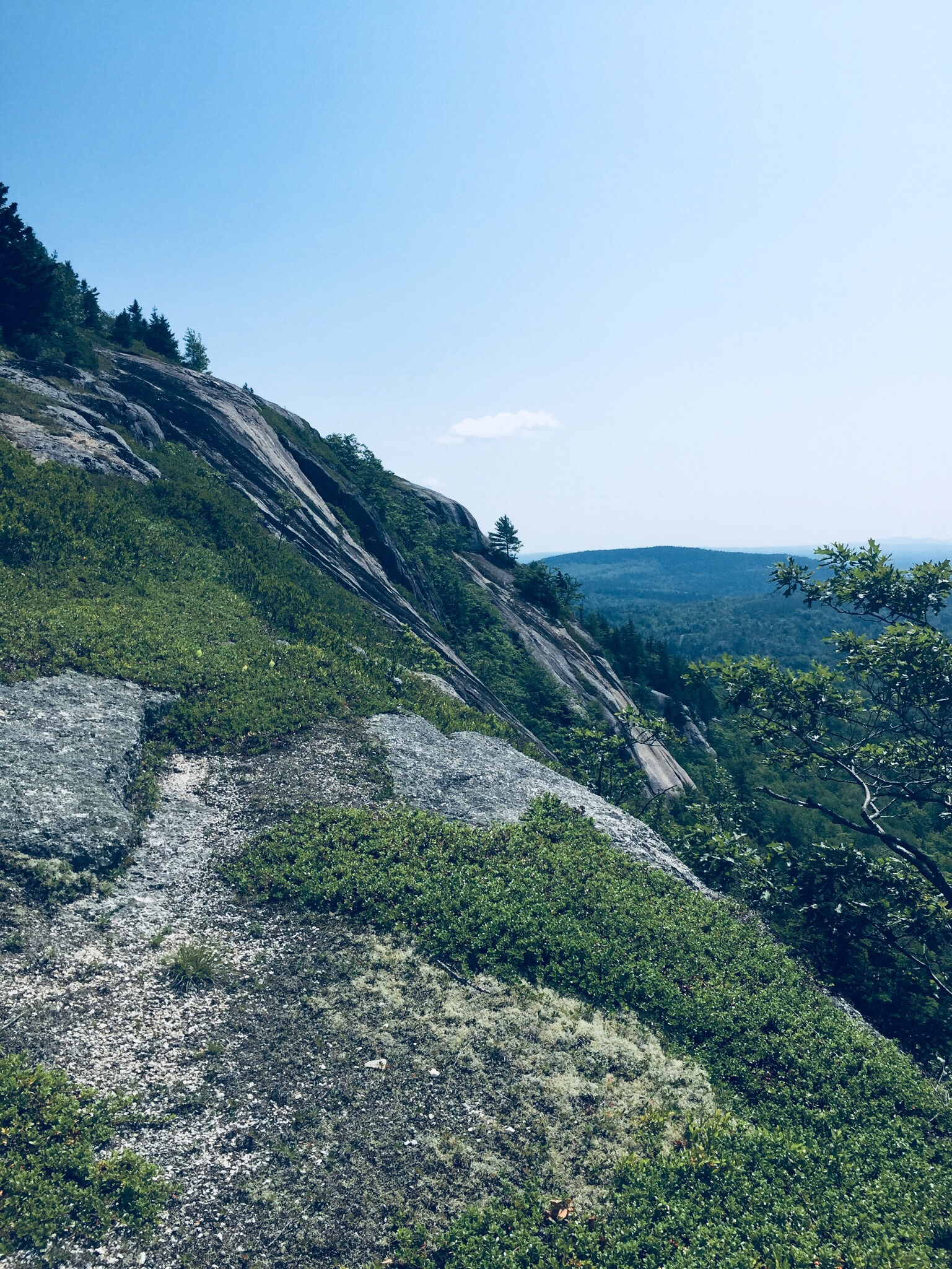
In August 2018, we hiked Peaked Mountain (1,160 ft), also known as Chick Hill, in the Clifton-Amherst area off Route 9. For years, we had observed the massive cliffs of Peaked and Little Peaked Mountains looming over the Airline, and hiking to the top was a great experience. We took our instructions from the AMC Maine Mountain Guide, as well as a November 2017 Portland Press Herald article by Carey Kish on Airline Road hikes. We did this 2.2 mile up-and-back hike during a sweltering heat wave, with temperatures in the nineties, and it took us about an hour, total.
The gradual climb up the gravel road, bounded by wildflowers and berries.
The steep trail that turns off through the woods at utility pole 18.
The trail route provided by the AMC guide needs no addition – we easily followed the logging road (fire road 32) from the trailhead, past the turn-off for Little Peaked Mountain, and turned into the woods at utility pole 18. A steep trail through the woods (which felt like a jungle on this hot, humid day) leads up to the open areas below the summit.
Mom/wife and daughter reached the cliff edge below the summit, and enjoyed the cooler breezes, while Dad continued to the top and looked at the expansive views. The longer alternative, taken by another group of hikers while we were there, is to take the road all the way to the summit cell tower.
Benchmark at summit.
Cell tower at the end of gravel road.
The trip down the mountain was much faster than the way up, descending the gravel road with occasional stops for raspberries and blackberries. Little Peaked Mountain would have to wait for next time. Most importantly, a stop on Route 9 in Aurora at Mace’s American Snackbar for cold Gifford’s ice cream capped a great hike.
(Disclaimer: This post contains affiliate links, and as an Amazon Associate Hiking in Maine blog earns from qualifying purchases.)
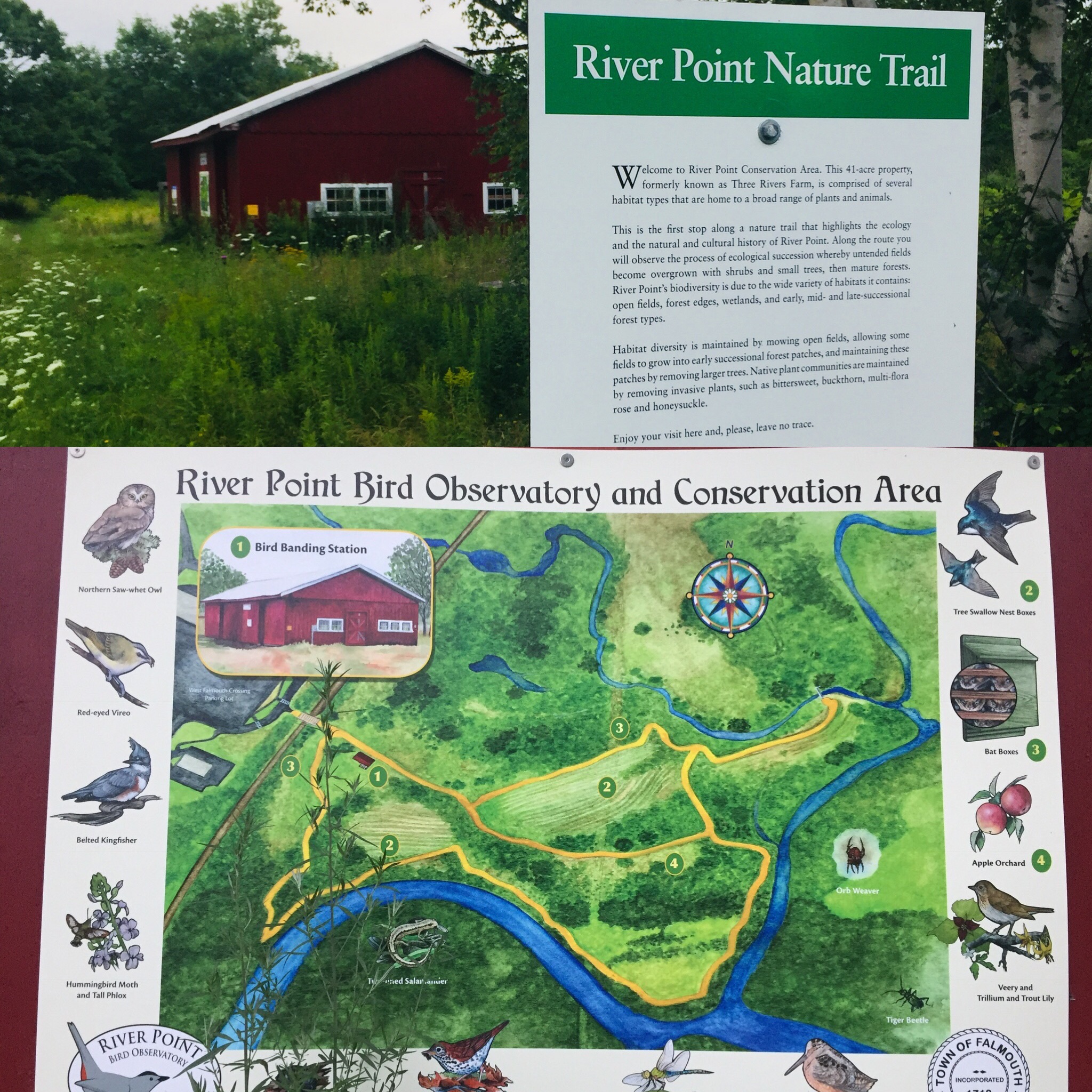
Off the West Falmouth exit of I-95 (exit 53), tucked behind the Hannaford plaza, is a hidden gem. You can find a detailed description of the land and its history at the Town of Falmouth site regarding the River Point Conservation Area. This 1.4 mile network of trails also links to the Cross Falmouth trails and Portland Trails, as well as being accessible by canoe from the Presumpscot River.
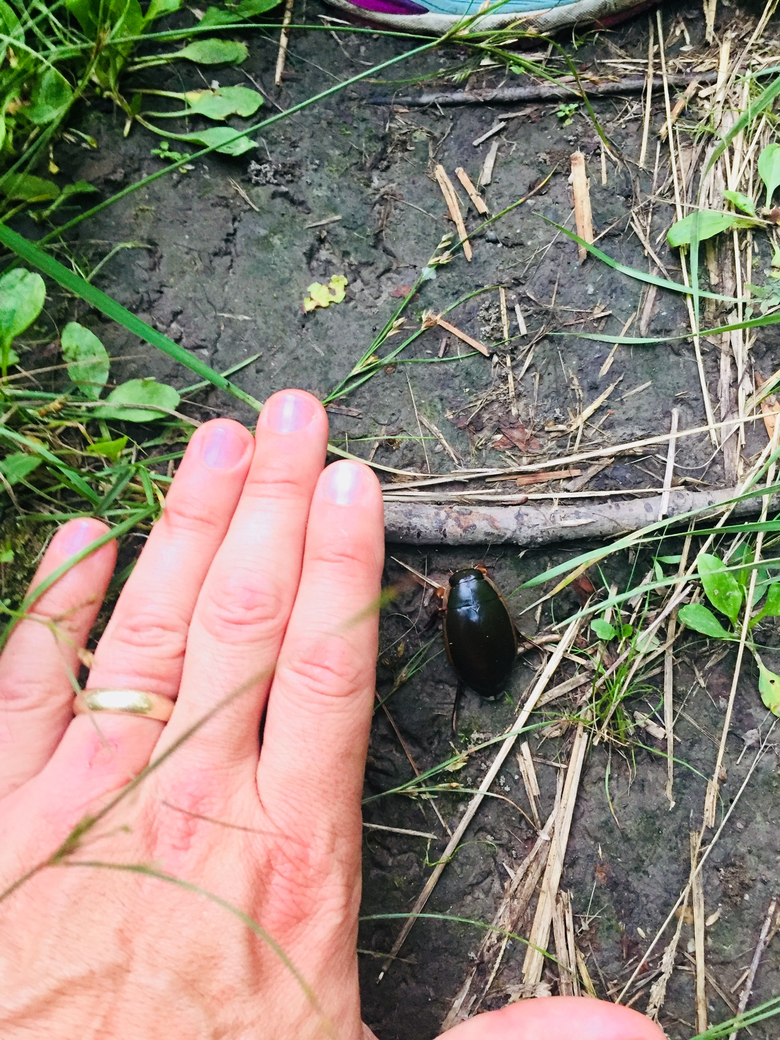
On the cloudy late July afternoon we visited the trails, mosquitoes were thick, and ticks were abundant in the tall grassy areas, so plan appropriately with insect repellent/gear. This did not hamper our enjoyment of the flowers and birds throughout the conservation area. Also, stay on the trails to avoid poison ivy.
Interpretive signs along the trails.
The interpretive signs along the trail would be good for scavenger hunt-type activities with kids, and provide insight to the area, its history, and the flora and fauna that inhabit it. The signs also disclose that the trail is sponsored by Dunkin Donuts, which has a location at the adjacent shopping center.
A massive beetle encountered on the trail.
According to the Town of Falmouth website, River Point was used for thousands of years as a campsite by Native Americans as they traveled seasonally from Sebago Lake to the ocean. The first white settlers homesteaded the original 151-acre property in 1775, and farmed there until 1883, establishing a brickyard and shingle mill on the property. In 1859, the Kennebec & Portland Railroad line bisected the property. The bridge, the only bridge in Maine built to connect to just one house, provided access to Route 100. The town acquired River Point in 1995 when the shopping center was developed. The Town Council designated the 41-acre property as a conservation area in 2009.
This small conservation area, with a short, flat loop trail, is perfect for a lunchtime or after-work walk in the greater Portland area, and the open fields, with birdhouses, are excellent places to observe songbirds (and in the evening, bats). The town of Falmouth lists allowable uses as: Hiking, mountain biking, snowshoeing, cross-country skiing, fishing, and nature study. For those with pets, just check the signs beforehand, as pets are not allowed when birds are nesting.


 In August 2018, we hiked Peaked Mountain (1,160 ft), also known as Chick Hill, in the Clifton-Amherst area off Route 9. For years, we had observed the massive cliffs of Peaked and Little Peaked Mountains looming over the Airline, and hiking to the top was a great experience. We took our instructions from the