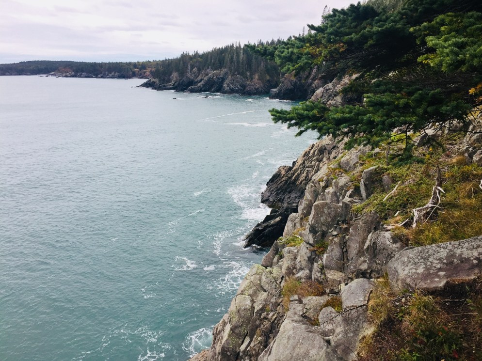
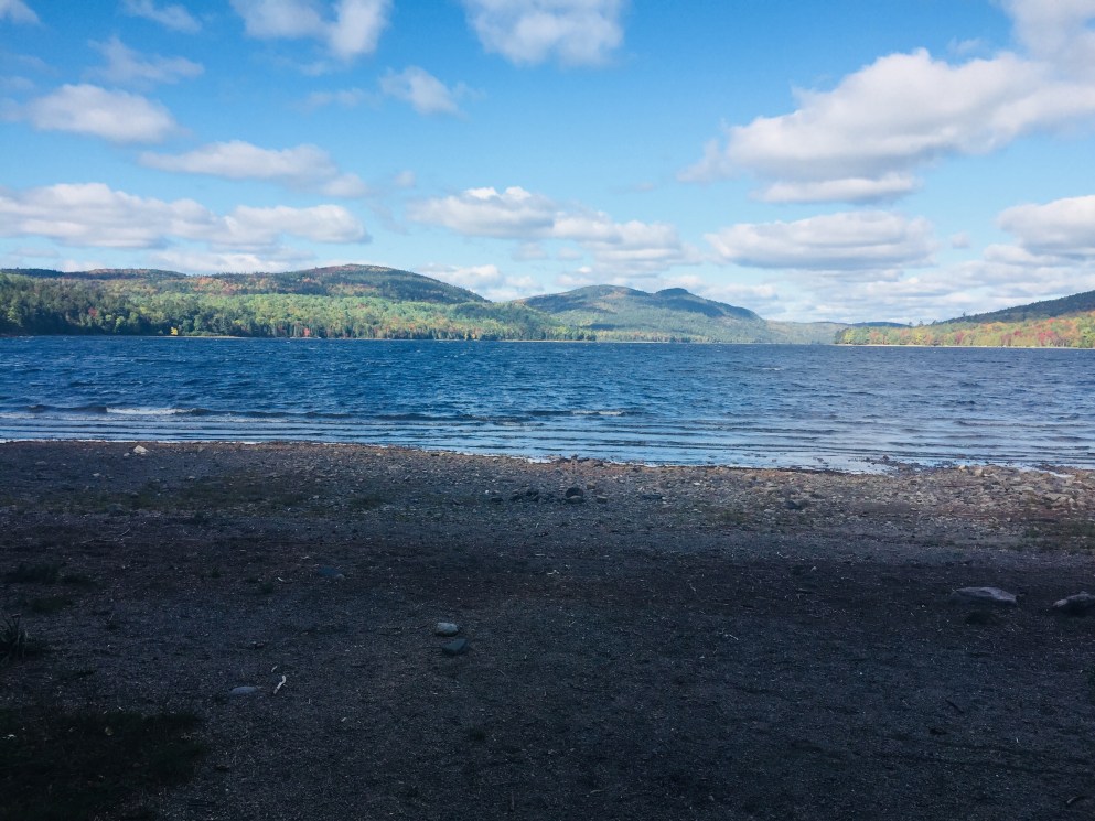
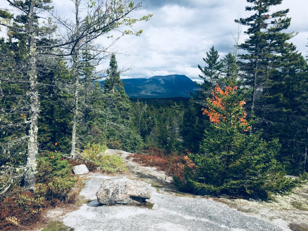
View of the Atlantic from the summit of First Hill, Mount Agamenticus
Mount Agamenticus, overlooking the southern Maine coast, apparently derives its name from an Algonquin coastal place name also used in Gloucester and Charlestown, Massachusetts. It’s not a giant, only 691 feet tall, but is part of the Mount Agamenticus Conservation Region, which covers over 10,000 acres, including over 40 miles of trails, with a trail map here. Its location in York makes it readily accessible from the Maine Turnpike and Route One. I had never climbed Mount Agamenticus, and figured that a looping walk over rolling hills would be a perfect spring tune-up hike.
View towards Mount Washington from First Hill, Mount Agamenticus
These trails allow for a variety of hikes by length and ability. On this spring day, I traversed the First, Second, and Third Hills, using the Ring, Fisher, Big A, Sweet Fern, Chestnut Oak, Ridge, Wheel, Third Hill, and Great Marsh Trails, along with Old Mountain Road, Porcupine, Rocky Road, and, again, Ring Trails to complete a loop of around 7 miles. Much shorter loops are available (the complete Ring Trail loop is only 1.9 miles), and the Ring (west) and Witch Hazel Trails contain a “Story Walk” that might keep younger hikers moving from storyboard to storyboard, up the hill.
Observation Deck, First Hill, Mount Agamenticus
It’s not a long hike from the Mountain Road trailhead to the top of First Hill via the Ring (west) and Fisher Trails – I covered it in fifteen to twenty minutes at a moderate pace. For those with mobility issues, there are also parking lots closer to the top. The open summit has observation decks to orient you to the sights in all directions, from the Atlantic to Mount Washington, and a Learning Lodge is open weekends from 11 am to 3 pm from Memorial Day to Columbus Day.
Picnic Tables, First Hill, Mount Agamenticus
There are picnic tables with views of the ocean, and restroom facilities. Songbirds abound, and I spotted an American Goldfinch near the old ski lift structures. Descending toward Second Hill, the trail still held some ice in shaded places, the only sign of winter’s clutches. The low points around Second and Third Hills were dotted with vernal pools, which were already riotous with the sounds of peepers.
Tree on Second Hill, Mount Agamenticus
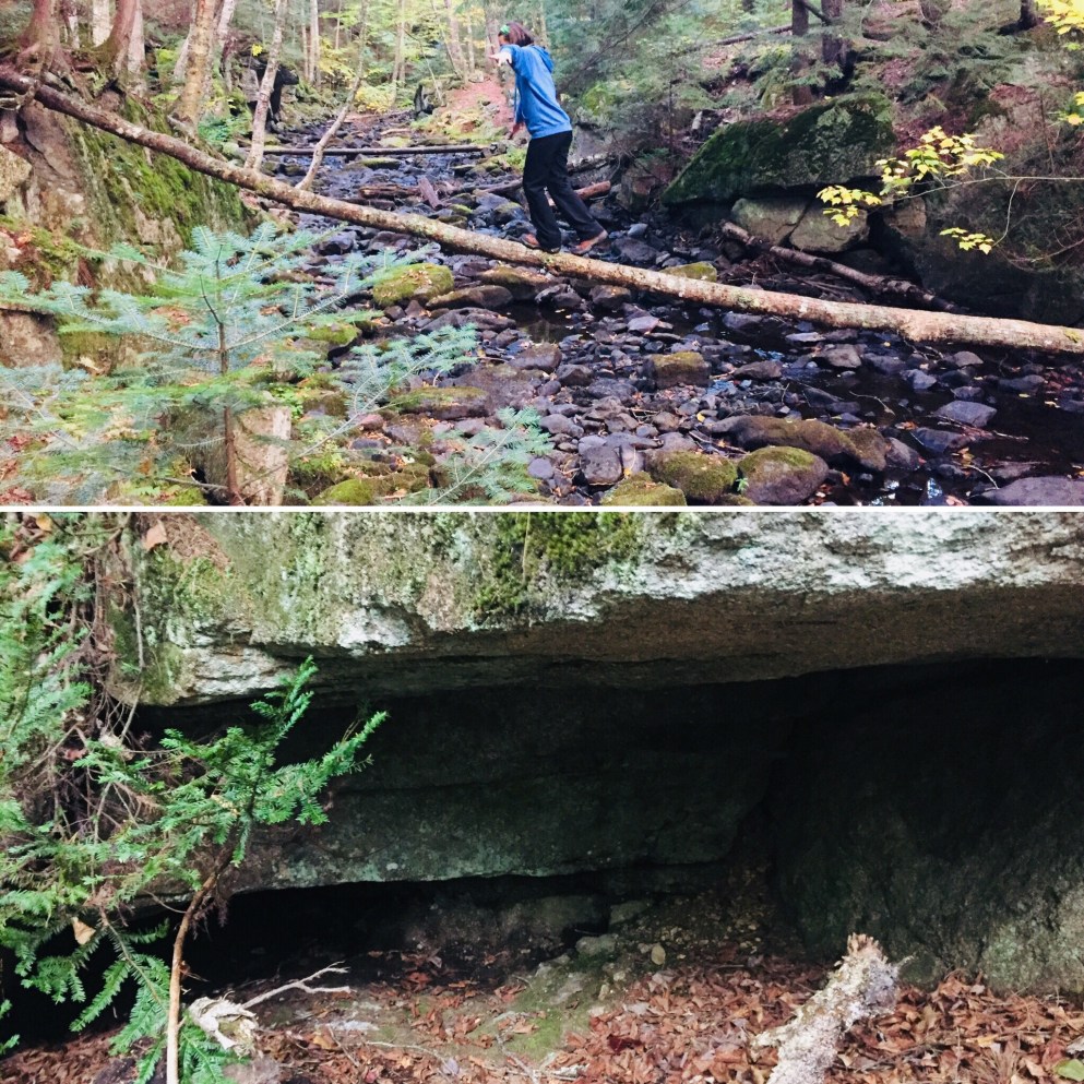
While First Hill is well-trafficked, with trail runners and dog walkers, the only other human being I saw on Second and Third Hills was a mountain biker. The trails here are not as well-marked as those on First Hill, and I had to double back several times to find the trail, particularly on the Ridge Trail, and Third Hill Trail. In addition, the summits are wooded, with less spectacular views than that of First Hill. But the hiking is not strenuous, and the scenery contains peaceful brooks and ample wildlife viewing opportunities. I saw turkeys, deer, and innumerable songbirds, as well as sizable ant mounds on the way down Third Hill.
Mount Agamenticus is an easily accessible, family-friendly trail network which allows the user to build his/her own itinerary based on activity, ability, and time, and provides boundless opportunities for observing fauna and flora.
Seal on observation deck, First Hill, Mount Agamenticus
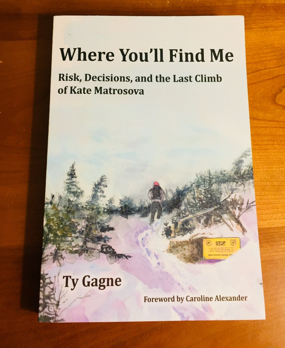
Gagne’s book follows the ill-fated attempt of the Northern Presidential traverse by thirty-two year-old Kate Matrosova in February 2015, and the ensuing rescue and ultimately, recovery operation. Gagne presents a scrupulously researched narrative and timeline of events, which is interspersed with maps, drawings, and analysis. The level of detail is astounding, and simultaneously gives the reader a bird’s-eye view of the unfolding drama along with granular details about the people on the ground.
We see Matrosova’s movements in comparison to other hiking groups in the White Mountains on the same day, and what the would-be rescuers were thinking, feeling, even eating. To his credit, Gagne keeps the reader hoping for a different outcome for Matrosova throughout the book, even though the ending is already known. All this detail leads to the central question of the book: if someone this fit and prepared lost her life, what measures can be taken to ensure one’s own safety? Gagne addresses Matrosova’s planned route:
In establishing bailout points and packing cell and satellite phones, a GPS device, a map, and a personal locator beacon, Matrosova is acknowledging the existence of risk on the traverse. She has established a risk management plan. But given her inexperience in the White Mountains, is her plan comprehensive enough to address the multitude of exposures that exist there, especially in winter?
After explaining the steps to an effective risk management plan, Gagne goes on:
A key to all this is timing. Even with a well-developed risk management strategy and the ability to implement it effectively, Matrosova will have to decide if and when to trigger alterations to her original plan. In the end, it will be the timing of her decisions that will make all the difference.
Gagne describes this timing, including the rapidly worsening weather, and subsequent warnings issued by the Mount Washington Observatory after Matrosova had already embarked on her hike. As Matrosova slowly falls behind her self-imposed timeline, her challenges become more and more complex, and Gagne explores the biases that may have factored into her decision-making. Whatever the reason, these decisions found her exhausted, frostbitten, and facing “an impenetrable wall of wind,” on Mt. Adams, “80-plus-mph headwinds,” that caused her to turn back, at a point that was too late to save her own life.
In the background of this heartbreaking human drama, Gagne illustrates the science of survival, with details regarding the functioning of the locator beacon, the progression of hypothermia, the record-setting extreme weather, and tactics and techniques of Search And Rescue (SAR) personnel.
Gagne fittingly ends the book with an account of his own February 2016 anniversary hike to where Matrosova’s body was eventually found, guided by her GPS track, and by one of her would-be rescuers. The conditions are different, far milder, and Gagne and his companion are together, well-prepared and equipped, but the ghost of loss still lingers on the periphery: “As I turn my back to the col and make my way down, I say my goodbyes to Kate.”
(Disclaimer: This post contains affiliate links, and as an Amazon Associate Hiking in Maine blog earns from qualifying purchases.)
Connecting kids with nature is a simple matter of allowing that inevitable relationship to happen. The difficult part is deciding what boundaries to set, letting go, and helping children deal with the unexpected challenges they may encounter. How to do that? One path is described in Up – A Mother and Daughter’s Peakbagging Adventure, by Patricia Ellis Herr (Broadway Paperbacks, 2012) , the story of Patricia Ellis Herr and her daughters Alex and Sage, and the quest of her older daughter Alex, then five, to summit all forty-eight of New Hampshire’s peaks over four thousand feet before Alex turned seven.
Herr begins the book with an anecdote about a failed attempt to summit Mt. Tom, thwarted by a lightning storm. This story sets the tone for the book: the weather forced Herr to make tough calls, and to explain her rationale for those decisions and the results to her daughters, including the realization that things can happen for which it can be impossible to prepare. Also, there was chocolate at the end.
The idea to bag all of New Hampshire’s four thousand footers was born following another hike, this one of Mount Tecumseh in April 2008, when Herr and her daughters eventually turned back, unprepared for the deep snow at higher elevations. Herr then researched the appropriate hiking gear and preparation, and they returned to summit Tecumseh that June, unknowingly beginning Alex’s quest.
During the peakbagging journey, they encounter unexpected obstacles, including the fear of “stranger danger,” the preconceived notions of other hikers regarding women and young children, and an aggressive spruce grouse. Herr turns these challenges into teachable moments, and Alex quickly gains confidence, and even makes some converts.
Alex is clearly a unique child, and uses a fountain of energy to power up and down the mountains in the beginning. Herr brings Alex back to earth, however, with a lesson from Alex and Sage’s father, Hugh, who relates the story to the girls of how he lost his legs on Mount Washington in the winter of 1982. A rescuer was killed by an avalanche while looking for Hugh and his climbing partner, a mental burden still carried by Hugh. The story has the desired effect, and Alex learns to be more careful, and respect the danger inherent in the White Mountains. This comes in handy during the ensuing months, as Herr and Alex hike through the winter and spring seasons, and learn, “Real hikers know when to continue and when to turn back.”
By the time the family, by this time accompanied by well-wishers, summits peak number forty-eight, Mount Moosilauke, in August 2009, they have accomplished much more than the physical challenge. Herr and her daughters have had conversations along the way wrestling with existential questions, mortality, motherhood, gender roles, and societal expectations:
What matters now is that they know, from experience, that they can accomplish something big, something huge. What matters is that, for the rest of their lives, both my daughters understand that to reach a goal, they must put one foot in front of the other and persevere. They know that they must expect and prepare for challenges. They know to ignore the naysayers and, instead, to have faith in themselves and their abilities to learn what they need to know. Above all else, they know that little does not mean weak, that girls are indeed strong, and that practically anything is possible.
This winning book, punctuated by mountaintop photos and small, sweet moments, shares a family’s triumph, and illuminates the lessons inherent in nature, waiting there to be elucidated by a mindful parent.
(Disclaimer: This post contains affiliate links, and as an Amazon Associate Hiking in Maine blog earns from qualifying purchases.)
When we aren’t hiking, we often consume content related to the outdoors. Podcasts are a great way to maximize transition to the outdoors and spark discussion during long drives to trailheads.
Outdoor content can be uneven – we tried some hiking podcasts that were basically unlistenable, for reasons ranging from long-winded alcohol or cannabis-infused monologues to insufferable condescension regarding non-thru-hikers. Also, the experiment of podcasting while hiking never seems to work, and devolves quickly into nonsense conveyed over heavy breathing.
But the best podcasts can capture unique moments, seen through the interesting lens of people new to the outdoors, or drawn from experienced adventurers through long-form interviews. They can also illuminate topics in science or history in a relatable way, including land and wildlife management, lightning, wildfires, and climate change. Listeners can also experience life-or-death situations in the safety of their homes and cars and gyms, taking lessons and inspiration with them when they venture out into the outdoors.
These are the ten best (and several honorable mention) hiking and outdoors podcasts we listened to in 2018. These are unscientifically and unfairly arranged by our own unique interest and enjoyment, with a brief description of each podcast, and the best audience and suggested gateway episode for each one.
A warning – playing podcasts or music on external speakers while hiking is basically a capital offense. Playing podcasts or music through headphones/earbuds while hiking is somewhere in the spectrum of inadvisable to mortally dangerous. Just from a common sense standpoint, why would you want to have your hearing and attention somewhere else if you want to maximize the benefits of being immersed in the outdoors (or, more basically, fail to hear the bear you just startled)? All that being said, hike your own hike.
Outside Magazine has long been the leader in outdoor storytelling, and they launched this podcast in March 2016 with Science of Survival (killer bees or hypothermia, anyone?), expanding it to include The Outside Interview and Dispatches. Each episode is a stand-alone experience, and the podcast explores every conceivable aspect of being outside.
Best for: Everyone – wide variety of outdoor topics in a tight, well-produced format.
Host Shelby Stanger enthusiastically interviews leaders in outdoor fields, with a focus on “how they’ve taken their own wild ideas and made them a reality.” Listen to this podcast for insights on breaking the mold and living wild from skiers, surfers, astronauts, authors, climbers, runners, and entrepreneurs.
Host Sam Evans-Brown “combines solid reporting and long-form narrative storytelling to bring the outdoors to you wherever you are.” This show sneakily weaves in science to explain and explore the outdoors.
This show might be worth it solely for the intro and background music, created by host Evan Phillips, an outstanding musician. Phillips’ goal is “to have meaningful conversations with extraordinary people; the folks who choose to live full-value lifestyles, in the most wild and rugged mountains on the planet.” Phillips interviews notable climbers in this Alaska-focused podcast.
This might be the most wide-ranging podcast on the list. It’s a collaborative effort, best described by the creators as an expansion of “the campfire tale,” and each listener is guaranteed to find an outdoor story that will resonate deeply and personally.
This podcast hosted by Gale Straub is focused on female exploration, and has a variety of interviews and stories covering the topic, as a gateway to longer discussions.
Backpacker Radio, co-hosted by Zach Davis and Juliana Chauncey, covers thru-hiking and long distance backpacking, complete with trail correspondents, interviews, and recommendations.
Hosts Heather Legler and Josh Legler focus on backpacking, with advice and content regarding food, gear, long-distance trails, and other hiking topics.
Hosts Scott & Ariane use their experiences to convey lessons (and laughs) about the outdoors. No topic is too broad or too small, and there are great insights in these episodes on hiking and backpacking.
Hosts Tom Griffin and Craig Brinin talk about hikes and adventures in Australia and beyond, with realistic advice and insights, all in Australian accents.
I first heard of Jeffrey H. Ryan’s book Appalachian Odyssey: A 28-Year Hike on America’s Trail, (Down East Books, 2016) at an engaging February 2017 talk Ryan gave at Frontier Cafe Cinema and Gallery in Brunswick, Maine, complete with a slide show of photographs from his almost thirty-year journey in sections of the Appalachian Trail (AT). The timing was perfect – in the teeth of the Maine winter, I saw again the possibilities of getting on the trail.
Ryan, having thru-hiked the Pacific Coast Trail (PCT) in the early 1980’s, began his Appalachian odyssey with a hike of Mount Katahdin with eight friends, including eventual AT companion Wayne Cyr, in September 1985. Hikes on the AT in Vermont and Massachusetts followed, and Ryan realized that he was completing the AT in sections, beginning a twenty-eight year quest to finally complete the 2,181 miles of the trail.
Ryan’s book breaks up this journey with Cyr into twenty-four chapters, including photographs, maps, gear lists, and salient historical facts about the AT and its surroundings. The anecdotes and (often self-deprecating) trail stories are excellent, and my personal favorite was the saga of a hungry Vermont porcupine, and the havoc it wreaked on the underside of Ryan’s parked vehicle, punctuated by the instructive note entitled, “Why Porcupines Love Working on Cars.” Ryan concludes the chapter describing his unexpected porcupine encounter with an understanding:
Because it’s the unexpected that fills life with excitement, joy and gratitude. When you let go of your expectations and allow journeys to unfold before you, you discover they are filled with wonder – clouds screaming past the moon, climbs to summits with vistas beyond belief, hoards of black flies that send you into the tent, porcupines that eat vehicles and strangers that give you a lift to the hardware store just when you need it most, I wouldn’t trade one bit of it – not even the black flies, the forced vacation or the $900 repair bill – for a more predictable and less fulfilling walk through life.
Throughout the book, we continue to see this theme resonate, and readers of the right age can nod, and remember not being able to reach people by cell phone, or puzzling over a map, prior to the advent of GPS and Google Maps. The appeal of returning to a new section of the trail each year for Ryan seems to include this passage back to a world of limited priorities, of perspective, of strictly the essential.
While many trail journals are immersive, and discuss the alternate thru-hiker universe, Ryan’s is different, as he also explores the physical and emotional challenges of getting on and off the trail in sections over the years. The physical effects of residual stress from work and travel, the betrayals of aging and benefits of maturity, and even the changes in technology on the trail over time are currents running through this book.
In following Ryan and Cyr through the years and miles, it’s impossible not to start seeing it through their eyes and pick up the trail shorthand they use. “First flat spot” to a hiking partner is a three-word utterance that says all that needs to be said about exhaustion, and the need to pitch a tent and call it a day. Ryan’s inner “drill sergeant” is the alternately self-motivating and abusive internal voice that drives him up and down hills when his reserves of energy are gone.
A brief encounter with a solo thru-hiker at the Sawmill Overlook in Virginia who admits to having the “Virginia Blues” causes Ryan to re-evaluate the mental load being carried by himself and Cyr on the trail. The Virginia Blues are the result of a formerly ambitious thru-hiker’s realization during a 550 mile section across Virginia of the realities of the length and deprivations of the trail, a two thousand mile endeavor with a 75% dropout rate. Ryan’s thoughts on the Virginia Blues are an unmistakable metaphor for the trials of middle age, the broader trails we all walk alone and together, and the societal supports we all need.
These times of exhaustion and doubt, however, are like the low points in the rolling “sawtooth” terrain Ryan crosses in his section-hiking journey – left in shadow by peaks bathed in sunshine, unexpected kindnesses from strangers, hot meals, and special places inaccessible except by the AT. Ryan conveys tricks of the trade in breathing, arranging gear, and staying in the game mentally, and says this about continually moving forward:
But my greatest source of strength was the reason I was out here in the first place. From the beginning, I have felt that it is a privilege to walk through some of the most fascinating and inspiring places on earth. It is something that makes me feel more complete and connected to nature than any activity I can imagine. Trying to do it for as long as I can is the greatest gift I can give myself. Yes, there are tough days. There are also many more glorious ones – just like life in general. And experiencing them out here helps keep things in perspective when I return to the man-made universe of projects, deadlines and the like.
Every person who punches a clock can understand Ryan’s realization that “my greatest challenge in getting to the trail wasn’t the travel, it was carving out the two week chunk of time I would need to make the trip happen.” But Appalachian Odyssey shows a blueprint for finding a balance between the things we must do, and those we dream of doing.
(Disclaimer: This post contains affiliate links, and as an Amazon Associate Hiking in Maine blog earns from qualifying purchases.)
Mowry Beach Trail from the Pleasant Street trailhead.
A short distance from downtown Lubec, the easternmost town in the U.S., Mowry Beach is a quiet 48-acre conservation area overlooking Deep Cove, Lubec Channel and Canada’s Campobello Island. This area, managed by the Downeast Coastal Conservancy (DCC), offers a .4 mile trail from Lubec’s Consolidated School on South Street to a parking area at the end of Pleasant Street, including a 1,700 foot boardwalk. The DCC publishes a map and brochure, available on their website.
View of Lubec village and the international bridge to Campobello from Mowry Beach.
We learned of this beach through a great Cobscook Trails Map and Guide published by Cobscook Trails, with hikes throughout the Cobscook Bay region, a free and widely available (at local businesses) pamphlet which I would recommend for anyone exploring the area. At the Pleasant Street end of the trail, which we accessed via a short walk from downtown, is 1,800 feet of shorefront along a sand beach. According to guides, ancient tree stumps can be seen along the lower portions of the beach at low tide, a forest that was present during an era with lower water levels.
On the October day we visited, seals were active, using the rapidly outgoing tide to move swiftly east at waterskiing speeds in the Lubec Channel in search of food. For sea-glass collectors, this working waterfront has a variety of shiny objects along the shore. During our walk, we also encountered two people helpfully picking up any garbage left on the beach.
Boardwalk on Mowry Beach Trail.
We turned into the trail, passing bright beach rose bushes. The trail and boardwalk are alive with birds, and we startled a large bird of prey that had been resting in a tree next to the boardwalk, which took off almost straight up, like a rocket (which, in turn, startled us). DCC’s guide lists rough-legged hawks, northern harriers, and northern shrikes as frequent visitors to the conservation area.
Mowry Beach conservation area from the playground of Lubec Consolidated School.
We continued through the coastal bog and an area lined with cattails and small trees, emerging behind the Lubec Consolidated School. For those with mobility issues, intimidated by longer hikes, or entertaining smaller children, this relatively short walk on wide paths and boardwalk is a great side excursion from the village of Lubec.
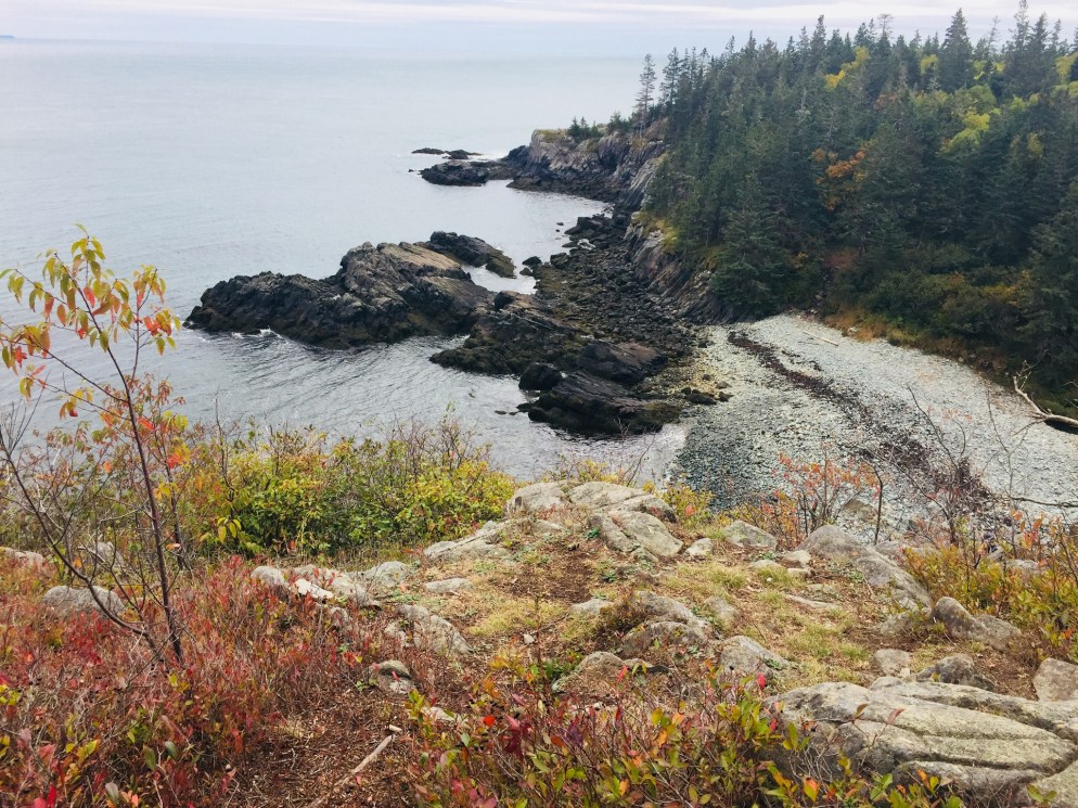
The “Bold Coast” of Maine is the area of coastal Washington County stretching from approximately Milbridge to Calais, and accessible through a route designated as the Bold Coast Scenic Byway (see map here from Maine DOT), which largely follows U.S. 1 North. Bold Coast Maine, a collaboration by the Washington County Council of Governments and Downeast-Acadia Regional Tourism, has an extensive site dedicated to the many attractions of this region, with a great interactive map, searchable by interest (Arts and Culture, Food and Drink, Recreation, etc.). For some area context, including post-hike food and drink, see the post on this blog on Quoddy Head State Park in Lubec.
For hikers, the centerpiece of this great region has to be the Cutler Coast Public Lands, managed by the Maine Bureau of Parks and Lands, which publishes an excellent guide and map. An important update to this map, however, is a rerouting of the Inland Trail, just east of the junction with the Black Point Brook Cutoff, which adds 1.2 miles to any loop using this segment, and was still in place as of October 2018.
Inland Trail Reroute (note 1.2 mile change in yellow), Cutler Coast Public Lands
These lands, overlooking the Bay of Fundy, have 10 miles of trails and three remote tent sites (first come, first serve) for hiking and camping with unparalleled views. We started on the Coastal Trail, which is a 1.4 mile hike east from the parking area off Route 191 in Cutler to the ocean. According to the guide, this is the easiest segment, and the remainder of the trails are “moderately difficult.”
None of the trails we explored here were particularly strenuous, but the paths are winding and require some climbing up and down over the rolling terrain. Like Quoddy Head, however, there are sudden cliffs that make it a potentially dangerous place for younger children. The rocky coastal sections are steep, and footing could be treacherous in rainy periods. And given the boggy inland areas, the insects in May and June must be fairly aggressive.
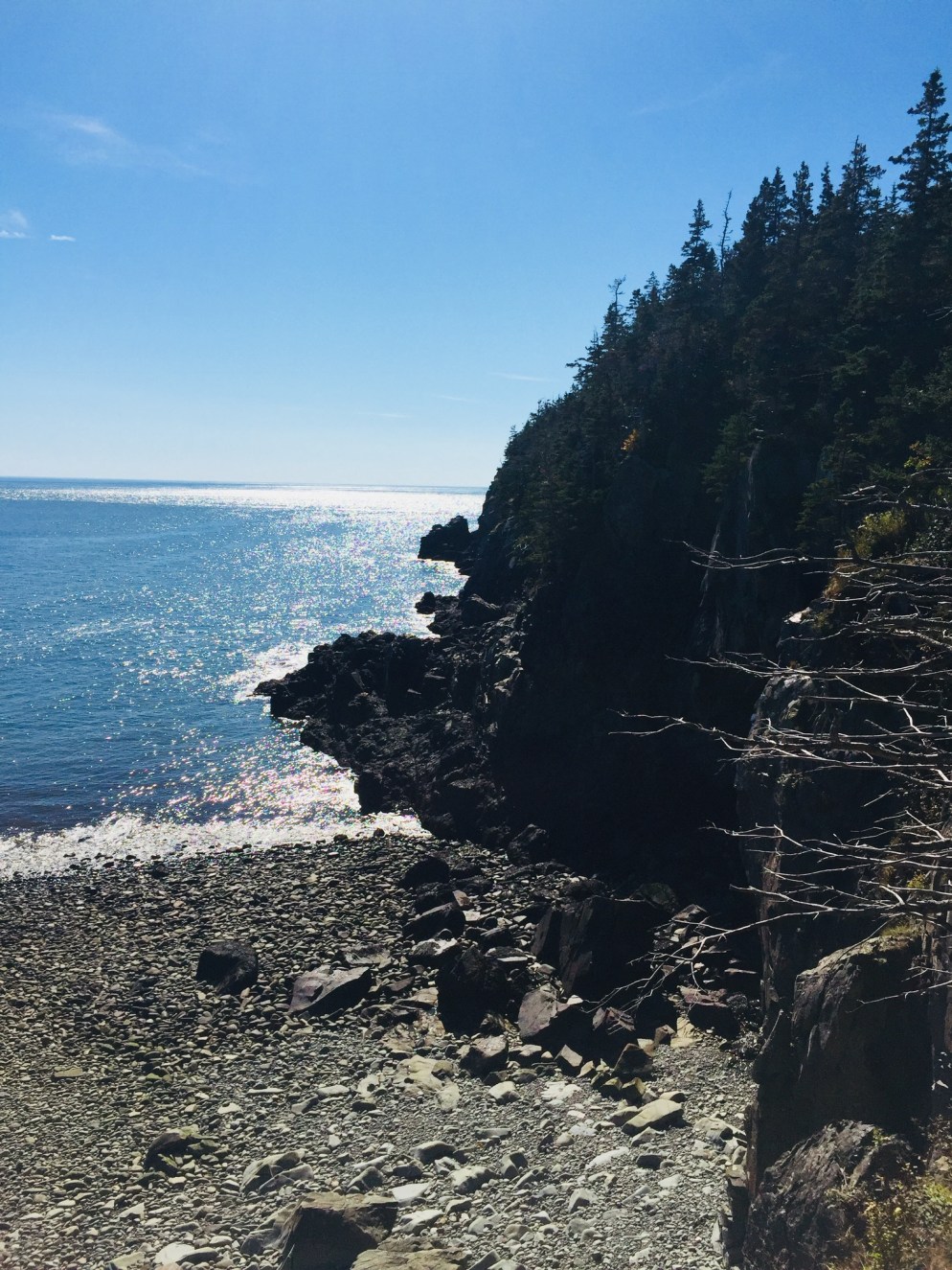
Coastal Trail view to south of Cutler Coast Public Lands.
The payoff upon reaching the coast, however, is instantaneous, as the dark rocky cliffs and forested coastline meet dramatically with the ocean in a stimulation of the five senses that can only be experienced firsthand. We picked our way slowly down the Coastal Trail toward Black Point, stopping at each short side overlook trail to listen to the powerful rumble of the waves and smell the mix of sea spray and pine.
Maine’s Bold Coast, Cutler Coast Public Lands.
The Black Point Brook Loop, with a turnaround at the beach at Black Point Cove, is normally 5.5 miles, but with the reroute on the Inland Trail, was closer to 6.7 miles, which took us about four hours at a slow pace, with many stops.
We agreed that a better (delayed gratification) itinerary for us would have been to take the Inland Trail first to the Black Point Brook Cutoff, have lunch at Black Point Cove, then hike up the Coastal Trail, so that our route back would take us along the shore (rather than having the forested trail and circuitous reroute on the return trip).
Rocky beach at Black Point, Cutler Coast Public Lands.
The Inland Trail was impressive in its own way, however, with variety in flora and fauna, rocky sections, mossy green hummocks, and some open meadows. The fall colors were much more pronounced in this section, with many deciduous trees and colorful bushes. We also saw many birds, including a noisy pair of Canada jays near the path.
For those looking for a longer route, or an overnight trip, the Fairy Head Loop is 9.2 miles (10.4 miles with current reroute), including 3.8 miles along the shore front, and this route accesses the three permitted campsites.
This quiet section of Maine’s Bold Coast, where the woods and the ocean come together, instantly became one of our favorite hikes. Any time a hike ends at a beach (see Morse Mountain), it’s special, and the Cutler Coast rivals any scenery on the East Coast, without the crowds of Acadia.
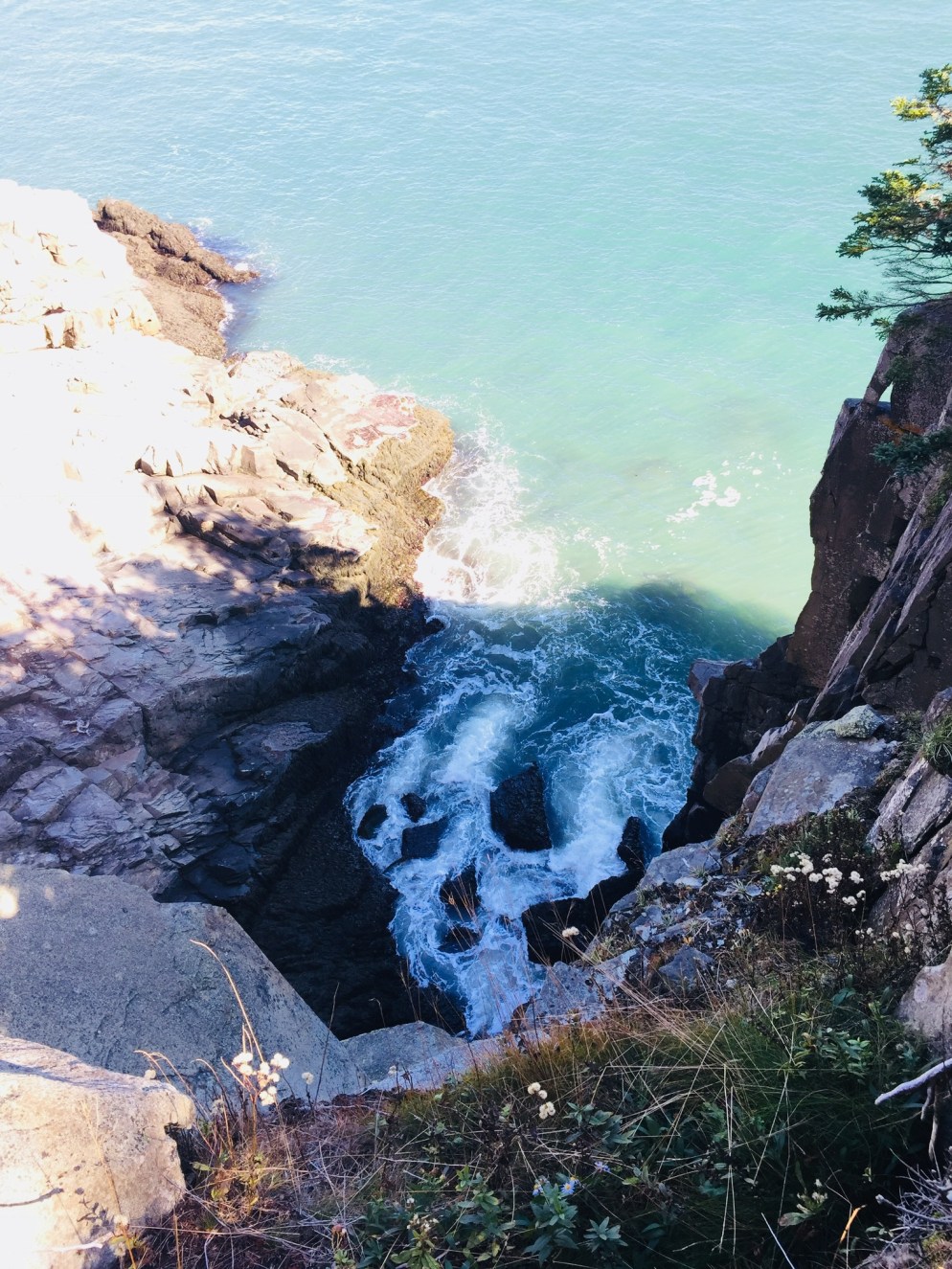
Rocky beach off the Coastal Trail, Quoddy Head State Park.
The word “Easternmost” is prominently advertised in many places across Lubec, including Quoddy Head State Park, which comprises 541 acres at the tip of the U.S.’s eastern reach. By the time you reach Quoddy Head State Park, off South Lubec Road, you will likely have seen many advertisements for all things “easternmost” (campgrounds, gift shops, etc). But beyond the quick tour stop and lighthouse “selfies,” this park offers an array of trails for all abilities with impressive ocean views and a variety of coastal vegetation. The best guide to the park’s trails is the map provided by the state of Maine: Quoddy Head State Park Guide & Map.
We started with the Coast Guard Trail, a 1-mile trail north of the entrance, which includes an overlook of the Lubec Channel, as well as a view of the town of Lubec back to the west, after a short climb up a wooden staircase. According to the Quoddy Head Guide, the first .5 miles of the western part of this trail is accessible by motorized wheelchair. After the lookout, the Coast Guard Trail then descends through the thick coastal woods to the lighthouse, passing several viewpoints along the volcanic rocks. The path was full of birds and squirrels gathering food on this warm, sunny October day.
West Quoddy Head Lighthouse, Lubec, ME
The small lighthouse museum (free, but donations always help) includes displays featuring the history of the lighthouse, flora and fauna of the area, and a guide to whales, commonly sighted off the coast. The area around the lighthouse contains a large number of picnic tables with excellent views, and the only restrooms in the park (easternmost privies in the U.S.? Probably). From the lighthouse area and most of the coastal trails, the cliffs of the Canadian island of Grand Manan are visible across the Quoddy Channel.
The terrain was impressive, and those with small children need to keep them close, as there are plenty of dizzying cliffs on the U.S. side, as well. The beaches are rocky, but make a far more interesting sound than sand beaches, combining the tidal roar with a rattling, suction sound as the rocks move together when the waves recede.
Coastal Trail at Quoddy Head State Park, Lubec, ME.
The Coastal Trail travels west along the shore past incredible views and scenic points like Gulliver’s Hole, High Ledge, and Green Point, with frequent stops in between to take in the powerful ocean. We did not linger at Green Point, a ledge with paths down to a beach, as we may have interrupted two hikers in some sort of extracurricular activity there (The trails became more and more empty the farther we got from the lighthouse).
At Carrying Place Cove, Thompson Trail heads back east, inland towards the parking area, with the short .2 mile spur of Bog Trail along the way. This side of the trail, in particular the sand beach at Carrying Place Cove, is also accessible from South Lubec Road. The Bog Trail includes a boardwalk and interpretive signs explaining the coastal plateau bog, also called a heath, according to the Quoddy Head Guide.
Thompson Trail is, for the most part, an easier walk than the coastal trail, with a few brief climbs. The best feature of this trail was the scent of pine, which created a perfumed evergreen tunnel in the narrower sections, redolent with notes of citrus and vanilla.
We completed most of the trails in the park, and stopped plenty of times to relax and take photos, making this about a three-hour visit. The difficulty level is described in the park guide as moderate, which seems about right. There are no strenuous climbs, but consistent steps over rocks and roots could make this more difficult for some hikers. There weren’t any bugs during this Columbus Day weekend, but the boggy areas guarantee mosquitoes and black flies in late spring and summer, and repellent would be a must. I would also suggest waterproof shoes, or at least wearing something on your feet that you don’t mind getting wet or muddy. Depending on your roaming plan, you may want to put your phone in airplane mode, as it will likely be using Canadian towers along this shore.
Lubec fishing fleet at dusk
Lubec, across a narrow channel from Canada’s Campobello Island, is the closest town nearby, but Machias is not that far away, and many smaller towns in Downeast Maine and the Cobscook Bay region are worth a visit. After the hike, if you can catch them open during fall hours, try the craft beer and pizza at Lubec Brewing Company or upscale pub cuisine at Cohill’s Inn on Water Street in Lubec. If you are headed south, go to Skywalker’s Bar and Grille in Machias (try the fish tacos) for a great menu and Machias River Brewing Company beers.
Quoddy Head, though remote, is hardly a secret anymore- we joked that AirBnB renters and vacationers from New York outnumbered locals in Lubec. But steps beyond the famous lighthouse is a surprisingly wild Maine coast to explore.
Fall colors on Pollywog Stream, 100 Mile Wilderness
[Note: this is the ninth and final part of a series begun in summer 2017 of an attempt at the 100 Mile Wilderness by dad, 41, and daughter, 12]
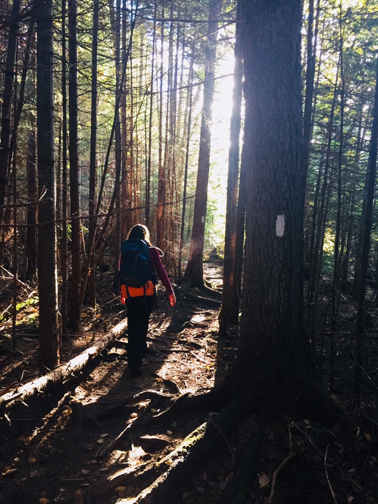
Should it take ten days to do the 100 Mile Wilderness? Probably not. Should it take eight days in 2017, and two days in 2018? Doesn’t matter- it did. As described on the 100 Mile Wilderness page, we started in 2017, had a great time together, but dad and daughter decided after 75 miles that we would continue some other time. This summer, we were dying to get back out there, and when the last weekend in September 2018 opened up for us, we jumped at the chance to complete the final 25 miles.
By definition, it’s a wilderness, so starting 25 miles south of Abol Bridge took logistical support. For that, we were helped by the friendly people at the Appalachian Trail Lodge in Millinocket, a hostel open during the hiking season until October 15th. We were greeted by Ole Man (these are trail names) upon our arrival, stayed at the Earl Shaffer Room (clean, two twin beds, shared bathroom, WiFi) for $55 the night before, got delicious breakfast sandwiches and a massive chocolate donut down the street at the Appalachian Trail Cafe the morning we left, and used the reasonably priced Appalachian Trail Lodge shuttle service to leave our truck at Abol Bridge, and get dropped off at the south end of Lake Nahmakanta. We swapped shuttles halfway, as the larger van we rode back to Millinocket from Abol Bridge was needed for the eager thru-hikers headed to Baxter State Park, and we traveled south in an SUV that had recently been repaired after a charging moose had broken off the driver’s side mirror.
We learned a lot on our shuttle ride from NoKey, a 2012 AT thru-hiker working at the Appalachian Trail Lodge, who was friendly, professional, and added all kinds of value to what otherwise would have been just a cab ride over logging roads. We had just missed a large bull moose on the Golden Road, of which NoKey showed us a picture. We got the scoop on good (most) and bad (very few) shuttle services/guides, places to stay near Millinocket, the effect of the Katahdin Woods and Waters National Monument on tourism, area wildlife and history, saw a lynx crossing the road, got an update on bear activity in the area, and even got a lesser-known trail recommendation (Turtle Ridge Trail in Nahmakanta Public Lands). We also passed a large encampment by Cooper Brook, which was the location of an L.L. Bean promotional “Trail Magic” campaign along the AT.
The beach at the south end of Lake Nahmakanta.
With that preamble, we got a mid-morning start at the south end of Lake Nahmakanta, and after a nostalgic moment on the windy beach, started walking north through the remote Nahmakanta Public Lands. Quickly, we saw large moose tracks and fresh droppings along the trail, and quickened our pace to try to see this animal, without success. We grudgingly adapted to having the heavy packs on our backs, and adjusted our day-hiker pace downward to accommodate the extra weight (we packed too much food). We stopped briefly at Wadleigh Stream Lean-to to crack open our Peanut Butter M&M’s, and noticed a plaque inside the lean-to honoring a hiker named Buffalo Bobby, who had passed away near this spot exactly 7 years before, 38 miles from finishing his third AT thru-hike. Wow. Rest in peace, BB.
Landscape and foliage views from north summit of Nesuntabunt Mountain.
By about 1 pm, we had reached the north summit of Nesuntabunt Mountain, and took the short side trail to view Nahmakanta Lake and far-off peaks. Then we sat down to make ourselves lunch, the same peanut butter, banana, and Nutella wraps we had used for energy on Katahdin a couple weeks before. A quick descent took us to the base of the mountain and around Crescent Pond to Pollywog Gorge.
Fall colors on the AT near Pollywog GorgeChanging leaves along Pollywog Stream.
The cliffs surrounding the gorge were impressive, but we were beginning to wear down, and didn’t linger. We crossed Pollywog Stream on a bridge, and made our way up Rainbow Stream to Rainbow Stream Lean-to a little before 5 pm, where a male thru-hiker and two female multi-day hikers we had seen earlier were getting ready for the night. This made it only a 10.7 mile day for us, but it felt like a lot more. The lean-to area quickly filled up with thru-hikers as the sun set. The thru-hikers we saw were exhausted, broken, and profane, but unfailingly friendly, polite, and focused on the last stretch of trail to Katahdin.
We set up our tent, which was complicated by a broken pole, repaired with a mostly ineffective combination of duct tape, twine, and tent stakes. We lay out our bedding, refilled our water, cooked dinner (Chicken Teriyaki Mountain House meal), hung our food in a bear bag, and were in our sleeping bags by 7 pm, fading into sleep despite the loud conversations by the lean-to campfire.
Log bridge and animal den.
It was a cold night, and we were uncomfortable, with neither of us sleeping well. Our sleeping bags and pads were up to the task, but we both agreed in the morning that we need to figure out how to pack pillows with us. Also, dad’s snoring woke up daughter, and daughter poking dad to stop his snoring woke up dad, creating the worst sort of perpetual motion machine throughout the night.
Daughter explored the campsite area in the morning, finding a precarious log bridge across Rainbow Stream to an animal den in a rock cave, possibly the former resting place of a bear. We peeked inside the den, seeing the small skull of an unfortunate prey animal. Dad made instant coffee and mixed in one of daughter’s hot chocolate packets for some more flavor in an attempt to wake up.
Morning light on the Rainbow Deadwaters.
We packed quickly and got moving around 7:30 AM, moving along the edge of the Rainbow Deadwaters. The trail was beautiful, and we marveled at spiderwebs covered in dew, and the unique morning light in the North Woods. We also heard late-season loons calling from Rainbow Lake.
Illuminated trail by Rainbow Lake.
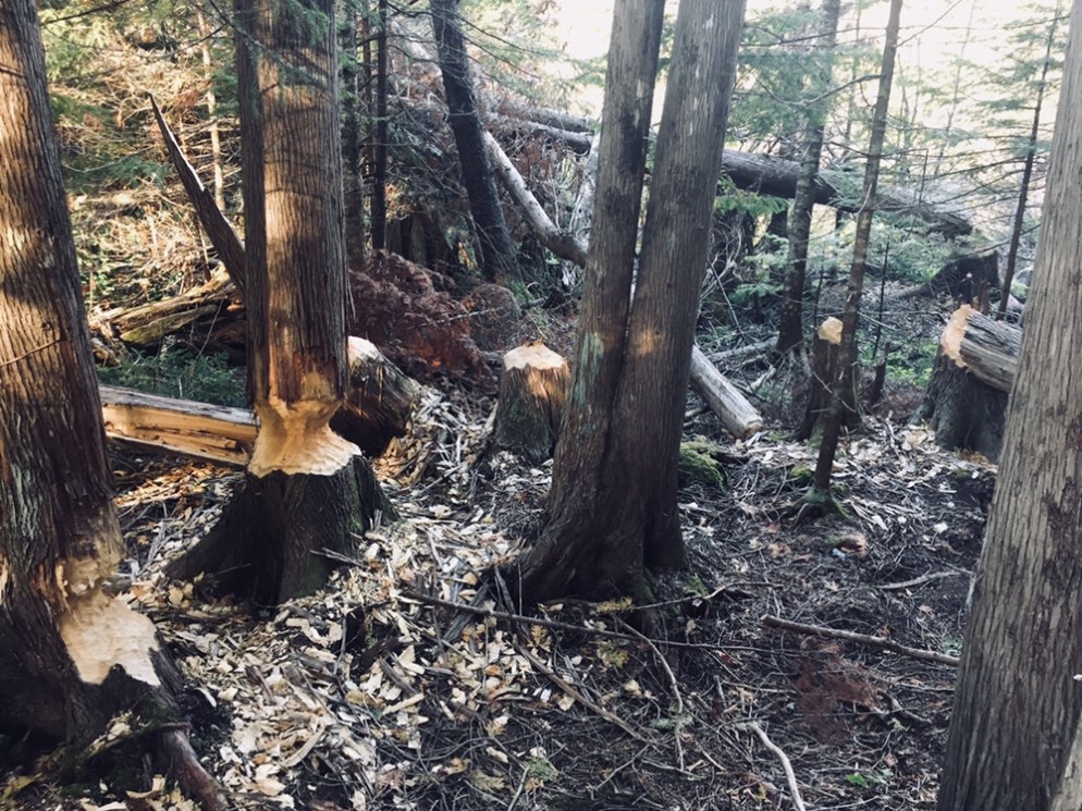
Daughter said that the Hobbit movies could have been filmed here, a recognition of the dramatic, colorful terrain that we tend to associate with movies, and so rarely see in person. We saw a root formation overtaking a tree that looked like a giant spider. As far as mythical creatures go, the west end of Rainbow Lake was the site of what can only be described as a beaver Armageddon, with fallen trees every which way across the trail.
Beaver Armageddon
We stopped for a break by Rainbow Spring Campsite. The privy there was filled with trail graffiti, including the signature of someone whose trail name was “The Privy Destroyer.” This harkened back to irreverent trail names scrawled inside the Appalachian Trail Cafe that had amused daughter, including “Swamp Butt.”
We continued past side trails to Rainbow Mountain and Big Beaver Pond in the Debsconeag Lakes Wilderness Area, stopping to check out Rainbow Lake (the largest lake on the 100 MW) from several rocky openings along the trail. On one stop, we cooked a Mountain House chicken and rice meal for lunch, and let it cool while we walked. When we sat down about fifteen minutes later to eat, it was perfect. Daughter was already sick of the Nutella and lavash bread, so the hot lunch was a good change-up. We also used this time to air out our feet, and change into clean, dry socks.
View of Katahdin from Rainbow Ledges.
Rainbow Ledges was a steady climb, with colorful foliage and views from the high point back to the White Cap range, and forward, towards Katahdin. We remembered crossing the White Cap range a year ago on the 4th of July, and the pea soup fog that hindered our summit views that day. Sadly, we ran out of Peanut Butter M&M’s during this Rainbow Ledges ascent, which had a devastating effect on morale. From here, we descended through the ever-changing forest and down well-set rock staircases to Hurd Brook Lean-To.
Different vegetation, incline, and make-up of the trail over just a 25-mile section.
The last few miles seemed to last the longest, as they always do. There weren’t many landmarks on the home stretch to Abol Bridge. The descriptive note, “Interesting area of large boulders and large hemlock trees,” on AT Map 1 at 2.2 miles from Abol Bridge, seemed superfluous after 100 miles of interesting rocks and trees. Suddenly, we were faced with a sign warning us that we were 100 miles north of Monson, and that we should have a minimum of 10 days supplies if we were heading south. We realized we were almost done, and saw the Golden Road peeking through the trees ahead.
Katahdin and the West Branch of the Penobscot from Abol Bridge.
We trudged across Abol Bridge in the late afternoon, completing our 15 mile day. We stopped by the Abol Bridge Campground store to buy some Gatorade, then got back in our truck, and drove out the Golden Road towards Millinocket. The Millinocket House of Pizza is daughter’s restaurant of choice, and she called in an order enroute for a large Hawaiian pizza as soon as cell service returned.
The soreness in our shoulders and knees and the chafing from the packs would fade in time, but completing the 100 Mile Wilderness together had been important to both of us. The cool, bug-free fall weather and colorful foliage were unexpected bonuses. To immerse yourself into the Wilderness, to walk there, sleep there on the ground, listen to the sounds of birds, bathe in the lakes, and then bring back out everything you came in with, is to feel shared ownership of this special place, where most people never go. Even in our weary haste at the end to finish, we had talked about new challenges, and also bringing memories of this hike back with us. As we split the pizza, we talked about our hike, and planned a lazy day for tomorrow.
We had hiked Katahdin, but daughter had never taken the legendary Knife Edge Trail, the narrow 1.1 mile stretch (and Maine rite of passage) from Pamola Peak to Baxter Peak. At age 12, it was time. On September 9, 2018, we hiked together to Baxter Peak on Mt. Katahdin via the Helon Taylor Trail to cross the Knife Edge. On the way down, dad and daughter took the Saddle and Chimney Pond Trails (total R/T appx 10.2 mi). (For maps, other routes, and links to Baxter State Park’s great resources, see our September 2017 Mt. Katahdin post.)
On the way in to Millinocket the night before, we stopped at Hannaford to stock up on supplies before staying at the Parks Edge Inn. In preparation, we went with a chocolate and peanut butter theme, and for our lunches, wrapped Nutella, peanut butter, and bananas in lavash bread like some Willy Wonka burritos, and grabbed peanut butter chocolate chip Larabars and peanut butter M&M’s to snack on.
To get into line at the Baxter State Park gate the next morning, we woke up around 5 am, and signed in to start hiking at Roaring Brook at 6:47 am. The $5 Day Use parking pass for Maine residents has to be the most value Mainers can get for $5. This easy online step is essential to guarantee a spot in the park, which is kept wild in many ways, including the limitation on daily access to the park.
The climb up Helon Taylor Trail was steady and tough, but we took our time, and enjoyed the changing vegetation and ubiquitous chattering of red squirrels, often looking back to enjoy the views behind us to the east, as we slowly emerged from the forest, patches of scrub pine, and finally above the tree line, reaching Pamola Peak around 10 am.
Getting ready to descend into the beginning of the Knife Edge.
The first step of the Knife Edge was the descent into the chimney adjoining Pamola, then a quick climb back up, setting the tone for a fun traverse. We saw several other groups of people crossing the Knife Edge, including some coming from the direction of Baxter Peak, one of which contained the only other child we saw, a nimble little boy, younger than daughter, leaping from rock to rock.
The Knife Edge Trail is a dizzying series of up and down climbs.
After the climb up Helon Taylor, exposed to the wind, and steeply ascending until our legs ached, we agreed that the Knife Edge was more mentally than physically challenging, and stopped frequently to gaze down into the bowl created by the steep cliffs of Katahdin, look at rock slides down the cliffs to the south, and watch ravens wheel and glide on the air currents below us.
We did not spend long on the summit of Baxter Peak, which was crowded with thru-hikers and large groups, with a long line to take pictures at the summit sign. Millennial-types used the cell service available due to the summit’s elevation to FaceTime with friends (“You’ll never guess where I am right now”) and send Instagram pictures ad nauseam. Daughter waited for a quick break in the action and snapped a ghost summit photo.
A weather-worn sign cautions hikers on the Saddle to take care with alpine plants.
Much more interesting was our meeting on the way down to the Saddle Trail with a Baxter State Park ranger, who educated us about the fragility of alpine plants. She told us that even a small patch can take up to one hundred years to grow back, and can be killed by as few as seven footsteps on it. We asked a number of questions we had gathered during our hike, including why some slides looked different- she explained that the slides where the trees were laying downhill were caused by avalanches in the winter, but that when the mountainside was denuded of vegetation, it meant that a rockslide had occurred. This ranger, from Asheville, North Carolina, works at Baxter from May to October educating hikers, conducting rescues, and sometimes climbs Katahdin every day.
Relaxing on the descent by Chimney Pond.
Our descent of the Saddle Trail was slowed by the onerous process of passing what looked like a large school group, and we got to Chimney Pond around 1:40 PM, where we took a long break to enjoy the sunshine, air out our feet, and birdwatch.
From there, it was a downhill walk over rocks and roots to Roaring Brook and our car, getting back around 3:30, for a total of almost nine hours of hiking. During this last stretch, one of dad’s hiking poles snapped, but our hike was otherwise uneventful.
So what worked? Obviously, chocolate and peanut butter. But daughter felt good about her hiking and running in the weeks leading up to the Knife Edge, and it got her into shape for the climb.
Mentally, we had talked about the challenges, and even used technology to our advantage, watching YouTube videos of the Knife Edge (the volume was quickly muted) to dispel fears. We started hiking with the agreement that we would not stupidly try to push through bad weather, and even reserved another parking spot for the following day, just in case.
We had a ton of water, using our 3 Liter Osprey hydration systems (Dad still ran out with a mile or two left to go). Dad carried a light pack with extra clothing layers and food. Daughter stayed with a Camelbak pack that allowed her to carry water and a few energy bars, but didn’t hinder her while climbing.
We shared a great hike, and daughter enjoyed being the tallest thing in Maine, even for a few seconds. With the right attitude, preparation, and training, the Knife Edge can be an incredible, unforgettable experience for kids, as part of an exploration of Maine’s tallest mountain and the limits within themselves. Even an unsuccessful attempt, safely and properly handled, can create a goal for future conquest, and build decision-making and risk management skills.


 Managing risk in the outdoors, particularly that of winter in the White Mountains, requires learning hard lessons. Focusing on one tragedy can have its pitfalls, but
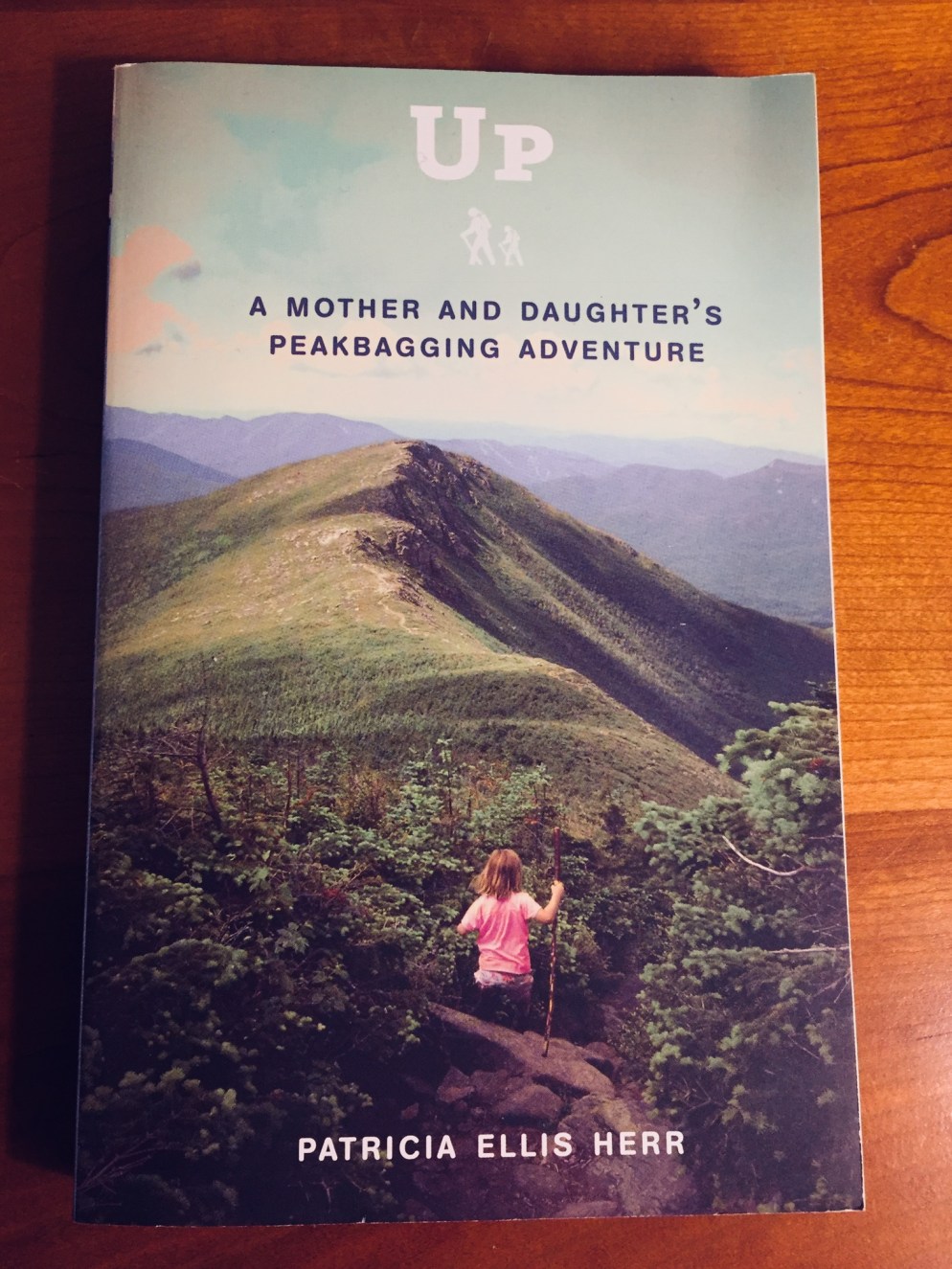


 Hike Like A Woman